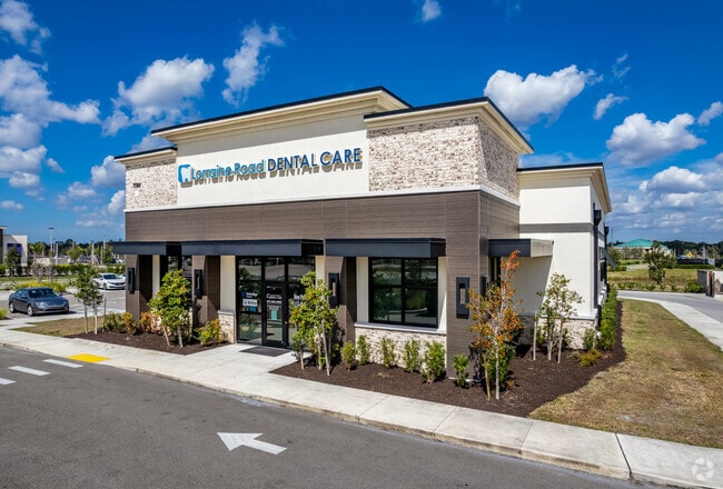
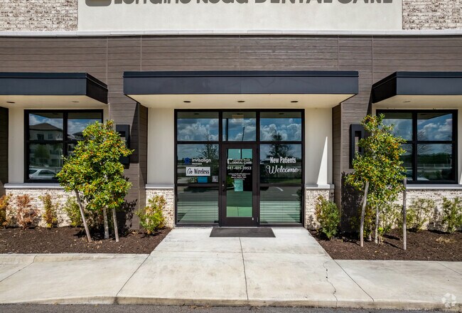
Property Record
8425 Lorraine Rd, Lakewood Ranch, FL 34202
NEARBY LISTINGS FOR SALE OR LEASE
Property Detail
8425 Lorraine Rd
5886-0145-9
PARCEL 3: A PARCEL OF LAND LOCATED IN SEC 34, TWN 35S, RNG 19E, MANATEE COUNTY, FL BEING DESC AS FOLLOWS: COM AT THE SW COR OF SD SEC 34; TH S 89 DEG 58 MIN 24 SEC E, ALG THE S LN
Storemultistory
Manatee
X
Florida
12115C0070F
3.13 AC
2023
Manatee Outlying
2025
Tampa/St Petersburg
002022
North Port-Sarasota-Bradenton, FL
16,950 SF
DEMOGRAPHICS near 8425 Lorraine Rd
1 Mile
3 Mile
5 Mile
2024 Total Population
1,541
22,095
62,024
2029 Population
1,812
26,103
72,798
Pop Growth 2024-2029
+ 17.59%
+ 18.14%
+ 17.37%
Average Age
57
52
49
2024 Total Households
712
9,478
26,886
HH Growth 2024-2029
+ 16.43%
+ 17.44%
+ 16.76%
Median Household Inc
$119,218
$114,423
$100,853
Avg Household Size
2.10
2.30
2.20
2024 Avg HH Vehicles
2.00
2.00
2.00
Median Home Value
$609,756
$577,260
$463,275
Median Year Built
2007
2010
2006
Nearby Places
Map Layers
Map Styles
 Street
 Aerial
- Restaurants
- Banks
- Shops
- Fitness
- Groceries
PUBLIC TRANSPORTATION
AIRPORT
Sarasota/Bradenton International
DRIVE
WALK
Distance
Sarasota/Bradenton International
21 min
11.4 mi
Freight Ports
Port Manatee
DRIVE
WALK
Distance
Port Manatee
35 min
23.9 mi
Nearby Properties
Address
Land Use
TOTAL SIZE
Lot Size
Zoning
Address
Land Use
TOTAL SIZE
Lot Size
Zoning
343,370 SF
10.77 AC
VPD
Address
Land Use
TOTAL SIZE
Lot Size
Zoning
343,100 SF
13.67 AC
VPD
Address
Land Use
TOTAL SIZE
Lot Size
Zoning
332,686 SF
37.78 AC
VPD
Address
Land Use
TOTAL SIZE
Lot Size
Zoning
268,645 SF
9.38 AC
VPD
Address
Land Use
TOTAL SIZE
Lot Size
Zoning
228,240 SF
23.48 AC
Address
Land Use
TOTAL SIZE
Lot Size
Zoning
353,888 SF
22.83 AC
PD-MU
Address
Land Use
TOTAL SIZE
Lot Size
Zoning
122,380 SF
26.49 AC
VPD
Address
Land Use
TOTAL SIZE
Lot Size
Zoning
204,843 SF
27.48 AC
PCD
Address
Land Use
TOTAL SIZE
Lot Size
Zoning
206,326 SF
5.01 AC
VPD
Address
Land Use
TOTAL SIZE
Lot Size
Zoning
235,732 SF
49.34 AC
PD-PI
Address
Land Use
TOTAL SIZE
Lot Size
Zoning
223,054 SF
21.72 AC
Address
Land Use
TOTAL SIZE
Lot Size
Zoning
120,140 SF
5.09 AC
VPD
Address
Land Use
TOTAL SIZE
Lot Size
Zoning
128,638 SF
59.55 AC
PCD
Address
Land Use
TOTAL SIZE
Lot Size
Zoning
76,844 SF
6.79 AC
PCD
Address
Land Use
TOTAL SIZE
Lot Size
Zoning
180,574 SF
22 AC
A GENERAL
Address
Land Use
TOTAL SIZE
Lot Size
Zoning
75,197 SF
6.46 AC
PCD
Address
Land Use
TOTAL SIZE
Lot Size
Zoning
190,299 SF
4.43 AC
PD-MU
Address
Land Use
TOTAL SIZE
Lot Size
Zoning
75,712 SF
33.55 AC
PD-MU
Address
Land Use
TOTAL SIZE
Lot Size
Zoning
143,277 SF
21.39 AC
PCD
Address
Land Use
TOTAL SIZE
Lot Size
Zoning
119,960 SF
27.91 AC
PID
Address
Land Use
TOTAL SIZE
Lot Size
Zoning
84,858 SF
6.75 AC
PCD
Address
Land Use
TOTAL SIZE
Lot Size
Zoning
78,000 SF
6.81 AC
PCD
Address
Land Use
TOTAL SIZE
Lot Size
Zoning
77,072 SF
10.17 AC
PCD
Address
Land Use
TOTAL SIZE
Lot Size
Zoning
125,662 SF
10.19 AC
PD-MU
Address
Land Use
TOTAL SIZE
Lot Size
Zoning
146,176 SF
33.37 AC
PID
Address
Land Use
TOTAL SIZE
Lot Size
Zoning
78,773 SF
15.34 AC
Address
Land Use
TOTAL SIZE
Lot Size
Zoning
84,440 SF
9.25 AC
PCD
Address
Land Use
TOTAL SIZE
Lot Size
Zoning
40,583 SF
2.21 AC
PCD
Address
Land Use
TOTAL SIZE
Lot Size
Zoning
68,761 SF
10.85 AC
OUE
Address
Land Use
TOTAL SIZE
Lot Size
Zoning
101.28 AC
VPD
The World's #1 Commercial Real Estate Marketplace
Connect with us
© 2026 CoStar Group
The information above has been obtained from sources believed reliable. While we do not doubt its accuracy we have not verified it and make no guarantee, warranty or representation about it. It is your responsibility to independently confirm its accuracy and completeness. Any projections, opinions, assumptions, or estimates used are for example only and do not represent the current or future performance of the property. The value of this transaction to you depends on tax and other factors which should be evaluated by your tax, financial, and legal advisors. You and your advisors should conduct a careful, independent investigation of the property to determine to your satisfaction the suitability of the property for your needs.