Property Record
8426 S Highway 287 Ave, Fort Collins, CO 80525


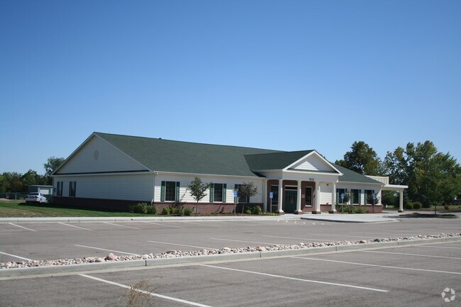

Property Detail
8426 S Highway 287 Ave
96240-00-008
BEG AT SW COR 24-6-69, TH N 1502.41 FT, E 701.27 FT, S 1600 FT, W 700 FT; LESS 1403-511
Commercialnec
LARIMER
FA
Colorado
B and X Area of moderate flood hazard, usually the area between the limits of the 100-year and 500-year floods.
22.77 AC
2024
Fort Collins/Loveland
2025
Denver
001007
Fort Collins-Loveland, CO
7,532 SF
NEARBY LISTINGS FOR SALE OR LEASE
-
-
View all Fort Collins listings for sale on LoopNet.com
DEMOGRAPHICS near 8426 S Highway 287 Ave
1 mile
3 mile
5 mile
2025 Total Population
1,985
37,840
116,678
2030 Population
2,062
38,961
119,753
Pop Growth 2025-2030
+ 3.88%
+ 2.96%
+ 2.64%
Average Age
44
42
41
2025 Total Households
764
14,825
47,566
HH Growth 2025-2030
+ 4.06%
+ 3.08%
+ 2.77%
Median Household Inc
$79,829
$98,383
$95,166
Avg Household Size
2.60
2.50
2.40
2025 Avg HH Vehicles
2.00
2.00
2.00
Median Home Value
$709,735
$547,200
$578,636
Median Year Built
2001
1998
1994
Nearby Places
Map Layers
Map Styles
 Street
 Aerial
Transit
 Traffic
 Biking
Places
Listings with unknown addresses are not visible on the map
- Restaurants
- Banks
- Shops
- Fitness
- Groceries
Nearby Properties
Address
Land Use
TOTAL SIZE
Lot Size
Zoning
Address
Land Use
TOTAL SIZE
Lot Size
Zoning
573.74 AC
FA1
Address
Land Use
TOTAL SIZE
Lot Size
Zoning
117,434 SF
29.34 AC
R1
Address
Land Use
TOTAL SIZE
Lot Size
Zoning
222,636 SF
26.89 AC
P65
Address
Land Use
TOTAL SIZE
Lot Size
Zoning
42,205 SF
11.50 AC
Address
Land Use
TOTAL SIZE
Lot Size
Zoning
67,144 SF
39.41 AC
Address
Land Use
TOTAL SIZE
Lot Size
Zoning
109,911 SF
6.74 AC
Address
Land Use
TOTAL SIZE
Lot Size
Zoning
363,533 SF
13.39 AC
Address
Land Use
TOTAL SIZE
Lot Size
Zoning
117,157 SF
117.61 AC
Address
Land Use
TOTAL SIZE
Lot Size
Zoning
123,130 SF
4.17 AC
Address
Land Use
TOTAL SIZE
Lot Size
Zoning
55,831 SF
6.69 AC
Address
Land Use
TOTAL SIZE
Lot Size
Zoning
162,703 SF
14.92 AC
B
Address
Land Use
TOTAL SIZE
Lot Size
Zoning
117,496 SF
6.24 AC
Address
Land Use
TOTAL SIZE
Lot Size
Zoning
332,645 SF
14.16 AC
BUD
Address
Land Use
TOTAL SIZE
Lot Size
Zoning
125,250 SF
9.55 AC
P93
Address
Land Use
TOTAL SIZE
Lot Size
Zoning
87,518 SF
8.02 AC
Address
Land Use
TOTAL SIZE
Lot Size
Zoning
107,271 SF
3.30 AC
Address
Land Use
TOTAL SIZE
Lot Size
Zoning
82,749 SF
25.54 AC
R2
Address
Land Use
TOTAL SIZE
Lot Size
Zoning
97,225 SF
4.60 AC
P55
Address
Land Use
TOTAL SIZE
Lot Size
Zoning
80,156 SF
16 AC
FA
Address
Land Use
TOTAL SIZE
Lot Size
Zoning
56,724 SF
9.11 AC
Address
Land Use
TOTAL SIZE
Lot Size
Zoning
387,075 SF
17.61 AC
Address
Land Use
TOTAL SIZE
Lot Size
Zoning
54,300 SF
4.05 AC
FA1
Address
Land Use
TOTAL SIZE
Lot Size
Zoning
56,876 SF
3.85 AC
R3
Address
Land Use
TOTAL SIZE
Lot Size
Zoning
54,950 SF
12.37 AC
P73
Address
Land Use
TOTAL SIZE
Lot Size
Zoning
1 SF
4.42 AC
I
Address
Land Use
TOTAL SIZE
Lot Size
Zoning
164,619 SF
11.54 AC
Address
Land Use
TOTAL SIZE
Lot Size
Zoning
71,082 SF
6.32 AC
Address
Land Use
TOTAL SIZE
Lot Size
Zoning
51,000 SF
4.21 AC
I
Address
Land Use
TOTAL SIZE
Lot Size
Zoning
33,211 SF
3.45 AC
Address
Land Use
TOTAL SIZE
Lot Size
Zoning
3,792 SF
13.75 AC
The World's #1 Commercial Real Estate Marketplace
Connect with us
© 2026 CoStar Group
The information above has been obtained from sources believed reliable. While we do not doubt its accuracy we have not verified it and make no guarantee, warranty or representation about it. It is your responsibility to independently confirm its accuracy and completeness. Any projections, opinions, assumptions, or estimates used are for example only and do not represent the current or future performance of the property. The value of this transaction to you depends on tax and other factors which should be evaluated by your tax, financial, and legal advisors. You and your advisors should conduct a careful, independent investigation of the property to determine to your satisfaction the suitability of the property for your needs.