Property Record
843 Main St, Martin, OH 43445

Property Detail
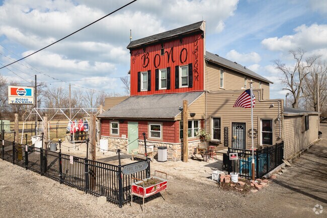
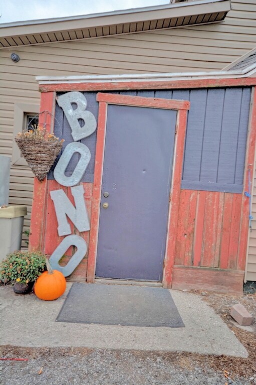
843 Main St
33-53231
10 10 8 NW 1/4 S 83 FT N 495.36 FT W 336FT E 1/2
Restaurantbuilding
Lucas
28-AR
Ohio
AE The base floodplain where base flood elevations are provided. AE Zones are now used on new format FIRMs instead of A1-A30 Zones.
0.60 AC
2025
East Toledo/Oregon
2025
Toledo
009700
Toledo, OH
4,912 SF
NEARBY LISTINGS FOR SALE OR LEASE
-
-
View all Martin listings for sale on LoopNet.com
DEMOGRAPHICS near 843 Main St
1 mile
3 mile
5 mile
2025 Total Population
382
2,026
3,709
2030 Population
379
2,011
3,577
Pop Growth 2025-2030
(0.79%)
(0.74%)
(3.56%)
Average Age
45
45
45
2025 Total Households
152
825
1,458
HH Growth 2025-2030
(0.66%)
(0.73%)
(3.70%)
Median Household Inc
$118,749
$90,591
$101,003
Avg Household Size
2.50
2.40
2.50
2025 Avg HH Vehicles
3.00
2.00
2.00
Median Home Value
$247,619
$219,264
$232,827
Median Year Built
1969
1957
1958
Nearby Places
Map Layers
Map Styles
 Street
 Aerial
Transit
 Traffic
 Biking
Places
Listings with unknown addresses are not visible on the map
- Restaurants
- Banks
- Shops
- Fitness
- Groceries
PUBLIC TRANSPORTATION
AIRPORT
Eugene F Kranz Toledo Express
Drive
Walk
Distance
Eugene F Kranz Toledo Express
54 min
33.0 mi
Freight Ports
Port of Toledo
Drive
Walk
Distance
Port of Toledo
27 min
14.5 mi
SALE & LEASE HISTORY
LISTING DATE
SALE/LEASE

Nov 15, 2023
For Sale
Nearby Properties
Address
Land Use
TOTAL SIZE
Lot Size
Zoning
Address
Land Use
TOTAL SIZE
Lot Size
Zoning
72,520 SF
10 AC
28-AR
Address
Land Use
TOTAL SIZE
Lot Size
Zoning
92,120 SF
9.78 AC
28-RC
Address
Land Use
TOTAL SIZE
Lot Size
Zoning
416 SF
742.09 AC
28-MX
Address
Land Use
TOTAL SIZE
Lot Size
Zoning
160 AC
28-OSP
Address
Land Use
TOTAL SIZE
Lot Size
Zoning
160 AC
28-OSP
Address
Land Use
TOTAL SIZE
Lot Size
Zoning
14,768 SF
10.01 AC
28-AR
Address
Land Use
TOTAL SIZE
Lot Size
Zoning
19,478 SF
2.50 AC
28-AR
Address
Land Use
TOTAL SIZE
Lot Size
Zoning
19,636 SF
11.13 AC
Address
Land Use
TOTAL SIZE
Lot Size
Zoning
8,096 SF
29.59 AC
28-MX
Address
Land Use
TOTAL SIZE
Lot Size
Zoning
35.08 AC
28-RC
Address
Land Use
TOTAL SIZE
Lot Size
Zoning
8,484 SF
27.64 AC
28-AR
Address
Land Use
TOTAL SIZE
Lot Size
Zoning
18,432 SF
3.38 AC
28-C2
Address
Land Use
TOTAL SIZE
Lot Size
Zoning
111.71 AC
28-OSP
Address
Land Use
TOTAL SIZE
Lot Size
Zoning
5,815 SF
10.49 AC
28-AR
Address
Land Use
TOTAL SIZE
Lot Size
Zoning
91.80 AC
28-OSP
Address
Land Use
TOTAL SIZE
Lot Size
Zoning
7,228 SF
7.13 AC
28-AR
Address
Land Use
TOTAL SIZE
Lot Size
Zoning
1,120 SF
93.56 AC
Address
Land Use
TOTAL SIZE
Lot Size
Zoning
10,264 SF
5 AC
28-C2
Address
Land Use
TOTAL SIZE
Lot Size
Zoning
4,806 SF
35.46 AC
28-MX
Address
Land Use
TOTAL SIZE
Lot Size
Zoning
3,281 SF
20.03 AC
28-AR
Address
Land Use
TOTAL SIZE
Lot Size
Zoning
243.25 AC
28-MX
Address
Land Use
TOTAL SIZE
Lot Size
Zoning
22,880 SF
2.59 AC
Address
Land Use
TOTAL SIZE
Lot Size
Zoning
84.10 AC
Address
Land Use
TOTAL SIZE
Lot Size
Zoning
159.75 AC
28-R1
Address
Land Use
TOTAL SIZE
Lot Size
Zoning
65.29 AC
28-OSP
Address
Land Use
TOTAL SIZE
Lot Size
Zoning
3,964 SF
40 AC
28-AR
Address
Land Use
TOTAL SIZE
Lot Size
Zoning
80 AC
Address
Land Use
TOTAL SIZE
Lot Size
Zoning
Address
Land Use
TOTAL SIZE
Lot Size
Zoning
54.20 AC
28-OSP
Address
Land Use
TOTAL SIZE
Lot Size
Zoning
2,442 SF
10 AC
28-AR
The World's #1 Commercial Real Estate Marketplace
Connect with us
© 2026 CoStar Group
The information above has been obtained from sources believed reliable. While we do not doubt its accuracy we have not verified it and make no guarantee, warranty or representation about it. It is your responsibility to independently confirm its accuracy and completeness. Any projections, opinions, assumptions, or estimates used are for example only and do not represent the current or future performance of the property. The value of this transaction to you depends on tax and other factors which should be evaluated by your tax, financial, and legal advisors. You and your advisors should conduct a careful, independent investigation of the property to determine to your satisfaction the suitability of the property for your needs.