Property Record
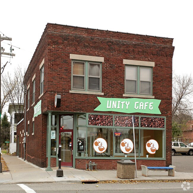
843 Rice St, Saint Paul, MN 55117


NEARBY LISTINGS FOR SALE OR LEASE
Property Detail
843 Rice St
Minneapolis-St. Paul-Bloomington, MN-WI
Mckentys Out Lots To,St. Paul
25-29-23-41-0266
MCKENTYS OUT LOTS TO,ST. PAUL EX ST LOTS 1 & ALL OF LOT 2 & LOT 3 BLK 3
Commercialnec
Ramsey
X
Minnesota
27037C0050E
1,2,3
2024
0.17 AC
2025
Rosedale
031300
Minneapolis/St Paul
546 SF
DEMOGRAPHICS near 843 Rice St
1 Mile
3 Mile
5 Mile
2024 Total Population
19,139
167,072
358,878
2029 Population
18,411
162,343
350,111
Pop Growth 2024-2029
(3.80%)
(2.83%)
(2.44%)
Average Age
33
36
37
2024 Total Households
6,030
65,293
141,341
HH Growth 2024-2029
(4.03%)
(2.81%)
(2.49%)
Median Household Inc
$49,008
$61,782
$67,867
Avg Household Size
2.90
2.40
2.40
2024 Avg HH Vehicles
2.00
1.00
2.00
Median Home Value
$180,394
$251,363
$276,781
Median Year Built
1949
1952
1957
Nearby Places
Map Layers
Map Styles
 Street
 Aerial
- Restaurants
- Banks
- Shops
- Fitness
- Groceries
PUBLIC TRANSPORTATION
COMMUTER RAIL
DRIVE
WALK
Distance
5 min
2.1 mi
AIRPORT
Minneapolis-St Paul International/Wold-Chamberlain
DRIVE
WALK
Distance
Minneapolis-St Paul International/Wold-Chamberlain
18 min
10.4 mi
SALE & LEASE HISTORY
LISTING DATE
SALE/LEASE

Oct 27, 2020
For Sale
Oct 14, 2019
For Sale
May 06, 2024
For Lease
Jan 21, 2021
For Lease
Nearby Properties
Address
Land Use
TOTAL SIZE
Lot Size
Zoning
Address
Land Use
TOTAL SIZE
Lot Size
Zoning
384,515 SF
18.04 AC
Address
Land Use
TOTAL SIZE
Lot Size
Zoning
384,515 SF
1.33 AC
Address
Land Use
TOTAL SIZE
Lot Size
Zoning
582,896 SF
14 AC
Address
Land Use
TOTAL SIZE
Lot Size
Zoning
825,463 SF
7.04 AC
Address
Land Use
TOTAL SIZE
Lot Size
Zoning
63.12 AC
Address
Land Use
TOTAL SIZE
Lot Size
Zoning
646,900 SF
7.66 AC
Address
Land Use
TOTAL SIZE
Lot Size
Zoning
32,854 SF
5.55 AC
Address
Land Use
TOTAL SIZE
Lot Size
Zoning
404,491 SF
27.01 AC
Address
Land Use
TOTAL SIZE
Lot Size
Zoning
18.24 AC
Address
Land Use
TOTAL SIZE
Lot Size
Zoning
408.23 AC
Address
Land Use
TOTAL SIZE
Lot Size
Zoning
420,177 SF
2.13 AC
Address
Land Use
TOTAL SIZE
Lot Size
Zoning
516,325 SF
16.81 AC
Address
Land Use
TOTAL SIZE
Lot Size
Zoning
759,622 SF
2.66 AC
Address
Land Use
TOTAL SIZE
Lot Size
Zoning
786,042 SF
2.10 AC
Address
Land Use
TOTAL SIZE
Lot Size
Zoning
643,305 SF
1.93 AC
Address
Land Use
TOTAL SIZE
Lot Size
Zoning
7.41 AC
Address
Land Use
TOTAL SIZE
Lot Size
Zoning
793,465 SF
1.93 AC
Address
Land Use
TOTAL SIZE
Lot Size
Zoning
68,748 SF
21.59 AC
Address
Land Use
TOTAL SIZE
Lot Size
Zoning
3,050 SF
58.60 AC
Address
Land Use
TOTAL SIZE
Lot Size
Zoning
18,630 SF
22.02 AC
Address
Land Use
TOTAL SIZE
Lot Size
Zoning
276,144 SF
347.68 AC
Address
Land Use
TOTAL SIZE
Lot Size
Zoning
160,800 SF
5.05 AC
Address
Land Use
TOTAL SIZE
Lot Size
Zoning
393,443 SF
3.75 AC
Address
Land Use
TOTAL SIZE
Lot Size
Zoning
260,739 SF
3.04 AC
Address
Land Use
TOTAL SIZE
Lot Size
Zoning
445,437 SF
7.80 AC
Address
Land Use
TOTAL SIZE
Lot Size
Zoning
265,736 SF
6.67 AC
Address
Land Use
TOTAL SIZE
Lot Size
Zoning
3.13 AC
Address
Land Use
TOTAL SIZE
Lot Size
Zoning
455,628 SF
2.81 AC
Address
Land Use
TOTAL SIZE
Lot Size
Zoning
47,670 SF
179 AC
Address
Land Use
TOTAL SIZE
Lot Size
Zoning
207.61 AC
The World's #1 Commercial Real Estate Marketplace
Connect with us
© 2026 CoStar Group
The information above has been obtained from sources believed reliable. While we do not doubt its accuracy we have not verified it and make no guarantee, warranty or representation about it. It is your responsibility to independently confirm its accuracy and completeness. Any projections, opinions, assumptions, or estimates used are for example only and do not represent the current or future performance of the property. The value of this transaction to you depends on tax and other factors which should be evaluated by your tax, financial, and legal advisors. You and your advisors should conduct a careful, independent investigation of the property to determine to your satisfaction the suitability of the property for your needs.