Property Record
8434 S Kipling Pkwy, Littleton, CO 80127
NEARBY LISTINGS FOR SALE OR LEASE
Property Detail
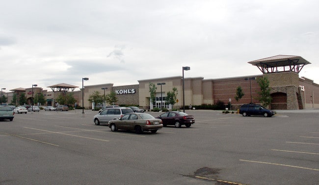
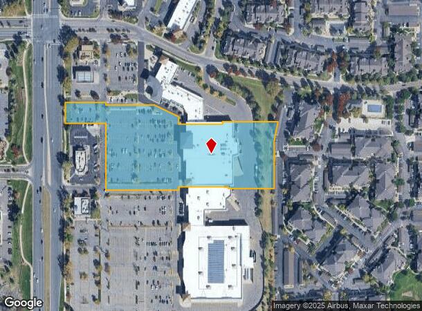
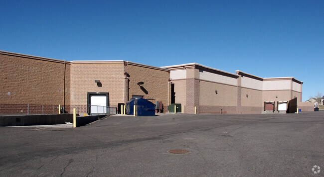
8434 S Kipling Pkwy
Denver-Aurora-Lakewood, CO
Jefferson Village Flg 1 Ex 3 Amd 1
69-032-02-413
SECTION 03 TOWNSHIP 06 RANGE 69 QTR NW SUBDIVISIONCD 386245 SUBDIVISIONNAME JEFFERSON VILLAGE FLG 1 EX 3 AMD 1 BLOCK LOT 05A1 SIZE: 251932 TRACT 00A VALUE: 5.784
Commercialnec
Jefferson
X
Colorado
08059C0403F
5a1
2023
5.78 AC
2024
Southwest
012057
Denver
57,509 SF
DEMOGRAPHICS near 8434 S Kipling Pkwy
1 Mile
3 Mile
5 Mile
2024 Total Population
11,249
56,787
129,180
2029 Population
11,123
55,755
129,375
Pop Growth 2024-2029
(1.12%)
(1.82%)
+ 0.15%
Average Age
41
42
43
2024 Total Households
4,787
21,873
50,890
HH Growth 2024-2029
(1.17%)
(1.91%)
+ 0.25%
Median Household Inc
$95,727
$112,795
$113,075
Avg Household Size
2.30
2.50
2.50
2024 Avg HH Vehicles
2.00
2.00
2.00
Median Home Value
$486,513
$560,990
$604,486
Median Year Built
1987
1984
1988
Nearby Places
Map Layers
Map Styles
 Street
 Aerial
- Restaurants
- Banks
- Shops
- Fitness
- Groceries
SALE & LEASE HISTORY
LISTING DATE
SALE/LEASE

Sep 25, 2016
For Lease
Nearby Properties
Address
Land Use
TOTAL SIZE
Lot Size
Zoning
Address
Land Use
TOTAL SIZE
Lot Size
Zoning
272,246 SF
31.76 AC
PD
Address
Land Use
TOTAL SIZE
Lot Size
Zoning
2,884.97 AC
A1
Address
Land Use
TOTAL SIZE
Lot Size
Zoning
214,066 SF
82.60 AC
PD
Address
Land Use
TOTAL SIZE
Lot Size
Zoning
392,710 SF
21.23 AC
PD
Address
Land Use
TOTAL SIZE
Lot Size
Zoning
101,699 SF
10.34 AC
Address
Land Use
TOTAL SIZE
Lot Size
Zoning
297,003 SF
26.77 AC
PD
Address
Land Use
TOTAL SIZE
Lot Size
Zoning
119,540 SF
10.67 AC
C1
Address
Land Use
TOTAL SIZE
Lot Size
Zoning
100,550 SF
7.72 AC
PD
Address
Land Use
TOTAL SIZE
Lot Size
Zoning
12,367 SF
4.18 AC
Address
Land Use
TOTAL SIZE
Lot Size
Zoning
29,094 SF
11.33 AC
Address
Land Use
TOTAL SIZE
Lot Size
Zoning
68,373 SF
7.97 AC
C1
Address
Land Use
TOTAL SIZE
Lot Size
Zoning
58,550 SF
9.67 AC
Address
Land Use
TOTAL SIZE
Lot Size
Zoning
105,392 SF
7.44 AC
Address
Land Use
TOTAL SIZE
Lot Size
Zoning
28,533 SF
11.07 AC
Address
Land Use
TOTAL SIZE
Lot Size
Zoning
71,091 SF
4.93 AC
PD
Address
Land Use
TOTAL SIZE
Lot Size
Zoning
82,765 SF
4.85 AC
PD
Address
Land Use
TOTAL SIZE
Lot Size
Zoning
74,322 SF
7.87 AC
Address
Land Use
TOTAL SIZE
Lot Size
Zoning
104,984 SF
3.11 AC
Address
Land Use
TOTAL SIZE
Lot Size
Zoning
36,847 SF
3.02 AC
PD
Address
Land Use
TOTAL SIZE
Lot Size
Zoning
61,038 SF
8.19 AC
Address
Land Use
TOTAL SIZE
Lot Size
Zoning
52,803 SF
3.40 AC
PD
Address
Land Use
TOTAL SIZE
Lot Size
Zoning
40,129 SF
5.47 AC
Address
Land Use
TOTAL SIZE
Lot Size
Zoning
97,668 SF
5.90 AC
PD
Address
Land Use
TOTAL SIZE
Lot Size
Zoning
470 AC
A1
Address
Land Use
TOTAL SIZE
Lot Size
Zoning
53,542 SF
10 AC
PD
Address
Land Use
TOTAL SIZE
Lot Size
Zoning
153.92 AC
PD
Address
Land Use
TOTAL SIZE
Lot Size
Zoning
25,008 SF
2.16 AC
PD
Address
Land Use
TOTAL SIZE
Lot Size
Zoning
63,535 SF
7.04 AC
PD
Address
Land Use
TOTAL SIZE
Lot Size
Zoning
72,330 SF
5.20 AC
PD
Address
Land Use
TOTAL SIZE
Lot Size
Zoning
86,797 SF
10.07 AC
PD
The World's #1 Commercial Real Estate Marketplace
Connect with us
© 2025 CoStar Group
The information above has been obtained from sources believed reliable. While we do not doubt its accuracy we have not verified it and make no guarantee, warranty or representation about it. It is your responsibility to independently confirm its accuracy and completeness. Any projections, opinions, assumptions, or estimates used are for example only and do not represent the current or future performance of the property. The value of this transaction to you depends on tax and other factors which should be evaluated by your tax, financial, and legal advisors. You and your advisors should conduct a careful, independent investigation of the property to determine to your satisfaction the suitability of the property for your needs.