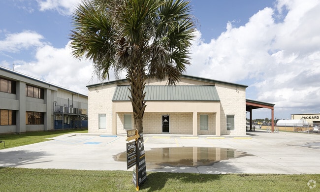
Property Record
844 Engineers Rd, Belle Chasse, LA 70037


NEARBY LISTINGS FOR SALE OR LEASE
Property Detail
844 Engineers Rd
New Orleans-Metairie, LA
Highland Industrial
1615214
1B (25, 000 SQ FT), HIGHLAND INDUSTRIAL PARK S/D - 125' FRONT ON ENGINEERS RD X 200'. OFFICE/WHSE
Commercialnec
Plaquemines
2024
Louisiana
2024
0.57 AC
050202
Plaquemines Parish
6,300 SF
New Orleans/Metairie/Kenner
DEMOGRAPHICS near 844 Engineers Rd
1 Mile
3 Mile
5 Mile
2024 Total Population
7,100
65,686
146,401
2029 Population
6,790
62,766
139,974
Pop Growth 2024-2029
(4.37%)
(4.45%)
(4.39%)
Average Age
40
38
39
2024 Total Households
2,557
23,794
54,856
HH Growth 2024-2029
(4.50%)
(4.58%)
(4.55%)
Median Household Inc
$79,088
$65,044
$54,864
Avg Household Size
2.70
2.70
2.60
2024 Avg HH Vehicles
2.00
2.00
2.00
Median Home Value
$249,390
$214,580
$195,863
Median Year Built
1980
1979
1976
Nearby Places
Map Layers
Map Styles
 Street
 Aerial
- Restaurants
- Banks
- Shops
- Fitness
- Groceries
PUBLIC TRANSPORTATION
COMMUTER RAIL
New Orleans Union Passenger Terminal (City of New Orleans - Amtrak, Crescent - Amtrak, Sunset Limited - Amtrak)
DRIVE
WALK
Distance
New Orleans Union Passenger Terminal (City of New Orleans - Amtrak, Crescent - Amtrak, Sunset Limited - Amtrak)
16 min
8.8 mi
AIRPORT
Louis Armstrong New Orleans International
DRIVE
WALK
Distance
Louis Armstrong New Orleans International
34 min
23.1 mi
Freight Ports
Plaquemines Port
DRIVE
WALK
Distance
Plaquemines Port
4 min
2.6 mi
SALE & LEASE HISTORY
LISTING DATE
SALE/LEASE

Oct 08, 2018
For Lease
Nearby Properties
Address
Land Use
TOTAL SIZE
Lot Size
Zoning
Address
Land Use
TOTAL SIZE
Lot Size
Zoning
3,215.52 AC
Address
Land Use
TOTAL SIZE
Lot Size
Zoning
53.64 AC
Address
Land Use
TOTAL SIZE
Lot Size
Zoning
14.40 AC
Address
Land Use
TOTAL SIZE
Lot Size
Zoning
Address
Land Use
TOTAL SIZE
Lot Size
Zoning
16.87 AC
R1A
Address
Land Use
TOTAL SIZE
Lot Size
Zoning
1.38 AC
Address
Land Use
TOTAL SIZE
Lot Size
Zoning
42.23 AC
Address
Land Use
TOTAL SIZE
Lot Size
Zoning
Address
Land Use
TOTAL SIZE
Lot Size
Zoning
Address
Land Use
TOTAL SIZE
Lot Size
Zoning
12.33 AC
Address
Land Use
TOTAL SIZE
Lot Size
Zoning
0.10 AC
Address
Land Use
TOTAL SIZE
Lot Size
Zoning
Address
Land Use
TOTAL SIZE
Lot Size
Zoning
0.15 AC
Address
Land Use
TOTAL SIZE
Lot Size
Zoning
0.15 AC
Address
Land Use
TOTAL SIZE
Lot Size
Zoning
Address
Land Use
TOTAL SIZE
Lot Size
Zoning
45,000 SF
Address
Land Use
TOTAL SIZE
Lot Size
Zoning
2.92 AC
Address
Land Use
TOTAL SIZE
Lot Size
Zoning
14.55 AC
Address
Land Use
TOTAL SIZE
Lot Size
Zoning
2.18 AC
R1A
Address
Land Use
TOTAL SIZE
Lot Size
Zoning
11.62 AC
Address
Land Use
TOTAL SIZE
Lot Size
Zoning
9.39 AC
R1A
Address
Land Use
TOTAL SIZE
Lot Size
Zoning
7,200 SF
1.46 AC
C2
Address
Land Use
TOTAL SIZE
Lot Size
Zoning
11.99 AC
MUCD
Address
Land Use
TOTAL SIZE
Lot Size
Zoning
9.15 AC
R1A
Address
Land Use
TOTAL SIZE
Lot Size
Zoning
10.15 AC
Address
Land Use
TOTAL SIZE
Lot Size
Zoning
10.14 AC
Address
Land Use
TOTAL SIZE
Lot Size
Zoning
5.35 AC
H1
Address
Land Use
TOTAL SIZE
Lot Size
Zoning
10.79 AC
Address
Land Use
TOTAL SIZE
Lot Size
Zoning
260,452 SF
11.03 AC
S-RM1
Address
Land Use
TOTAL SIZE
Lot Size
Zoning
148,122 SF
46.58 AC
I3
The World's #1 Commercial Real Estate Marketplace
Connect with us
© 2026 CoStar Group
The information above has been obtained from sources believed reliable. While we do not doubt its accuracy we have not verified it and make no guarantee, warranty or representation about it. It is your responsibility to independently confirm its accuracy and completeness. Any projections, opinions, assumptions, or estimates used are for example only and do not represent the current or future performance of the property. The value of this transaction to you depends on tax and other factors which should be evaluated by your tax, financial, and legal advisors. You and your advisors should conduct a careful, independent investigation of the property to determine to your satisfaction the suitability of the property for your needs.