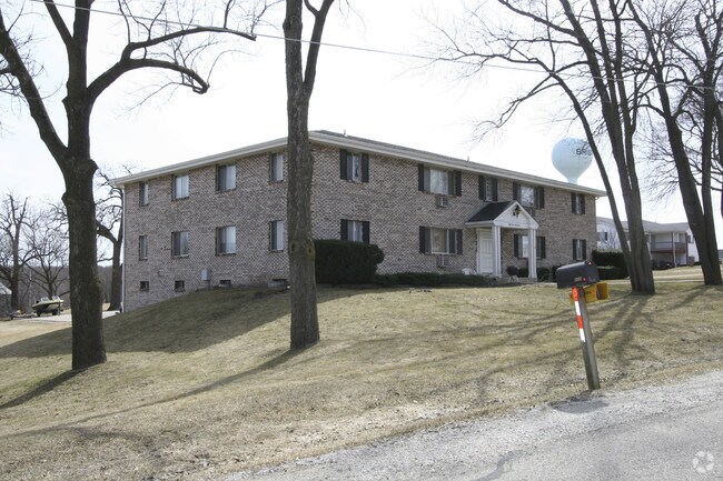
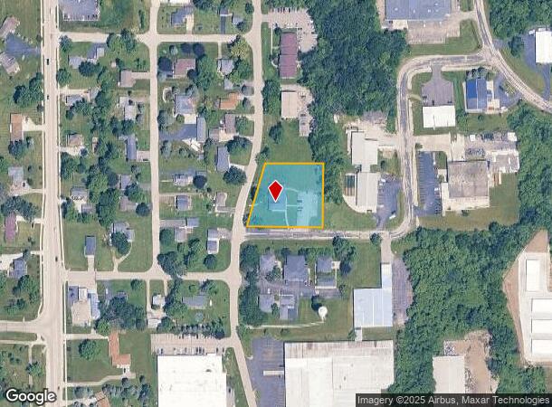
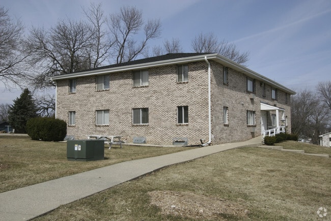
Property Record
8443 198Th Ave, Bristol, WI 53104
NEARBY LISTINGS FOR SALE OR LEASE
-
-
View all Bristol listings for sale on LoopNet.com
Property Detail
8443 198Th Ave
Chicago-Naperville-Elgin, IL-IN-WI
Csm# 510
37-4-121-083-0362
185-B-8 PT SW 1/4 SEC 8 T1 R21 PARCEL A CSM #510 V1013 P245 .993 AC DOC#1062991 DOC#1350153 DOC#1558232 (2010 INCORPORATION I
Commercialnec
Kenosha
X
Wisconsin
55059C0166D
0
2024
0.99 AC
2024
Outlying Kenosha County
002700
Chicago
7,296 SF
DEMOGRAPHICS near 8443 198Th Ave
1 Mile
3 Mile
5 Mile
2024 Total Population
1,643
6,419
21,324
2029 Population
1,622
6,443
21,383
Pop Growth 2024-2029
(1.28%)
+ 0.37%
+ 0.28%
Average Age
39
40
41
2024 Total Households
611
2,445
8,272
HH Growth 2024-2029
(1.31%)
+ 0.29%
+ 0.18%
Median Household Inc
$123,025
$110,965
$91,340
Avg Household Size
2.70
2.60
2.60
2024 Avg HH Vehicles
3.00
2.00
2.00
Median Home Value
$334,659
$338,695
$288,159
Median Year Built
1976
1986
1985
Nearby Places
Map Layers
Map Styles
 Street
 Aerial
- Restaurants
- Banks
- Shops
- Fitness
- Groceries
PUBLIC TRANSPORTATION
COMMUTER RAIL
Antioch Station (North Central Service - Northeast Illinois Regional Commuter Railroad (Metra))
DRIVE
WALK
Distance
Antioch Station (North Central Service - Northeast Illinois Regional Commuter Railroad (Metra))
15 min
7.2 mi
AIRPORT
General Mitchell International
DRIVE
WALK
Distance
General Mitchell International
43 min
34.1 mi
Freight Ports
Port Milwaukee
DRIVE
WALK
Distance
Port Milwaukee
47 min
38.0 mi
Nearby Properties
Address
Land Use
TOTAL SIZE
Lot Size
Zoning
Address
Land Use
TOTAL SIZE
Lot Size
Zoning
106,740 SF
7.34 AC
Address
Land Use
TOTAL SIZE
Lot Size
Zoning
11,324 SF
7.94 AC
Address
Land Use
TOTAL SIZE
Lot Size
Zoning
3,040 SF
145.82 AC
Address
Land Use
TOTAL SIZE
Lot Size
Zoning
8,112 SF
146 AC
Address
Land Use
TOTAL SIZE
Lot Size
Zoning
1,082 SF
142.60 AC
Address
Land Use
TOTAL SIZE
Lot Size
Zoning
95 AC
Address
Land Use
TOTAL SIZE
Lot Size
Zoning
5.04 AC
Address
Land Use
TOTAL SIZE
Lot Size
Zoning
16,800 SF
4.60 AC
Address
Land Use
TOTAL SIZE
Lot Size
Zoning
5,376 SF
4.92 AC
Address
Land Use
TOTAL SIZE
Lot Size
Zoning
4,810 SF
6.17 AC
Address
Land Use
TOTAL SIZE
Lot Size
Zoning
6,432 SF
1.96 AC
Address
Land Use
TOTAL SIZE
Lot Size
Zoning
17,946 SF
5.81 AC
Address
Land Use
TOTAL SIZE
Lot Size
Zoning
13,020 SF
2.46 AC
Address
Land Use
TOTAL SIZE
Lot Size
Zoning
9,644 SF
1.84 AC
Address
Land Use
TOTAL SIZE
Lot Size
Zoning
1,920 SF
1.56 AC
Address
Land Use
TOTAL SIZE
Lot Size
Zoning
18,225 SF
103.60 AC
Address
Land Use
TOTAL SIZE
Lot Size
Zoning
2,742 SF
2.54 AC
Address
Land Use
TOTAL SIZE
Lot Size
Zoning
960 SF
47.30 AC
Address
Land Use
TOTAL SIZE
Lot Size
Zoning
5.01 AC
Address
Land Use
TOTAL SIZE
Lot Size
Zoning
5,103 SF
1.16 AC
Address
Land Use
TOTAL SIZE
Lot Size
Zoning
3.51 AC
Address
Land Use
TOTAL SIZE
Lot Size
Zoning
4.99 AC
Address
Land Use
TOTAL SIZE
Lot Size
Zoning
11,880 SF
2.40 AC
Address
Land Use
TOTAL SIZE
Lot Size
Zoning
3,689 SF
1.06 AC
Address
Land Use
TOTAL SIZE
Lot Size
Zoning
4,860 SF
3.07 AC
Address
Land Use
TOTAL SIZE
Lot Size
Zoning
4,200 SF
2.04 AC
Address
Land Use
TOTAL SIZE
Lot Size
Zoning
627 SF
0.14 AC
Address
Land Use
TOTAL SIZE
Lot Size
Zoning
35.37 AC
Address
Land Use
TOTAL SIZE
Lot Size
Zoning
5,400 SF
3.60 AC
Address
Land Use
TOTAL SIZE
Lot Size
Zoning
25,460 SF
4.41 AC
The World's #1 Commercial Real Estate Marketplace
Connect with us
© 2025 CoStar Group
The information above has been obtained from sources believed reliable. While we do not doubt its accuracy we have not verified it and make no guarantee, warranty or representation about it. It is your responsibility to independently confirm its accuracy and completeness. Any projections, opinions, assumptions, or estimates used are for example only and do not represent the current or future performance of the property. The value of this transaction to you depends on tax and other factors which should be evaluated by your tax, financial, and legal advisors. You and your advisors should conduct a careful, independent investigation of the property to determine to your satisfaction the suitability of the property for your needs.