Property Record
8445 Dani Dr, Fort Myers, FL 33966


NEARBY LISTINGS FOR SALE OR LEASE
-
-
View all Fort Myers listings for sale on LoopNet.com
Property Detail
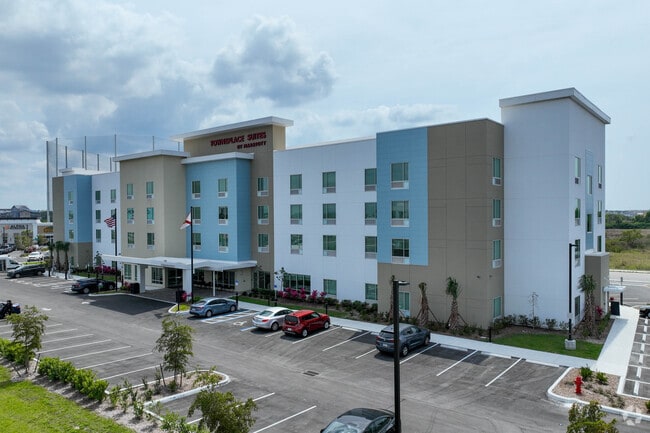
8445 Dani Dr
Southwest Florida
Colonial 75 Replat
Cape Coral-Fort Myers, FL
COLONIAL 75 REPLAT AS DESC IN INST 2020000269811 LOT 1
34-44-25-P1-29000.0010
Lee
Hotel
Florida
2024
1
2025
2.22 AC
040134
Fort Myers/Bonita Springs
DEMOGRAPHICS near 8445 Dani Dr
1 Mile
3 Mile
5 Mile
2024 Total Population
7,860
49,293
145,764
2029 Population
9,631
59,494
173,585
Pop Growth 2024-2029
+ 22.53%
+ 20.69%
+ 19.09%
Average Age
39
44
42
2024 Total Households
3,098
20,510
58,451
HH Growth 2024-2029
+ 23.72%
+ 20.78%
+ 19.06%
Median Household Inc
$65,579
$67,652
$59,935
Avg Household Size
2.10
2.20
2.30
2024 Avg HH Vehicles
2.00
2.00
2.00
Median Home Value
$269,793
$311,453
$291,663
Median Year Built
2010
2008
2000
Nearby Places
Map Layers
Map Styles
 Street
 Aerial
- Restaurants
- Banks
- Shops
- Fitness
- Groceries
PUBLIC TRANSPORTATION
AIRPORT
Southwest Florida International
DRIVE
WALK
Distance
Southwest Florida International
14 min
8.5 mi
Punta Gorda
DRIVE
WALK
Distance
Punta Gorda
33 min
27.3 mi
Freight Ports
Port Manatee
DRIVE
WALK
Distance
Port Manatee
113 min
99.0 mi
Nearby Properties
Address
Land Use
TOTAL SIZE
Lot Size
Zoning
Address
Land Use
TOTAL SIZE
Lot Size
Zoning
608,522 SF
38.57 AC
CG
Address
Land Use
TOTAL SIZE
Lot Size
Zoning
438,839 SF
66.95 AC
MU
Address
Land Use
TOTAL SIZE
Lot Size
Zoning
463,722 SF
23.85 AC
C-1
Address
Land Use
TOTAL SIZE
Lot Size
Zoning
520,572 SF
24.13 AC
CG
Address
Land Use
TOTAL SIZE
Lot Size
Zoning
429,703 SF
16.24 AC
PUD
Address
Land Use
TOTAL SIZE
Lot Size
Zoning
362,391 SF
12.80 AC
SDA
Address
Land Use
TOTAL SIZE
Lot Size
Zoning
475,045 SF
30.22 AC
PUD
Address
Land Use
TOTAL SIZE
Lot Size
Zoning
24.69 AC
C-1
Address
Land Use
TOTAL SIZE
Lot Size
Zoning
432,890 SF
18.88 AC
SDA
Address
Land Use
TOTAL SIZE
Lot Size
Zoning
422,099 SF
1.10 AC
CG
Address
Land Use
TOTAL SIZE
Lot Size
Zoning
286,629 SF
13.01 AC
SDA
Address
Land Use
TOTAL SIZE
Lot Size
Zoning
16.13 AC
Address
Land Use
TOTAL SIZE
Lot Size
Zoning
111.70 AC
C1
Address
Land Use
TOTAL SIZE
Lot Size
Zoning
425,658 SF
25.61 AC
CG
Address
Land Use
TOTAL SIZE
Lot Size
Zoning
304,258 SF
12.20 AC
CG
Address
Land Use
TOTAL SIZE
Lot Size
Zoning
368,722 SF
18.09 AC
CG
Address
Land Use
TOTAL SIZE
Lot Size
Zoning
305,224 SF
17.11 AC
CG
Address
Land Use
TOTAL SIZE
Lot Size
Zoning
694,188 SF
22.43 AC
PUD
Address
Land Use
TOTAL SIZE
Lot Size
Zoning
364,206 SF
106.76 AC
PUD
Address
Land Use
TOTAL SIZE
Lot Size
Zoning
580,121 SF
61.83 AC
IL
Address
Land Use
TOTAL SIZE
Lot Size
Zoning
324,346 SF
20 AC
C1
Address
Land Use
TOTAL SIZE
Lot Size
Zoning
9.07 AC
SDA
Address
Land Use
TOTAL SIZE
Lot Size
Zoning
17.50 AC
C1
Address
Land Use
TOTAL SIZE
Lot Size
Zoning
260,320 SF
8.81 AC
SDA
Address
Land Use
TOTAL SIZE
Lot Size
Zoning
261,340 SF
9.07 AC
CG
Address
Land Use
TOTAL SIZE
Lot Size
Zoning
6.99 AC
C-1
Address
Land Use
TOTAL SIZE
Lot Size
Zoning
13.71 AC
Address
Land Use
TOTAL SIZE
Lot Size
Zoning
319,765 SF
47.40 AC
RS7
Address
Land Use
TOTAL SIZE
Lot Size
Zoning
11.64 AC
C-1
Address
Land Use
TOTAL SIZE
Lot Size
Zoning
250,169 SF
10.67 AC
CI
The World's #1 Commercial Real Estate Marketplace
Connect with us
© 2026 CoStar Group
The information above has been obtained from sources believed reliable. While we do not doubt its accuracy we have not verified it and make no guarantee, warranty or representation about it. It is your responsibility to independently confirm its accuracy and completeness. Any projections, opinions, assumptions, or estimates used are for example only and do not represent the current or future performance of the property. The value of this transaction to you depends on tax and other factors which should be evaluated by your tax, financial, and legal advisors. You and your advisors should conduct a careful, independent investigation of the property to determine to your satisfaction the suitability of the property for your needs.