Property Record
8451 Oakdale Rd, Sherwood, AR 72120
This Property Is For Sale
NEARBY LISTINGS FOR SALE OR LEASE
Property Detail
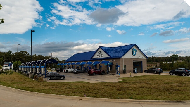
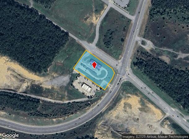
8451 Oakdale Rd
Little Rock-North Little Rock-Conway, AR
Oakdale Valley Addn
22S-929-03-001-00
LT 1R
Carwash
Pulaski
X
Arkansas
05119C0355G
1r
2025
2.12 AC
2025
Outlying Pulaski County
003713
Little Rock/N Little Rock
4,750 SF
DEMOGRAPHICS near 8451 Oakdale Rd
1 Mile
3 Mile
5 Mile
2024 Total Population
5,764
34,748
69,301
2029 Population
5,750
34,335
68,436
Pop Growth 2024-2029
(0.24%)
(1.19%)
(1.25%)
Average Age
40
40
40
2024 Total Households
2,311
14,407
28,645
HH Growth 2024-2029
(0.35%)
(1.33%)
(1.37%)
Median Household Inc
$74,655
$68,970
$62,954
Avg Household Size
2.50
2.40
2.30
2024 Avg HH Vehicles
2.00
2.00
2.00
Median Home Value
$247,532
$186,498
$178,402
Median Year Built
1999
1986
1981
Nearby Places
- Restaurants
- Banks
- Shops
- Fitness
- Groceries
PUBLIC TRANSPORTATION
AIRPORT
Bill and Hillary Clinton Ntl/Adams Field
DRIVE
WALK
Distance
Bill and Hillary Clinton Ntl/Adams Field
24 min
14.9 mi
Freight Ports
Port of Shreveport
DRIVE
WALK
Distance
Port of Shreveport
265 min
243.8 mi
Nearby Properties
Address
Land Use
TOTAL SIZE
Lot Size
Zoning
Address
Land Use
TOTAL SIZE
Lot Size
Zoning
316,927 SF
50.65 AC
Address
Land Use
TOTAL SIZE
Lot Size
Zoning
72,806 SF
10.95 AC
Address
Land Use
TOTAL SIZE
Lot Size
Zoning
17,352 SF
42.55 AC
Address
Land Use
TOTAL SIZE
Lot Size
Zoning
36,934 SF
15.06 AC
Address
Land Use
TOTAL SIZE
Lot Size
Zoning
75,462 SF
5.33 AC
Address
Land Use
TOTAL SIZE
Lot Size
Zoning
219,330 SF
24.14 AC
Address
Land Use
TOTAL SIZE
Lot Size
Zoning
72,157 SF
9.45 AC
Address
Land Use
TOTAL SIZE
Lot Size
Zoning
31,644 SF
Address
Land Use
TOTAL SIZE
Lot Size
Zoning
56,643 SF
9.46 AC
Address
Land Use
TOTAL SIZE
Lot Size
Zoning
8,520 SF
11.30 AC
Address
Land Use
TOTAL SIZE
Lot Size
Zoning
45,500 SF
12.07 AC
Address
Land Use
TOTAL SIZE
Lot Size
Zoning
145,604 SF
12.62 AC
Address
Land Use
TOTAL SIZE
Lot Size
Zoning
32,788 SF
3.99 AC
Address
Land Use
TOTAL SIZE
Lot Size
Zoning
33,597 SF
Address
Land Use
TOTAL SIZE
Lot Size
Zoning
44,092 SF
7.97 AC
Address
Land Use
TOTAL SIZE
Lot Size
Zoning
54,401 SF
1.68 AC
Address
Land Use
TOTAL SIZE
Lot Size
Zoning
40,065 SF
8.26 AC
Address
Land Use
TOTAL SIZE
Lot Size
Zoning
26,334 SF
4.51 AC
Address
Land Use
TOTAL SIZE
Lot Size
Zoning
75,064 SF
5.78 AC
Address
Land Use
TOTAL SIZE
Lot Size
Zoning
35,645 SF
7.97 AC
Address
Land Use
TOTAL SIZE
Lot Size
Zoning
105,833 SF
21.94 AC
Address
Land Use
TOTAL SIZE
Lot Size
Zoning
89,724 SF
7.60 AC
Address
Land Use
TOTAL SIZE
Lot Size
Zoning
29,600 SF
4.43 AC
Address
Land Use
TOTAL SIZE
Lot Size
Zoning
12,990 SF
5.72 AC
Address
Land Use
TOTAL SIZE
Lot Size
Zoning
32,256 SF
6.22 AC
Address
Land Use
TOTAL SIZE
Lot Size
Zoning
97,980 SF
5.89 AC
Address
Land Use
TOTAL SIZE
Lot Size
Zoning
1,353 SF
0.68 AC
M-H
Address
Land Use
TOTAL SIZE
Lot Size
Zoning
24,678 SF
108.23 AC
Address
Land Use
TOTAL SIZE
Lot Size
Zoning
14,416 SF
3.54 AC
Address
Land Use
TOTAL SIZE
Lot Size
Zoning
90,914 SF
2.88 AC
The World's #1 Commercial Real Estate Marketplace
Connect with us
© 2025 CoStar Group
The information above has been obtained from sources believed reliable. While we do not doubt its accuracy we have not verified it and make no guarantee, warranty or representation about it. It is your responsibility to independently confirm its accuracy and completeness. Any projections, opinions, assumptions, or estimates used are for example only and do not represent the current or future performance of the property. The value of this transaction to you depends on tax and other factors which should be evaluated by your tax, financial, and legal advisors. You and your advisors should conduct a careful, independent investigation of the property to determine to your satisfaction the suitability of the property for your needs.