Property Record
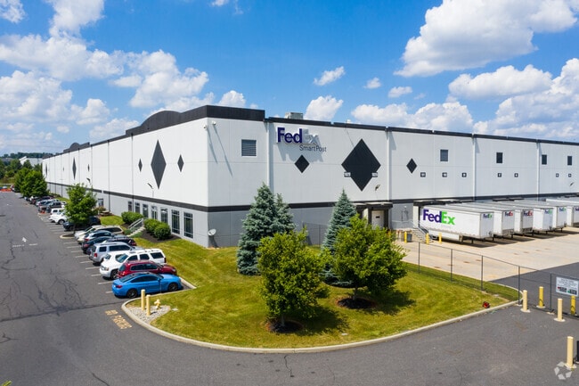
8451 Willard Dr, Breinigsville, PA 18031


NEARBY LISTINGS FOR SALE OR LEASE
Property Detail
8451 Willard Dr
545581383487-1
Boulder Bus Ctr West
Distributionwarehouseregional
Lehigh
X
Pennsylvania
42011C0220G
65.34 AC
2025
Lehigh Valley
2025
Philadelphia
006205
Allentown-Bethlehem-Easton, PA-NJ
920,400 SF
DEMOGRAPHICS near 8451 Willard Dr
1 Mile
3 Mile
5 Mile
2024 Total Population
5,747
27,023
73,624
2029 Population
5,900
27,282
74,145
Pop Growth 2024-2029
+ 2.66%
+ 0.96%
+ 0.71%
Average Age
38
40
41
2024 Total Households
2,146
9,776
27,693
HH Growth 2024-2029
+ 2.84%
+ 1.00%
+ 0.71%
Median Household Inc
$77,176
$105,279
$99,198
Avg Household Size
2.60
2.70
2.60
2024 Avg HH Vehicles
2.00
2.00
2.00
Median Home Value
$269,939
$317,553
$319,941
Median Year Built
2004
1999
1991
Nearby Places
Map Layers
Map Styles
 Street
 Aerial
- Restaurants
- Banks
- Shops
- Fitness
- Groceries
PUBLIC TRANSPORTATION
AIRPORT
Lehigh Valley International
DRIVE
WALK
Distance
Lehigh Valley International
25 min
15.2 mi
Freight Ports
Port of Philadelphia
DRIVE
WALK
Distance
Port of Philadelphia
83 min
63.5 mi
SALE & LEASE HISTORY
LISTING DATE
SALE/LEASE

Sep 11, 2019
For Lease
Nearby Properties
Address
Land Use
TOTAL SIZE
Lot Size
Zoning
Address
Land Use
TOTAL SIZE
Lot Size
Zoning
474,892 SF
33.35 AC
L1-L
Address
Land Use
TOTAL SIZE
Lot Size
Zoning
1,155,164 SF
101.05 AC
L1
Address
Land Use
TOTAL SIZE
Lot Size
Zoning
1,042,665 SF
86 AC
LI
Address
Land Use
TOTAL SIZE
Lot Size
Zoning
600,000 SF
72.02 AC
L1
Address
Land Use
TOTAL SIZE
Lot Size
Zoning
1,200,000 SF
77.38 AC
HI-S
Address
Land Use
TOTAL SIZE
Lot Size
Zoning
1,099,800 SF
70 AC
HI-S
Address
Land Use
TOTAL SIZE
Lot Size
Zoning
1,088,000 SF
70.68 AC
HI-S
Address
Land Use
TOTAL SIZE
Lot Size
Zoning
1,192,380 SF
83.59 AC
LI
Address
Land Use
TOTAL SIZE
Lot Size
Zoning
5,240 SF
137.34 AC
RT
Address
Land Use
TOTAL SIZE
Lot Size
Zoning
927,980 SF
58.81 AC
HI-S
Address
Land Use
TOTAL SIZE
Lot Size
Zoning
685,920 SF
83.33 AC
LI
Address
Land Use
TOTAL SIZE
Lot Size
Zoning
999,600 SF
67.99 AC
LI
Address
Land Use
TOTAL SIZE
Lot Size
Zoning
12,545 SF
84.20 AC
LI
Address
Land Use
TOTAL SIZE
Lot Size
Zoning
4,990 SF
39.62 AC
R5
Address
Land Use
TOTAL SIZE
Lot Size
Zoning
789,551 SF
52.39 AC
LI
Address
Land Use
TOTAL SIZE
Lot Size
Zoning
822,162 SF
50.12 AC
LI
Address
Land Use
TOTAL SIZE
Lot Size
Zoning
730,080 SF
44.34 AC
Address
Land Use
TOTAL SIZE
Lot Size
Zoning
730,080 SF
44.96 AC
Address
Land Use
TOTAL SIZE
Lot Size
Zoning
794,880 SF
45.63 AC
LI
Address
Land Use
TOTAL SIZE
Lot Size
Zoning
651,393 SF
71.96 AC
HI-S
Address
Land Use
TOTAL SIZE
Lot Size
Zoning
573,344 SF
38.61 AC
LI
Address
Land Use
TOTAL SIZE
Lot Size
Zoning
480,000 SF
27.94 AC
LI
Address
Land Use
TOTAL SIZE
Lot Size
Zoning
610,647 SF
46.50 AC
LI
Address
Land Use
TOTAL SIZE
Lot Size
Zoning
19,055 SF
194.07 AC
LI
Address
Land Use
TOTAL SIZE
Lot Size
Zoning
4,948 SF
51.05 AC
R3
Address
Land Use
TOTAL SIZE
Lot Size
Zoning
725,760 SF
50.25 AC
LI
Address
Land Use
TOTAL SIZE
Lot Size
Zoning
4,037 SF
30.51 AC
R5
Address
Land Use
TOTAL SIZE
Lot Size
Zoning
808,418 SF
65.50 AC
LI
Address
Land Use
TOTAL SIZE
Lot Size
Zoning
607,320 SF
53.44 AC
LI
The World's #1 Commercial Real Estate Marketplace
Connect with us
© 2026 CoStar Group
The information above has been obtained from sources believed reliable. While we do not doubt its accuracy we have not verified it and make no guarantee, warranty or representation about it. It is your responsibility to independently confirm its accuracy and completeness. Any projections, opinions, assumptions, or estimates used are for example only and do not represent the current or future performance of the property. The value of this transaction to you depends on tax and other factors which should be evaluated by your tax, financial, and legal advisors. You and your advisors should conduct a careful, independent investigation of the property to determine to your satisfaction the suitability of the property for your needs.