Property Record
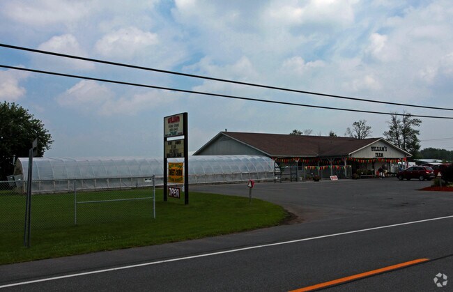
8455 Whiting Rd, Cicero, NY 13039


Property Detail
8455 Whiting Rd
312289-088-000-0001-005-001-0000
ONONDAGA
Truckcrops
New York
N00
5.001
B and X Area of moderate flood hazard, usually the area between the limits of the 100-year and 500-year floods.
66.55 AC
0
SE Outer Onondaga County
2025
Syracuse
010321
Syracuse, NY
13,983 SF
NEARBY LISTINGS FOR SALE OR LEASE
DEMOGRAPHICS near 8455 Whiting Rd
1 mile
3 mile
5 mile
2025 Total Population
2,769
18,119
42,531
2030 Population
2,713
17,874
41,915
Pop Growth 2025-2030
(2.02%)
(1.35%)
(1.45%)
Average Age
41
43
43
2025 Total Households
1,000
7,252
17,388
HH Growth 2025-2030
(2.10%)
(1.42%)
(1.55%)
Median Household Inc
$140,258
$110,935
$99,866
Avg Household Size
2.80
2.50
2.40
2025 Avg HH Vehicles
2.00
2.00
2.00
Median Home Value
$296,666
$245,095
$214,529
Median Year Built
1994
1982
1974
Nearby Places
Map Layers
Map Styles
 Street
 Aerial
Layers
 Traffic
 Biking
Places
Listings with unknown addresses are not visible on the map
- Restaurants
- Banks
- Shops
- Fitness
- Groceries
PUBLIC TRANSPORTATION
AIRPORT
Syracuse Hancock International
Drive
Walk
Distance
Syracuse Hancock International
15 min
8.8 mi
Freight Ports
Albany, NY Port
Drive
Walk
Distance
Albany, NY Port
176 min
146.0 mi
Nearby Properties
Address
Land Use
TOTAL SIZE
Lot Size
Zoning
Address
Land Use
TOTAL SIZE
Lot Size
Zoning
256,727 SF
70.21 AC
Address
Land Use
TOTAL SIZE
Lot Size
Zoning
439,670 SF
74.73 AC
C-G
Address
Land Use
TOTAL SIZE
Lot Size
Zoning
157,010 SF
36.98 AC
Address
Land Use
TOTAL SIZE
Lot Size
Zoning
24,556 SF
16.52 AC
Address
Land Use
TOTAL SIZE
Lot Size
Zoning
203,345 SF
18.17 AC
Address
Land Use
TOTAL SIZE
Lot Size
Zoning
84,048 SF
19.42 AC
Address
Land Use
TOTAL SIZE
Lot Size
Zoning
125,400 SF
18.11 AC
GC
Address
Land Use
TOTAL SIZE
Lot Size
Zoning
92,844 SF
14.26 AC
C-G
Address
Land Use
TOTAL SIZE
Lot Size
Zoning
66,538 SF
18.24 AC
Address
Land Use
TOTAL SIZE
Lot Size
Zoning
61,469 SF
17.72 AC
Address
Land Use
TOTAL SIZE
Lot Size
Zoning
81,439 SF
15.48 AC
Address
Land Use
TOTAL SIZE
Lot Size
Zoning
57,052 SF
16.82 AC
Address
Land Use
TOTAL SIZE
Lot Size
Zoning
67,143 SF
3.91 AC
Address
Land Use
TOTAL SIZE
Lot Size
Zoning
2,404 SF
9.73 AC
Address
Land Use
TOTAL SIZE
Lot Size
Zoning
62,247 SF
48.75 AC
Address
Land Use
TOTAL SIZE
Lot Size
Zoning
29,745 SF
31.63 AC
Address
Land Use
TOTAL SIZE
Lot Size
Zoning
42,698 SF
13.85 AC
Address
Land Use
TOTAL SIZE
Lot Size
Zoning
271,263 SF
77.30 AC
Address
Land Use
TOTAL SIZE
Lot Size
Zoning
17,436 SF
98.89 AC
06000
Address
Land Use
TOTAL SIZE
Lot Size
Zoning
8,224 SF
8.45 AC
PUD-R
Address
Land Use
TOTAL SIZE
Lot Size
Zoning
8,224 SF
9.86 AC
PUD-R
Address
Land Use
TOTAL SIZE
Lot Size
Zoning
15,696 SF
26.92 AC
PUD-R
Address
Land Use
TOTAL SIZE
Lot Size
Zoning
900 SF
0.44 AC
R-10
Address
Land Use
TOTAL SIZE
Lot Size
Zoning
43,968 SF
1.95 AC
Address
Land Use
TOTAL SIZE
Lot Size
Zoning
3,724 SF
56.89 AC
N00
Address
Land Use
TOTAL SIZE
Lot Size
Zoning
12,220 SF
5.86 AC
Address
Land Use
TOTAL SIZE
Lot Size
Zoning
23.23 AC
Address
Land Use
TOTAL SIZE
Lot Size
Zoning
74,342 SF
8.81 AC
Address
Land Use
TOTAL SIZE
Lot Size
Zoning
26,724 SF
89.15 AC
Address
Land Use
TOTAL SIZE
Lot Size
Zoning
800 SF
13.62 AC
The World's #1 Commercial Real Estate Marketplace
Connect with us
© 2026 CoStar Group
The information above has been obtained from sources believed reliable. While we do not doubt its accuracy we have not verified it and make no guarantee, warranty or representation about it. It is your responsibility to independently confirm its accuracy and completeness. Any projections, opinions, assumptions, or estimates used are for example only and do not represent the current or future performance of the property. The value of this transaction to you depends on tax and other factors which should be evaluated by your tax, financial, and legal advisors. You and your advisors should conduct a careful, independent investigation of the property to determine to your satisfaction the suitability of the property for your needs.