Property Record
8459 Olean Rd, Holland, NY 14080

Property Detail
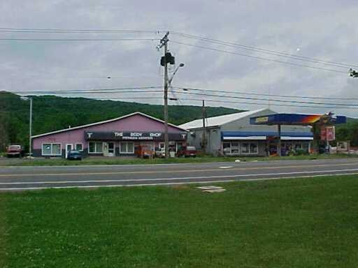
8459 Olean Rd
Buffalo-Cheektowaga, NY
N MARTINDALE E CREEK S RANGER W HIGHWAY 7.1AC
145000-231-000-0003-013-000
ERIE
Commercialnec
New York
AE The base floodplain where base flood elevations are provided. AE Zones are now used on new format FIRMs instead of A1-A30 Zones.
13.000
2025
7.59 AC
2024
Outlying Erie County
015003
Buffalo/Niagara Falls
11,900 SF
NEARBY LISTINGS FOR SALE OR LEASE
-
-
View all Holland listings for sale on LoopNet.com
DEMOGRAPHICS near 8459 Olean Rd
1 mile
3 mile
5 mile
2024 Total Population
901
2,805
6,618
2029 Population
893
2,795
6,633
Pop Growth 2024-2029
(0.89%)
(0.36%)
+ 0.23%
Average Age
43
44
45
2024 Total Households
388
1,200
2,789
HH Growth 2024-2029
(0.77%)
(0.42%)
+ 0.18%
Median Household Inc
$43,928
$72,175
$80,153
Avg Household Size
2.30
2.30
2.40
2024 Avg HH Vehicles
2.00
2.00
2.00
Median Home Value
$229,411
$268,492
$279,352
Median Year Built
1955
1964
1969
Nearby Places
Map Layers
Map Styles
 Street
 Aerial
Transit
 Traffic
 Biking
Places
Listings with unknown addresses are not visible on the map
- Restaurants
- Banks
- Shops
- Fitness
- Groceries
PUBLIC TRANSPORTATION
AIRPORT
Buffalo Niagara International
Drive
Walk
Distance
Buffalo Niagara International
40 min
26.0 mi
Freight Ports
Albany, NY Port
Drive
Walk
Distance
Albany, NY Port
357 min
289.9 mi
Nearby Properties
Address
Land Use
TOTAL SIZE
Lot Size
Zoning
Address
Land Use
TOTAL SIZE
Lot Size
Zoning
100,150 SF
31.77 AC
Address
Land Use
TOTAL SIZE
Lot Size
Zoning
121,798 SF
24.38 AC
Address
Land Use
TOTAL SIZE
Lot Size
Zoning
170,043 SF
16.59 AC
Address
Land Use
TOTAL SIZE
Lot Size
Zoning
26,640 SF
10.50 AC
Address
Land Use
TOTAL SIZE
Lot Size
Zoning
18,780 SF
2.24 AC
Address
Land Use
TOTAL SIZE
Lot Size
Zoning
5,472 SF
7.11 AC
Address
Land Use
TOTAL SIZE
Lot Size
Zoning
7,200 SF
19.58 AC
Address
Land Use
TOTAL SIZE
Lot Size
Zoning
910 SF
34.14 AC
Address
Land Use
TOTAL SIZE
Lot Size
Zoning
Address
Land Use
TOTAL SIZE
Lot Size
Zoning
9,873 SF
2.19 AC
Address
Land Use
TOTAL SIZE
Lot Size
Zoning
605 SF
8.62 AC
Address
Land Use
TOTAL SIZE
Lot Size
Zoning
3,038 SF
4.10 AC
Address
Land Use
TOTAL SIZE
Lot Size
Zoning
5,992 SF
3.38 AC
Address
Land Use
TOTAL SIZE
Lot Size
Zoning
12,000 SF
8 AC
Address
Land Use
TOTAL SIZE
Lot Size
Zoning
4,274 SF
3.28 AC
Address
Land Use
TOTAL SIZE
Lot Size
Zoning
7,500 SF
2.61 AC
05 - COMME
Address
Land Use
TOTAL SIZE
Lot Size
Zoning
Address
Land Use
TOTAL SIZE
Lot Size
Zoning
1.74 AC
Address
Land Use
TOTAL SIZE
Lot Size
Zoning
23,820 SF
4.70 AC
Address
Land Use
TOTAL SIZE
Lot Size
Zoning
8,476 SF
4.90 AC
Address
Land Use
TOTAL SIZE
Lot Size
Zoning
543.57 AC
Address
Land Use
TOTAL SIZE
Lot Size
Zoning
1.50 AC
Address
Land Use
TOTAL SIZE
Lot Size
Zoning
4,008 SF
1.26 AC
Address
Land Use
TOTAL SIZE
Lot Size
Zoning
Address
Land Use
TOTAL SIZE
Lot Size
Zoning
2,800 SF
0.95 AC
Address
Land Use
TOTAL SIZE
Lot Size
Zoning
1,850 SF
12 AC
Address
Land Use
TOTAL SIZE
Lot Size
Zoning
8,640 SF
10 AC
Address
Land Use
TOTAL SIZE
Lot Size
Zoning
1,480 SF
271.19 AC
Address
Land Use
TOTAL SIZE
Lot Size
Zoning
3,782 SF
67.51 AC
Address
Land Use
TOTAL SIZE
Lot Size
Zoning
16,816 SF
11 AC
The World's #1 Commercial Real Estate Marketplace
Connect with us
© 2026 CoStar Group
The information above has been obtained from sources believed reliable. While we do not doubt its accuracy we have not verified it and make no guarantee, warranty or representation about it. It is your responsibility to independently confirm its accuracy and completeness. Any projections, opinions, assumptions, or estimates used are for example only and do not represent the current or future performance of the property. The value of this transaction to you depends on tax and other factors which should be evaluated by your tax, financial, and legal advisors. You and your advisors should conduct a careful, independent investigation of the property to determine to your satisfaction the suitability of the property for your needs.