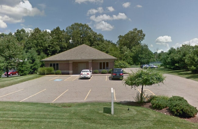
Property Record
846 3Rd St Nw, Massillon, OH 44647

Save to a Folder
{{folder.Name}}
{{folder.ListingIds.length}} Properties
{{folder.ListingIds.length}} Property
Create a New Folder
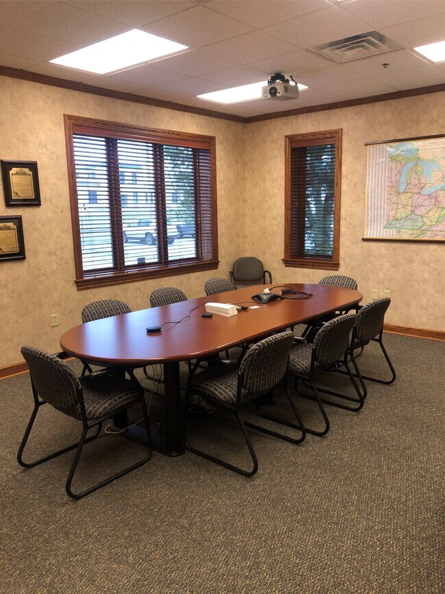
Property Detail
846 3Rd St Nw
10012599
OL 1211 - 1.66A
Lightindustrial
Stark
AE The base floodplain where base flood elevations are provided. AE Zones are now used on new format FIRMs instead of A1-A30 Zones.
Ohio
0
1.66 AC
2025
Stark County
713900
Cleveland
8,262 SF
Canton-Massillon, OH
NEARBY LISTINGS FOR SALE OR LEASE
DEMOGRAPHICS near 846 3Rd St Nw
1 mile
3 mile
5 mile
2025 Total Population
9,436
48,389
82,209
2030 Population
9,635
48,515
82,179
Pop Growth 2025-2030
+ 2.11%
+ 0.26%
(0.04%)
Average Age
40
42
43
2025 Total Households
4,134
20,576
34,433
HH Growth 2025-2030
+ 2.06%
+ 0.25%
(0.05%)
Median Household Inc
$51,875
$59,705
$64,905
Avg Household Size
2.20
2.30
2.30
2025 Avg HH Vehicles
2.00
2.00
2.00
Median Home Value
$123,526
$162,370
$185,810
Median Year Built
1949
1963
1968
Nearby Places
Map Layers
Map Styles
 Street
 Aerial
Layers
 Traffic
 Biking
Places
Listings with unknown addresses are not visible on the map
- Restaurants
- Banks
- Shops
- Fitness
- Groceries
PUBLIC TRANSPORTATION
AIRPORT
Akron-Canton Regional
Drive
Walk
Distance
Akron-Canton Regional
21 min
11.5 mi
Freight Ports
Port of Toledo
Drive
Walk
Distance
Port of Toledo
178 min
151.6 mi
SALE & LEASE HISTORY
LISTING DATE
SALE/LEASE

Feb 12, 2020
For Sale
Nearby Properties
Address
Land Use
TOTAL SIZE
Lot Size
Zoning
Address
Land Use
TOTAL SIZE
Lot Size
Zoning
417,003 SF
35.79 AC
Address
Land Use
TOTAL SIZE
Lot Size
Zoning
297,109 SF
61.24 AC
Address
Land Use
TOTAL SIZE
Lot Size
Zoning
287,504 SF
54.58 AC
Address
Land Use
TOTAL SIZE
Lot Size
Zoning
222,352 SF
5.45 AC
Address
Land Use
TOTAL SIZE
Lot Size
Zoning
276,484 SF
21.51 AC
Address
Land Use
TOTAL SIZE
Lot Size
Zoning
215,273 SF
31.35 AC
Address
Land Use
TOTAL SIZE
Lot Size
Zoning
290,926 SF
43.11 AC
Address
Land Use
TOTAL SIZE
Lot Size
Zoning
68,518 SF
9.27 AC
Address
Land Use
TOTAL SIZE
Lot Size
Zoning
96,277 SF
13.51 AC
Address
Land Use
TOTAL SIZE
Lot Size
Zoning
216,760 SF
15.51 AC
Address
Land Use
TOTAL SIZE
Lot Size
Zoning
246,618 SF
11.30 AC
Address
Land Use
TOTAL SIZE
Lot Size
Zoning
59,337 SF
5.99 AC
Address
Land Use
TOTAL SIZE
Lot Size
Zoning
228,545 SF
19.07 AC
Address
Land Use
TOTAL SIZE
Lot Size
Zoning
118,943 SF
10.51 AC
Address
Land Use
TOTAL SIZE
Lot Size
Zoning
63,324 SF
5.93 AC
Address
Land Use
TOTAL SIZE
Lot Size
Zoning
47,050 SF
3.58 AC
Address
Land Use
TOTAL SIZE
Lot Size
Zoning
69,514 SF
22.98 AC
Address
Land Use
TOTAL SIZE
Lot Size
Zoning
306,616 SF
5.80 AC
Address
Land Use
TOTAL SIZE
Lot Size
Zoning
67,056 SF
1.91 AC
Address
Land Use
TOTAL SIZE
Lot Size
Zoning
82,413 SF
15.62 AC
Address
Land Use
TOTAL SIZE
Lot Size
Zoning
79,092 SF
1.29 AC
Address
Land Use
TOTAL SIZE
Lot Size
Zoning
139,720 SF
9.51 AC
Address
Land Use
TOTAL SIZE
Lot Size
Zoning
140,818 SF
12.09 AC
Address
Land Use
TOTAL SIZE
Lot Size
Zoning
96,944 SF
12.84 AC
Address
Land Use
TOTAL SIZE
Lot Size
Zoning
70,544 SF
3.43 AC
Address
Land Use
TOTAL SIZE
Lot Size
Zoning
48,994 SF
4.39 AC
Address
Land Use
TOTAL SIZE
Lot Size
Zoning
67,011 SF
17.58 AC
Address
Land Use
TOTAL SIZE
Lot Size
Zoning
142,214 SF
8.75 AC
Address
Land Use
TOTAL SIZE
Lot Size
Zoning
70,309 SF
12.66 AC
Address
Land Use
TOTAL SIZE
Lot Size
Zoning
69,880 SF
1.27 AC
The World's #1 Commercial Real Estate Marketplace
Connect with us
© 2026 CoStar Group
The information above has been obtained from sources believed reliable. While we do not doubt its accuracy we have not verified it and make no guarantee, warranty or representation about it. It is your responsibility to independently confirm its accuracy and completeness. Any projections, opinions, assumptions, or estimates used are for example only and do not represent the current or future performance of the property. The value of this transaction to you depends on tax and other factors which should be evaluated by your tax, financial, and legal advisors. You and your advisors should conduct a careful, independent investigation of the property to determine to your satisfaction the suitability of the property for your needs.