Property Record
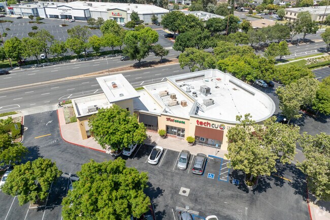
846 Blossom Hill Rd, San Jose, CA 95123


NEARBY LISTINGS FOR SALE OR LEASE
Property Detail
846 Blossom Hill Rd
Regionalshoppingcenterormallwithanchorstore
Santa Clara
D
California
06085C0401H
2.23 AC
2024
South San Jose
2025
South Bay/San Jose
512052
San Jose-Sunnyvale-Santa Clara, CA
16,432 SF
694-19-018
DEMOGRAPHICS near 846 Blossom Hill Rd
1 Mile
3 Mile
5 Mile
2024 Total Population
22,036
201,030
408,218
2029 Population
21,134
192,979
391,946
Pop Growth 2024-2029
(4.09%)
(4.00%)
(3.99%)
Average Age
41
40
40
2024 Total Households
7,935
66,844
133,708
HH Growth 2024-2029
(4.35%)
(4.25%)
(4.22%)
Median Household Inc
$116,232
$134,976
$132,999
Avg Household Size
2.70
2.90
2.90
2024 Avg HH Vehicles
2.00
2.00
2.00
Median Home Value
$1,023,292
$1,058,843
$1,062,841
Median Year Built
1978
1974
1974
Nearby Places
Map Layers
Map Styles
 Street
 Aerial
- Restaurants
- Banks
- Shops
- Fitness
- Groceries
PUBLIC TRANSPORTATION
COMMUTER RAIL
Blossom Hill (Caltrain - Caltrain (Caltrain))
DRIVE
WALK
Distance
Blossom Hill (Caltrain - Caltrain (Caltrain))
7 min
3.7 mi
Capitol (Caltrain - Caltrain (Caltrain))
DRIVE
WALK
Distance
Capitol (Caltrain - Caltrain (Caltrain))
9 min
4.5 mi
AIRPORT
Norman Y Mineta San Jose International
DRIVE
WALK
Distance
Norman Y Mineta San Jose International
15 min
9.8 mi
Freight Ports
Port of Redwood City
DRIVE
WALK
Distance
Port of Redwood City
37 min
29.0 mi
SALE & LEASE HISTORY
LISTING DATE
SALE/LEASE

Sep 25, 2016
For Lease
Nearby Properties
Address
Land Use
TOTAL SIZE
Lot Size
Zoning
Address
Land Use
TOTAL SIZE
Lot Size
Zoning
526,700 SF
29.03 AC
APD
Address
Land Use
TOTAL SIZE
Lot Size
Zoning
414,727 SF
16.59 AC
PD
Address
Land Use
TOTAL SIZE
Lot Size
Zoning
323,496 SF
12.02 AC
R140
Address
Land Use
TOTAL SIZE
Lot Size
Zoning
212,532 SF
7.12 AC
APD
Address
Land Use
TOTAL SIZE
Lot Size
Zoning
0.13 AC
R1B6
Address
Land Use
TOTAL SIZE
Lot Size
Zoning
241,800 SF
15.07 AC
R4
Address
Land Use
TOTAL SIZE
Lot Size
Zoning
209,128 SF
13.13 AC
R1PD
Address
Land Use
TOTAL SIZE
Lot Size
Zoning
10.56 AC
APD
Address
Land Use
TOTAL SIZE
Lot Size
Zoning
279,086 SF
10.74 AC
R3
Address
Land Use
TOTAL SIZE
Lot Size
Zoning
11.39 AC
A-PD
Address
Land Use
TOTAL SIZE
Lot Size
Zoning
5,000 SF
3.52 AC
CN
Address
Land Use
TOTAL SIZE
Lot Size
Zoning
8.72 AC
A-PD
Address
Land Use
TOTAL SIZE
Lot Size
Zoning
121,648 SF
5.80 AC
R1B6
Address
Land Use
TOTAL SIZE
Lot Size
Zoning
155,286 SF
9.50 AC
R3
Address
Land Use
TOTAL SIZE
Lot Size
Zoning
275,000 SF
12.24 AC
A-PD
Address
Land Use
TOTAL SIZE
Lot Size
Zoning
20,150.53 AC
SJ
Address
Land Use
TOTAL SIZE
Lot Size
Zoning
6.24 AC
A-PD
Address
Land Use
TOTAL SIZE
Lot Size
Zoning
216,589 SF
20.22 AC
C3
Address
Land Use
TOTAL SIZE
Lot Size
Zoning
21.67 AC
R3B
Address
Land Use
TOTAL SIZE
Lot Size
Zoning
163,904 SF
9.48 AC
R3APD
Address
Land Use
TOTAL SIZE
Lot Size
Zoning
5.05 AC
APD
Address
Land Use
TOTAL SIZE
Lot Size
Zoning
151,200 SF
5.82 AC
APD
Address
Land Use
TOTAL SIZE
Lot Size
Zoning
209,101 SF
3.52 AC
APD
Address
Land Use
TOTAL SIZE
Lot Size
Zoning
46,440 SF
3.57 AC
R-1-8
Address
Land Use
TOTAL SIZE
Lot Size
Zoning
133,513 SF
7.83 AC
R3
Address
Land Use
TOTAL SIZE
Lot Size
Zoning
252,868 SF
4.75 AC
R1-8
Address
Land Use
TOTAL SIZE
Lot Size
Zoning
20,160.11 AC
SJ
Address
Land Use
TOTAL SIZE
Lot Size
Zoning
30,136 SF
4.66 AC
CG
Address
Land Use
TOTAL SIZE
Lot Size
Zoning
72,588 SF
4.63 AC
R1PD
Address
Land Use
TOTAL SIZE
Lot Size
Zoning
287,782 SF
10.87 AC
R3B
The World's #1 Commercial Real Estate Marketplace
Connect with us
© 2026 CoStar Group
The information above has been obtained from sources believed reliable. While we do not doubt its accuracy we have not verified it and make no guarantee, warranty or representation about it. It is your responsibility to independently confirm its accuracy and completeness. Any projections, opinions, assumptions, or estimates used are for example only and do not represent the current or future performance of the property. The value of this transaction to you depends on tax and other factors which should be evaluated by your tax, financial, and legal advisors. You and your advisors should conduct a careful, independent investigation of the property to determine to your satisfaction the suitability of the property for your needs.