Property Record
8476 E Marlboro Rd, Greenville, NC 27858


NEARBY LISTINGS FOR SALE OR LEASE
Property Detail
8476 E Marlboro Rd
045571
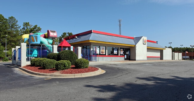
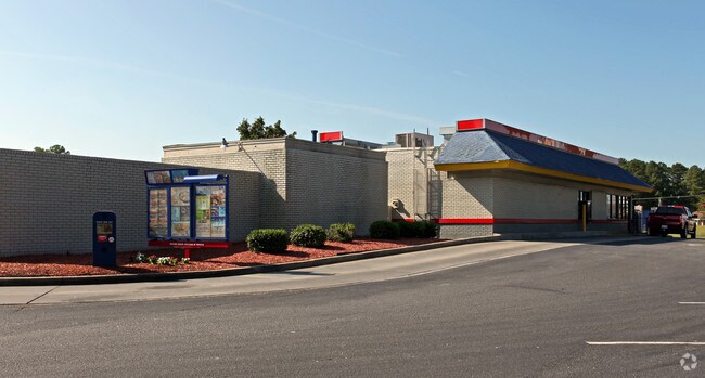
Brightleaf Shopping Center
Restaurantdrivein
BRIGHTLEAF SHOPPING CNTR(
X
Pitt
3720461600K
North Carolina
2025
1.10 AC
2025
North Carolina Northeast Area
000304
Other Market Areas
2,315 SF
Greenville, NC
DEMOGRAPHICS near 8476 E Marlboro Rd
1 Mile
3 Mile
5 Mile
2024 Total Population
2,349
6,395
8,693
2029 Population
2,477
6,723
9,070
Pop Growth 2024-2029
+ 5.45%
+ 5.13%
+ 4.34%
Average Age
40
41
41
2024 Total Households
970
2,648
3,574
HH Growth 2024-2029
+ 5.77%
+ 5.44%
+ 4.59%
Median Household Inc
$33,749
$41,171
$42,678
Avg Household Size
2.40
2.30
2.40
2024 Avg HH Vehicles
2.00
2.00
2.00
Median Home Value
$156,329
$161,048
$153,158
Median Year Built
1982
1984
1984
Nearby Places
Map Layers
Map Styles
 Street
 Aerial
- Restaurants
- Banks
- Shops
- Fitness
- Groceries
PUBLIC TRANSPORTATION
AIRPORT
Pitt-Greenville
DRIVE
WALK
Distance
Pitt-Greenville
23 min
16.4 mi
Freight Ports
Port of Morehead City
DRIVE
WALK
Distance
Port of Morehead City
143 min
95.6 mi
Nearby Properties
Address
Land Use
TOTAL SIZE
Lot Size
Zoning
Address
Land Use
TOTAL SIZE
Lot Size
Zoning
156,504 SF
41.42 AC
R15
Address
Land Use
TOTAL SIZE
Lot Size
Zoning
91,777 SF
18.82 AC
R8
Address
Land Use
TOTAL SIZE
Lot Size
Zoning
143,275 SF
14.97 AC
ID
Address
Land Use
TOTAL SIZE
Lot Size
Zoning
51,968 SF
6.93 AC
HBD
Address
Land Use
TOTAL SIZE
Lot Size
Zoning
432,265 SF
24.43 AC
ID
Address
Land Use
TOTAL SIZE
Lot Size
Zoning
81,752 SF
25 AC
R15
Address
Land Use
TOTAL SIZE
Lot Size
Zoning
319,554 SF
35.86 AC
ID
Address
Land Use
TOTAL SIZE
Lot Size
Zoning
27,704 SF
0.20 AC
CBD
Address
Land Use
TOTAL SIZE
Lot Size
Zoning
513,903 SF
36.50 AC
ID
Address
Land Use
TOTAL SIZE
Lot Size
Zoning
103,000 SF
5.50 AC
ID
Address
Land Use
TOTAL SIZE
Lot Size
Zoning
122,554 SF
3.96 AC
ID
Address
Land Use
TOTAL SIZE
Lot Size
Zoning
212,796 SF
16.57 AC
ID
Address
Land Use
TOTAL SIZE
Lot Size
Zoning
19,889 SF
5.37 AC
R15
Address
Land Use
TOTAL SIZE
Lot Size
Zoning
13,431 SF
10 AC
ID
Address
Land Use
TOTAL SIZE
Lot Size
Zoning
14,550 SF
4.15 AC
CBD
Address
Land Use
TOTAL SIZE
Lot Size
Zoning
52,432 SF
7.64 AC
HBD
Address
Land Use
TOTAL SIZE
Lot Size
Zoning
37,453 SF
7 AC
R8
Address
Land Use
TOTAL SIZE
Lot Size
Zoning
124,249 SF
10.87 AC
ID
Address
Land Use
TOTAL SIZE
Lot Size
Zoning
19,620 SF
0.76 AC
R8
Address
Land Use
TOTAL SIZE
Lot Size
Zoning
18,731 SF
4.50 AC
RA
Address
Land Use
TOTAL SIZE
Lot Size
Zoning
135,000 SF
14.59 AC
RA20
Address
Land Use
TOTAL SIZE
Lot Size
Zoning
3,547 SF
7.90 AC
RMF
Address
Land Use
TOTAL SIZE
Lot Size
Zoning
10,836 SF
1.71 AC
HBD
Address
Land Use
TOTAL SIZE
Lot Size
Zoning
7,150 SF
2.15 AC
HBD
Address
Land Use
TOTAL SIZE
Lot Size
Zoning
11,083 SF
10.49 AC
RA
Address
Land Use
TOTAL SIZE
Lot Size
Zoning
1,508 SF
5.02 AC
ZZZ
Address
Land Use
TOTAL SIZE
Lot Size
Zoning
17,551 SF
3.27 AC
R15
Address
Land Use
TOTAL SIZE
Lot Size
Zoning
28,734 SF
9.03 AC
ID
Address
Land Use
TOTAL SIZE
Lot Size
Zoning
29,566 SF
4.43 AC
ID
Address
Land Use
TOTAL SIZE
Lot Size
Zoning
34,340 SF
6.90 AC
ID
The World's #1 Commercial Real Estate Marketplace
Connect with us
© 2025 CoStar Group
The information above has been obtained from sources believed reliable. While we do not doubt its accuracy we have not verified it and make no guarantee, warranty or representation about it. It is your responsibility to independently confirm its accuracy and completeness. Any projections, opinions, assumptions, or estimates used are for example only and do not represent the current or future performance of the property. The value of this transaction to you depends on tax and other factors which should be evaluated by your tax, financial, and legal advisors. You and your advisors should conduct a careful, independent investigation of the property to determine to your satisfaction the suitability of the property for your needs.