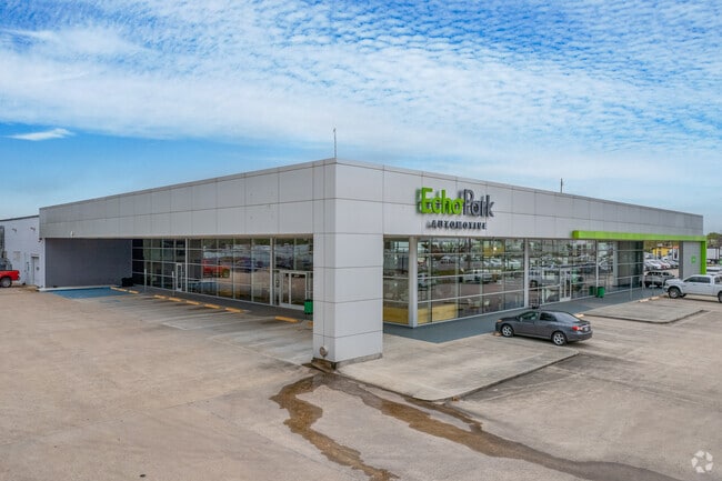
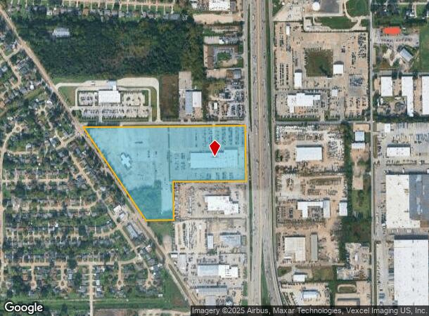
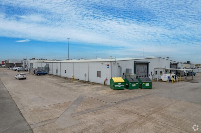
Property Record
8477 North Fwy, Houston, TX 77037
NEARBY LISTINGS FOR SALE OR LEASE
Property Detail
8477 North Fwy
0432310000085
Abst 565 T A Menefee
Vehiclerentalsvehiclesales
TRS 6 7 & 7A ABST 565 T A MENEFEE
X
Harris
48201C0470L
Texas
2024
20.32 AC
2025
Near North
533500
Houston
69,257 SF
Houston-The Woodlands-Sugar Land, TX
DEMOGRAPHICS near 8477 North Fwy
1 Mile
3 Mile
5 Mile
2024 Total Population
13,694
114,196
326,333
2029 Population
13,890
116,180
332,498
Pop Growth 2024-2029
+ 1.43%
+ 1.74%
+ 1.89%
Average Age
37
35
35
2024 Total Households
4,205
34,717
107,172
HH Growth 2024-2029
+ 1.52%
+ 1.83%
+ 1.99%
Median Household Inc
$46,205
$38,077
$41,265
Avg Household Size
3.10
3.20
3.00
2024 Avg HH Vehicles
2.00
2.00
2.00
Median Home Value
$154,648
$151,272
$179,169
Median Year Built
1971
1973
1975
Nearby Places
Map Layers
Map Styles
 Street
 Aerial
- Restaurants
- Banks
- Shops
- Fitness
- Groceries
PUBLIC TRANSPORTATION
COMMUTER RAIL
Houston (Sunset Limited - Amtrak)
DRIVE
WALK
Distance
Houston (Sunset Limited - Amtrak)
14 min
8.9 mi
AIRPORT
George Bush Intcntl/Houston
DRIVE
WALK
Distance
George Bush Intcntl/Houston
19 min
12.8 mi
William P Hobby
DRIVE
WALK
Distance
William P Hobby
34 min
21.8 mi
Freight Ports
Port of Houston
DRIVE
WALK
Distance
Port of Houston
26 min
17.3 mi
Nearby Properties
Address
Land Use
TOTAL SIZE
Lot Size
Zoning
Address
Land Use
TOTAL SIZE
Lot Size
Zoning
594,105 SF
43.68 AC
Address
Land Use
TOTAL SIZE
Lot Size
Zoning
718,600 SF
42.09 AC
Address
Land Use
TOTAL SIZE
Lot Size
Zoning
284,476 SF
20 AC
Address
Land Use
TOTAL SIZE
Lot Size
Zoning
531,786 SF
17.60 AC
Address
Land Use
TOTAL SIZE
Lot Size
Zoning
194,990 SF
16.36 AC
Address
Land Use
TOTAL SIZE
Lot Size
Zoning
221,810 SF
13.96 AC
Address
Land Use
TOTAL SIZE
Lot Size
Zoning
218,734 SF
11.24 AC
Address
Land Use
TOTAL SIZE
Lot Size
Zoning
201,292 SF
7.67 AC
Address
Land Use
TOTAL SIZE
Lot Size
Zoning
361,869 SF
39.62 AC
Address
Land Use
TOTAL SIZE
Lot Size
Zoning
236,780 SF
35.30 AC
Address
Land Use
TOTAL SIZE
Lot Size
Zoning
200,511 SF
9.48 AC
Address
Land Use
TOTAL SIZE
Lot Size
Zoning
139,886 SF
10.02 AC
Address
Land Use
TOTAL SIZE
Lot Size
Zoning
190,543 SF
9.09 AC
Address
Land Use
TOTAL SIZE
Lot Size
Zoning
178,824 SF
5.85 AC
Address
Land Use
TOTAL SIZE
Lot Size
Zoning
137,353 SF
15.25 AC
Address
Land Use
TOTAL SIZE
Lot Size
Zoning
43.68 AC
Address
Land Use
TOTAL SIZE
Lot Size
Zoning
293,049 SF
27.06 AC
Address
Land Use
TOTAL SIZE
Lot Size
Zoning
120,602 SF
7.75 AC
Address
Land Use
TOTAL SIZE
Lot Size
Zoning
179,804 SF
11.24 AC
Address
Land Use
TOTAL SIZE
Lot Size
Zoning
49,933 SF
8.35 AC
Address
Land Use
TOTAL SIZE
Lot Size
Zoning
135,318 SF
10.20 AC
Address
Land Use
TOTAL SIZE
Lot Size
Zoning
85,376 SF
4.35 AC
Address
Land Use
TOTAL SIZE
Lot Size
Zoning
220,976 SF
12.06 AC
Address
Land Use
TOTAL SIZE
Lot Size
Zoning
29,029 SF
17.85 AC
Address
Land Use
TOTAL SIZE
Lot Size
Zoning
271,832 SF
14.93 AC
Address
Land Use
TOTAL SIZE
Lot Size
Zoning
184,536 SF
10 AC
Address
Land Use
TOTAL SIZE
Lot Size
Zoning
220,980 SF
8.01 AC
Address
Land Use
TOTAL SIZE
Lot Size
Zoning
220,310 SF
10.88 AC
Address
Land Use
TOTAL SIZE
Lot Size
Zoning
108,155 SF
14.64 AC
The World's #1 Commercial Real Estate Marketplace
Connect with us
© 2026 CoStar Group
The information above has been obtained from sources believed reliable. While we do not doubt its accuracy we have not verified it and make no guarantee, warranty or representation about it. It is your responsibility to independently confirm its accuracy and completeness. Any projections, opinions, assumptions, or estimates used are for example only and do not represent the current or future performance of the property. The value of this transaction to you depends on tax and other factors which should be evaluated by your tax, financial, and legal advisors. You and your advisors should conduct a careful, independent investigation of the property to determine to your satisfaction the suitability of the property for your needs.