Property Record
848 S Central Pkwy, Tracy, CA 95391

Property Detail
848 S Central Pkwy
Stockton-Lodi, CA
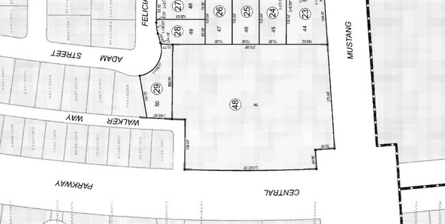
REDRAWN JAN-23-2012 FROM ORIGINAL APN 254-040-07
254-140-48
SAN JOAQUIN
Commercialacreage
California
B and X Area of moderate flood hazard, usually the area between the limits of the 100-year and 500-year floods.
2.93 AC
2025
Tracy/Manteca
2025
Stockton/Modesto
005222
NEARBY LISTINGS FOR SALE OR LEASE
DEMOGRAPHICS near 848 S Central Pkwy
1 mile
3 mile
5 mile
2025 Total Population
21,578
31,155
43,529
2030 Population
23,011
33,299
46,289
Pop Growth 2025-2030
+ 6.64%
+ 6.88%
+ 6.34%
Average Age
34
34
35
2025 Total Households
5,966
8,736
12,321
HH Growth 2025-2030
+ 6.77%
+ 7.03%
+ 6.46%
Median Household Inc
$187,232
$176,771
$163,286
Avg Household Size
3.60
3.50
3.50
2025 Avg HH Vehicles
2.00
2.00
3.00
Median Home Value
$850,017
$858,343
$838,457
Median Year Built
2010
2010
2010
Nearby Places
Map Layers
Map Styles
 Street
 Aerial
Layers
 Traffic
 Biking
Places
Listings with unknown addresses are not visible on the map
- Restaurants
- Banks
- Shops
- Fitness
- Groceries
PUBLIC TRANSPORTATION
AIRPORT
Stockton Metro
Drive
Walk
Distance
Stockton Metro
36 min
25.4 mi
Norman Y Mineta San Jose International
Drive
Walk
Distance
Norman Y Mineta San Jose International
63 min
47.3 mi
Freight Ports
Port of Stockton
Drive
Walk
Distance
Port of Stockton
38 min
28.7 mi
Nearby Properties
Address
Land Use
TOTAL SIZE
Lot Size
Zoning
Address
Land Use
TOTAL SIZE
Lot Size
Zoning
641,000 SF
378.88 AC
Address
Land Use
TOTAL SIZE
Lot Size
Zoning
15.20 AC
RH
Address
Land Use
TOTAL SIZE
Lot Size
Zoning
708,080 SF
83.08 AC
Address
Land Use
TOTAL SIZE
Lot Size
Zoning
407.40 AC
RL
Address
Land Use
TOTAL SIZE
Lot Size
Zoning
Address
Land Use
TOTAL SIZE
Lot Size
Zoning
960 SF
31.71 AC
RL
Address
Land Use
TOTAL SIZE
Lot Size
Zoning
616,700 SF
31.66 AC
IG
Address
Land Use
TOTAL SIZE
Lot Size
Zoning
407,563 SF
18.64 AC
IL
Address
Land Use
TOTAL SIZE
Lot Size
Zoning
83.58 AC
IL
Address
Land Use
TOTAL SIZE
Lot Size
Zoning
127,018 SF
66.71 AC
IL
Address
Land Use
TOTAL SIZE
Lot Size
Zoning
148,645 SF
7.15 AC
IP
Address
Land Use
TOTAL SIZE
Lot Size
Zoning
249.59 AC
PF
Address
Land Use
TOTAL SIZE
Lot Size
Zoning
139,273 SF
7.34 AC
IP
Address
Land Use
TOTAL SIZE
Lot Size
Zoning
34,532 SF
38.37 AC
AG40
Address
Land Use
TOTAL SIZE
Lot Size
Zoning
204,300 SF
9.50 AC
Address
Land Use
TOTAL SIZE
Lot Size
Zoning
106.25 AC
AG40
Address
Land Use
TOTAL SIZE
Lot Size
Zoning
64.78 AC
IL
Address
Land Use
TOTAL SIZE
Lot Size
Zoning
91,612 SF
6.20 AC
IP
Address
Land Use
TOTAL SIZE
Lot Size
Zoning
8.80 AC
RH
Address
Land Use
TOTAL SIZE
Lot Size
Zoning
80.44 AC
AG40
Address
Land Use
TOTAL SIZE
Lot Size
Zoning
82,567 SF
4.45 AC
IP
Address
Land Use
TOTAL SIZE
Lot Size
Zoning
1,320 SF
96.99 AC
AG40
Address
Land Use
TOTAL SIZE
Lot Size
Zoning
157.60 AC
AG40
Address
Land Use
TOTAL SIZE
Lot Size
Zoning
28,250 SF
1.95 AC
CO
The World's #1 Commercial Real Estate Marketplace
Connect with us
© 2026 CoStar Group
The information above has been obtained from sources believed reliable. While we do not doubt its accuracy we have not verified it and make no guarantee, warranty or representation about it. It is your responsibility to independently confirm its accuracy and completeness. Any projections, opinions, assumptions, or estimates used are for example only and do not represent the current or future performance of the property. The value of this transaction to you depends on tax and other factors which should be evaluated by your tax, financial, and legal advisors. You and your advisors should conduct a careful, independent investigation of the property to determine to your satisfaction the suitability of the property for your needs.