Property Record
8480 E 130Th Cir, Thornton, CO 80602


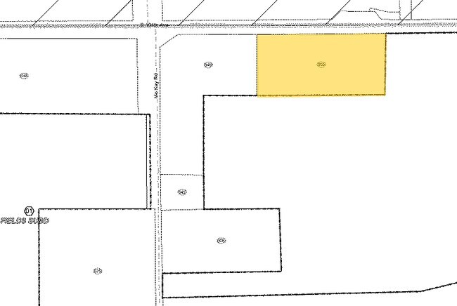
Property Detail
8480 E 130Th Cir
1721-17-0-00-050
SECT,TWN,RNG:17-2-67 DESC: PT OF THE N2 NE4 NW4 OF SEC 17 DESC AS BEG AT THE N4 OF SD SEC 17 TH S 00D032M 21S E 60/01 FT TH N 89D 47M 16S W 75/01 FT TO THE TRUE POB TH S 00D 33M 21S E 318/20 FT TH N 89D 51M 17S W 683/74 FT TH N 00D 33M 14S W 319 FT T
Commercialacreage
ADAMS
A1
Colorado
C and X Area of minimal flood hazard, usually depicted on FIRMs as above the 500-year flood level.
5 AC
2024
North Denver
2025
Denver
008540
Denver-Aurora-Centennial, CO
NEARBY LISTINGS FOR SALE OR LEASE
DEMOGRAPHICS near 8480 E 130Th Cir
1 mile
3 mile
5 mile
2024 Total Population
3,487
79,345
225,777
2029 Population
3,577
82,253
234,092
Pop Growth 2024-2029
+ 2.58%
+ 3.67%
+ 3.68%
Average Age
34
36
36
2024 Total Households
1,075
26,882
76,895
HH Growth 2024-2029
+ 2.60%
+ 3.72%
+ 3.73%
Median Household Inc
$73,722
$87,547
$84,329
Avg Household Size
3.20
2.90
2.90
2024 Avg HH Vehicles
2.00
2.00
2.00
Median Home Value
$300,649
$398,972
$406,438
Median Year Built
1990
1994
1991
Nearby Places
Map Layers
Map Styles
 Street
 Aerial
Transit
 Traffic
 Biking
Places
Listings with unknown addresses are not visible on the map
- Restaurants
- Banks
- Shops
- Fitness
- Groceries
PUBLIC TRANSPORTATION
COMMUTER RAIL
Eastlake - 124Th Station Track 2 (Union Station to Eastlake & 124th Station - Regional Transportation District)
Drive
Walk
Distance
Eastlake - 124Th Station Track 2 (Union Station to Eastlake & 124th Station - Regional Transportation District)
10 min
4.7 mi
Northglenn - 112Th Station Track 2 (Union Station to Eastlake & 124th Station - Regional Transportation District)
Drive
Walk
Distance
Northglenn - 112Th Station Track 2 (Union Station to Eastlake & 124th Station - Regional Transportation District)
12 min
5.9 mi
AIRPORT
Denver International
Drive
Walk
Distance
Denver International
27 min
19.8 mi
Freight Ports
Tulsa Port Of Catoosa
Drive
Walk
Distance
Tulsa Port Of Catoosa
733 min
713.9 mi
Nearby Properties
Address
Land Use
TOTAL SIZE
Lot Size
Zoning
Address
Land Use
TOTAL SIZE
Lot Size
Zoning
8,556 SF
382.73 AC
A3
Address
Land Use
TOTAL SIZE
Lot Size
Zoning
358,386 SF
76.08 AC
Address
Land Use
TOTAL SIZE
Lot Size
Zoning
290,566 SF
54.61 AC
Address
Land Use
TOTAL SIZE
Lot Size
Zoning
330,176 SF
17.12 AC
Address
Land Use
TOTAL SIZE
Lot Size
Zoning
153,301 SF
26.75 AC
Address
Land Use
TOTAL SIZE
Lot Size
Zoning
109,685 SF
11.51 AC
Address
Land Use
TOTAL SIZE
Lot Size
Zoning
86,977 SF
4.14 AC
Address
Land Use
TOTAL SIZE
Lot Size
Zoning
67,395 SF
13.38 AC
Address
Land Use
TOTAL SIZE
Lot Size
Zoning
96,628 SF
4.35 AC
Address
Land Use
TOTAL SIZE
Lot Size
Zoning
174.45 AC
Address
Land Use
TOTAL SIZE
Lot Size
Zoning
207,453 SF
26.66 AC
Address
Land Use
TOTAL SIZE
Lot Size
Zoning
121,275 SF
6.56 AC
Address
Land Use
TOTAL SIZE
Lot Size
Zoning
48,359 SF
278.79 AC
A3
Address
Land Use
TOTAL SIZE
Lot Size
Zoning
2,796 SF
134 AC
Address
Land Use
TOTAL SIZE
Lot Size
Zoning
65,462 SF
7.06 AC
Address
Land Use
TOTAL SIZE
Lot Size
Zoning
106,530 SF
7.04 AC
Address
Land Use
TOTAL SIZE
Lot Size
Zoning
70,573 SF
6.42 AC
Address
Land Use
TOTAL SIZE
Lot Size
Zoning
176,222 SF
7.99 AC
Address
Land Use
TOTAL SIZE
Lot Size
Zoning
63,602 SF
10.09 AC
Address
Land Use
TOTAL SIZE
Lot Size
Zoning
62,418 SF
23.44 AC
Address
Land Use
TOTAL SIZE
Lot Size
Zoning
56,697 SF
9.97 AC
PUD
Address
Land Use
TOTAL SIZE
Lot Size
Zoning
55,810 SF
14.52 AC
Address
Land Use
TOTAL SIZE
Lot Size
Zoning
106.69 AC
RE
Address
Land Use
TOTAL SIZE
Lot Size
Zoning
42,177 SF
17.73 AC
A3
Address
Land Use
TOTAL SIZE
Lot Size
Zoning
44,077 SF
13.02 AC
Address
Land Use
TOTAL SIZE
Lot Size
Zoning
108.96 AC
A3
Address
Land Use
TOTAL SIZE
Lot Size
Zoning
81,167 SF
9.63 AC
Address
Land Use
TOTAL SIZE
Lot Size
Zoning
2,832 SF
16.52 AC
Address
Land Use
TOTAL SIZE
Lot Size
Zoning
48,973 SF
4.06 AC
Address
Land Use
TOTAL SIZE
Lot Size
Zoning
86,532 SF
12.86 AC
The World's #1 Commercial Real Estate Marketplace
Connect with us
© 2026 CoStar Group
The information above has been obtained from sources believed reliable. While we do not doubt its accuracy we have not verified it and make no guarantee, warranty or representation about it. It is your responsibility to independently confirm its accuracy and completeness. Any projections, opinions, assumptions, or estimates used are for example only and do not represent the current or future performance of the property. The value of this transaction to you depends on tax and other factors which should be evaluated by your tax, financial, and legal advisors. You and your advisors should conduct a careful, independent investigation of the property to determine to your satisfaction the suitability of the property for your needs.