Property Record
8484 Scranton St, Houston, TX 77061
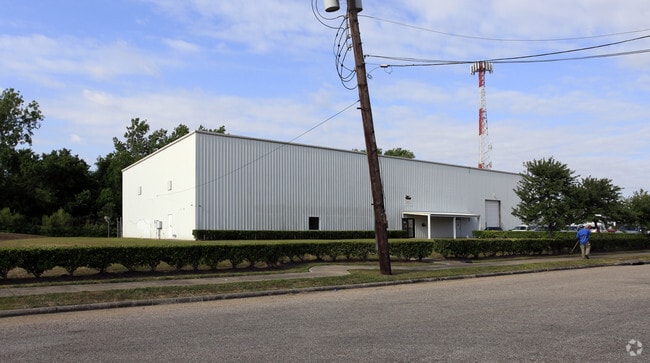


Property Detail
8484 Scranton St
0342030010317
TR 11C-1 SOUTH HOUSTON GARDENS SEC 6
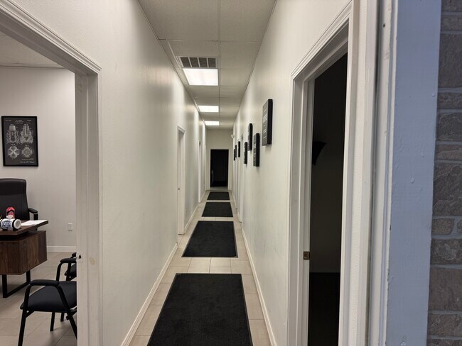
Lightindustrial
HARRIS
AE The base floodplain where base flood elevations are provided. AE Zones are now used on new format FIRMs instead of A1-A30 Zones.
Texas
2025
0.93 AC
2025
South Hwy 35
333302
Houston
10,840 SF
Houston-Pasadena-The Woodlands, TX
NEARBY LISTINGS FOR SALE OR LEASE
DEMOGRAPHICS near 8484 Scranton St
1 mile
3 mile
5 mile
2025 Total Population
3,920
120,329
331,843
2030 Population
4,185
128,493
354,656
Pop Growth 2025-2030
+ 6.76%
+ 6.78%
+ 6.87%
Average Age
36
36
36
2025 Total Households
1,152
39,215
107,834
HH Growth 2025-2030
+ 7.03%
+ 7.09%
+ 7.14%
Median Household Inc
$58,636
$56,611
$58,680
Avg Household Size
3.30
3.00
3.00
2025 Avg HH Vehicles
2.00
2.00
2.00
Median Home Value
$211,569
$219,184
$215,062
Median Year Built
1985
1974
1974
Nearby Places
Map Layers
Map Styles
 Street
 Aerial
Layers
 Traffic
 Biking
Places
Listings with unknown addresses are not visible on the map
- Restaurants
- Banks
- Shops
- Fitness
- Groceries
PUBLIC TRANSPORTATION
AIRPORT
William P Hobby
Drive
Walk
Distance
William P Hobby
8 min
2.1 mi
George Bush Intcntl/Houston
Drive
Walk
Distance
George Bush Intcntl/Houston
40 min
32.0 mi
Freight Ports
Port of Houston
Drive
Walk
Distance
Port of Houston
17 min
8.9 mi
SALE & LEASE HISTORY
LISTING DATE
SALE/LEASE

Oct 01, 2019
For Lease
Oct 01, 2019
For Sale
Mar 19, 2025
For Lease
Apr 30, 2018
For Sale
Apr 30, 2018
For Lease
Nearby Properties
Address
Land Use
TOTAL SIZE
Lot Size
Zoning
Address
Land Use
TOTAL SIZE
Lot Size
Zoning
690,590 SF
31.88 AC
Address
Land Use
TOTAL SIZE
Lot Size
Zoning
794,499 SF
31.71 AC
Address
Land Use
TOTAL SIZE
Lot Size
Zoning
369,871 SF
13.68 AC
Address
Land Use
TOTAL SIZE
Lot Size
Zoning
229,446 SF
21.05 AC
Address
Land Use
TOTAL SIZE
Lot Size
Zoning
411,252 SF
18.28 AC
Address
Land Use
TOTAL SIZE
Lot Size
Zoning
397,739 SF
15.93 AC
Address
Land Use
TOTAL SIZE
Lot Size
Zoning
342,149 SF
23.56 AC
Address
Land Use
TOTAL SIZE
Lot Size
Zoning
227,864 SF
9.83 AC
Address
Land Use
TOTAL SIZE
Lot Size
Zoning
556,568 SF
20 AC
Address
Land Use
TOTAL SIZE
Lot Size
Zoning
230,218 SF
10.67 AC
Address
Land Use
TOTAL SIZE
Lot Size
Zoning
260,972 SF
23.45 AC
Address
Land Use
TOTAL SIZE
Lot Size
Zoning
186,046 SF
13.34 AC
Address
Land Use
TOTAL SIZE
Lot Size
Zoning
188,110 SF
2.22 AC
Address
Land Use
TOTAL SIZE
Lot Size
Zoning
196,000 SF
29.42 AC
Address
Land Use
TOTAL SIZE
Lot Size
Zoning
136,335 SF
4.32 AC
Address
Land Use
TOTAL SIZE
Lot Size
Zoning
291,181 SF
11.07 AC
Address
Land Use
TOTAL SIZE
Lot Size
Zoning
391,576 SF
19.94 AC
Address
Land Use
TOTAL SIZE
Lot Size
Zoning
308,748 SF
11.34 AC
Address
Land Use
TOTAL SIZE
Lot Size
Zoning
353,676 SF
19.86 AC
Address
Land Use
TOTAL SIZE
Lot Size
Zoning
284,290 SF
20 AC
Address
Land Use
TOTAL SIZE
Lot Size
Zoning
433,760 SF
52.70 AC
Address
Land Use
TOTAL SIZE
Lot Size
Zoning
113,688 SF
4 AC
Address
Land Use
TOTAL SIZE
Lot Size
Zoning
164,515 SF
Address
Land Use
TOTAL SIZE
Lot Size
Zoning
257,481 SF
9.28 AC
Address
Land Use
TOTAL SIZE
Lot Size
Zoning
228,900 SF
3.85 AC
Address
Land Use
TOTAL SIZE
Lot Size
Zoning
152,276 SF
6.83 AC
Address
Land Use
TOTAL SIZE
Lot Size
Zoning
165,880 SF
19.20 AC
Address
Land Use
TOTAL SIZE
Lot Size
Zoning
148,765 SF
7.20 AC
Address
Land Use
TOTAL SIZE
Lot Size
Zoning
244,134 SF
9.44 AC
Address
Land Use
TOTAL SIZE
Lot Size
Zoning
353,120 SF
12.02 AC
The World's #1 Commercial Real Estate Marketplace
Connect with us
© 2026 CoStar Group
The information above has been obtained from sources believed reliable. While we do not doubt its accuracy we have not verified it and make no guarantee, warranty or representation about it. It is your responsibility to independently confirm its accuracy and completeness. Any projections, opinions, assumptions, or estimates used are for example only and do not represent the current or future performance of the property. The value of this transaction to you depends on tax and other factors which should be evaluated by your tax, financial, and legal advisors. You and your advisors should conduct a careful, independent investigation of the property to determine to your satisfaction the suitability of the property for your needs.