Property Record
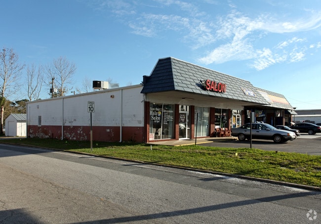
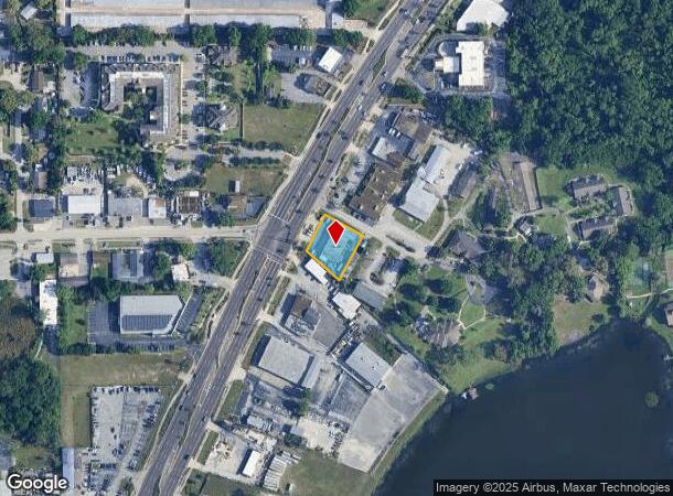
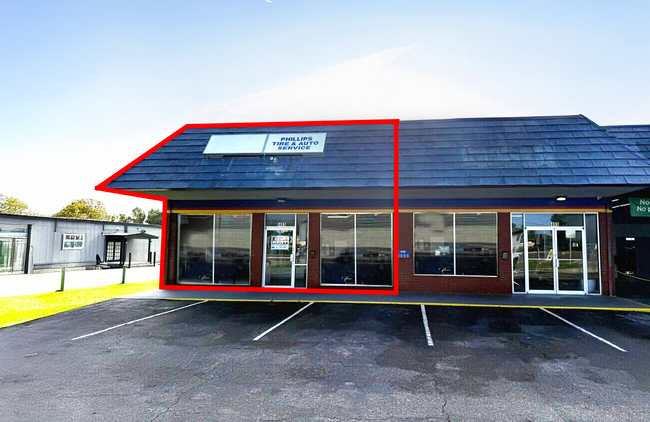
8495 S Us Highway 17-92, Fern Park, FL 32730
Current Lease Availabilities
NEARBY LISTINGS FOR SALE OR LEASE
Property Detail
8495 S Us Highway 17-92
Orlando-Kissimmee-Sanford, FL
Lake Of The Woods Subd
19-21-30-501-0000-002E
BEG INT ELY R/W HWY 17-92 + SLY LINE LOT 3 RUN S 46 DEG 8 1/2 MIN E 152.8 FT N 30 DEG 42 MIN E 162.32 FT N 59 DEG 18 MIN W 160 FT S 25 DEG 37 MIN W 127.99 FT TO BEG LAKE OF THE WOODS SUBD PB 7 PG 25
Autorepair
Seminole
X
Florida
12095C0165F
3
2024
0.45 AC
2024
Casselberry
022006
Orlando
4,920 SF
DEMOGRAPHICS near 8495 S Us Highway 17-92
1 Mile
3 Mile
5 Mile
2024 Total Population
10,682
95,896
269,909
2029 Population
11,007
99,860
281,008
Pop Growth 2024-2029
+ 3.04%
+ 4.13%
+ 4.11%
Average Age
42
42
41
2024 Total Households
4,505
41,955
114,421
HH Growth 2024-2029
+ 3.17%
+ 4.35%
+ 4.27%
Median Household Inc
$59,148
$61,454
$62,934
Avg Household Size
2.30
2.20
2.30
2024 Avg HH Vehicles
2.00
2.00
2.00
Median Home Value
$298,772
$310,778
$309,878
Median Year Built
1973
1978
1980
Nearby Places
- Restaurants
- Banks
- Shops
- Fitness
- Groceries
PUBLIC TRANSPORTATION
COMMUTER RAIL
DRIVE
WALK
Distance
4 min
1.6 mi
DRIVE
WALK
Distance
5 min
2.1 mi
AIRPORT
Orlando Sanford International
DRIVE
WALK
Distance
Orlando Sanford International
24 min
13.0 mi
Orlando International
DRIVE
WALK
Distance
Orlando International
31 min
17.8 mi
Freight Ports
Port Canaveral
DRIVE
WALK
Distance
Port Canaveral
77 min
60.3 mi
Nearby Properties
Address
Land Use
TOTAL SIZE
Lot Size
Zoning
Address
Land Use
TOTAL SIZE
Lot Size
Zoning
2,416 SF
29.71 AC
Address
Land Use
TOTAL SIZE
Lot Size
Zoning
88,256 SF
39.64 AC
MOC3
Address
Land Use
TOTAL SIZE
Lot Size
Zoning
423,270 SF
3.45 AC
MOC3
Address
Land Use
TOTAL SIZE
Lot Size
Zoning
21.25 AC
GC
Address
Land Use
TOTAL SIZE
Lot Size
Zoning
467,832 SF
20.10 AC
PD
Address
Land Use
TOTAL SIZE
Lot Size
Zoning
464,785 SF
2.19 AC
R-MF
Address
Land Use
TOTAL SIZE
Lot Size
Zoning
482,097 SF
2.42 AC
OC-PD
Address
Land Use
TOTAL SIZE
Lot Size
Zoning
Address
Land Use
TOTAL SIZE
Lot Size
Zoning
1,158 SF
17.22 AC
Address
Land Use
TOTAL SIZE
Lot Size
Zoning
1,400 SF
31.20 AC
A1
Address
Land Use
TOTAL SIZE
Lot Size
Zoning
508,923 SF
41.05 AC
C2
Address
Land Use
TOTAL SIZE
Lot Size
Zoning
656,009 SF
5.59 AC
DM
Address
Land Use
TOTAL SIZE
Lot Size
Zoning
563,546 SF
0.61 AC
DM
Address
Land Use
TOTAL SIZE
Lot Size
Zoning
555,833 SF
3.65 AC
DM
Address
Land Use
TOTAL SIZE
Lot Size
Zoning
400 SF
13.82 AC
R1AA
Address
Land Use
TOTAL SIZE
Lot Size
Zoning
505,902 SF
4.69 AC
DM
Address
Land Use
TOTAL SIZE
Lot Size
Zoning
231,070 SF
35.59 AC
MOR2
Address
Land Use
TOTAL SIZE
Lot Size
Zoning
277,160 SF
2.38 AC
R-MF
Address
Land Use
TOTAL SIZE
Lot Size
Zoning
434,387 SF
26.01 AC
R3
Address
Land Use
TOTAL SIZE
Lot Size
Zoning
456 SF
9.56 AC
Address
Land Use
TOTAL SIZE
Lot Size
Zoning
1,428 SF
8.56 AC
MOR3
Address
Land Use
TOTAL SIZE
Lot Size
Zoning
322,180 SF
14.60 AC
A1
Address
Land Use
TOTAL SIZE
Lot Size
Zoning
797,604 SF
3.31 AC
DM
Address
Land Use
TOTAL SIZE
Lot Size
Zoning
254,477 SF
13.14 AC
MOR2
Address
Land Use
TOTAL SIZE
Lot Size
Zoning
6,817 SF
19.83 AC
R3
Address
Land Use
TOTAL SIZE
Lot Size
Zoning
409,338 SF
27.27 AC
RSF-2
Address
Land Use
TOTAL SIZE
Lot Size
Zoning
488,884 SF
20.95 AC
WS-RT
Address
Land Use
TOTAL SIZE
Lot Size
Zoning
254,371 SF
15.63 AC
R1A
Address
Land Use
TOTAL SIZE
Lot Size
Zoning
6,466 SF
18.97 AC
MOC3
Address
Land Use
TOTAL SIZE
Lot Size
Zoning
377,321 SF
20.58 AC
R3A
The World's #1 Commercial Real Estate Marketplace
Connect with us
© 2025 CoStar Group
The information above has been obtained from sources believed reliable. While we do not doubt its accuracy we have not verified it and make no guarantee, warranty or representation about it. It is your responsibility to independently confirm its accuracy and completeness. Any projections, opinions, assumptions, or estimates used are for example only and do not represent the current or future performance of the property. The value of this transaction to you depends on tax and other factors which should be evaluated by your tax, financial, and legal advisors. You and your advisors should conduct a careful, independent investigation of the property to determine to your satisfaction the suitability of the property for your needs.