Property Record
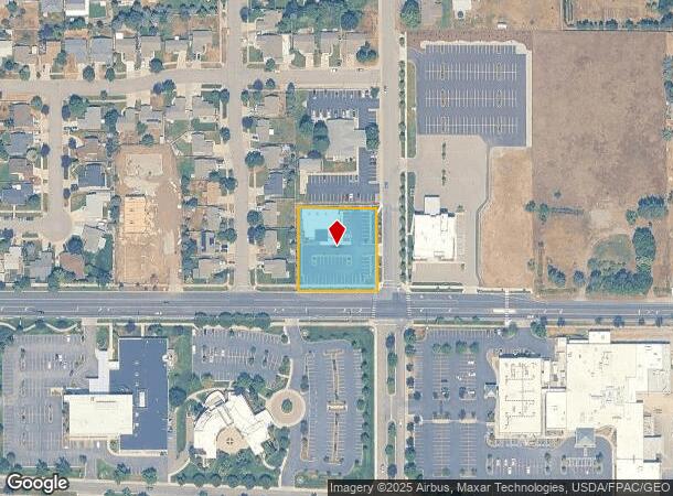
849 N Syringa St, Post Falls, ID 83854

NEARBY LISTINGS FOR SALE OR LEASE
-
-
Multiple Commercial/Light Industrial Lots
Post Falls, ID 83854
$431,244 - $6,183,985
0.55 - 4.57 AC Lot
Land
-
-
-
-
No Photo
-
-
View all Post Falls listings for sale on LoopNet.com
Property Detail
849 N Syringa St
P705035060AC
Post Falls
Realpropertynec
POST FALLS IRR TRS, E 208.41 FT-S 208.41 FT-TR 60 EX E 20 FT & EX S 10 FT BLOCK 35 3551N05W
X
Kootenai
16055C0383E
Idaho
2025
0.86 AC
2025
Post Falls
000501
Coeur D'Alene
6,290 SF
Coeur d'Alene, ID
DEMOGRAPHICS near 849 N Syringa St
1 mile
3 mile
5 mile
2024 Total Population
11,232
49,226
70,593
2029 Population
13,325
58,800
84,260
Pop Growth 2024-2029
+ 18.63%
+ 19.45%
+ 19.36%
Average Age
38
39
39
2024 Total Households
4,315
18,572
26,432
HH Growth 2024-2029
+ 18.38%
+ 19.08%
+ 19.02%
Median Household Inc
$62,446
$69,024
$69,294
Avg Household Size
2.50
2.60
2.60
2024 Avg HH Vehicles
2.00
2.00
2.00
Median Home Value
$303,409
$404,198
$429,591
Median Year Built
1992
2001
2002
Nearby Places
Map Layers
Map Styles
 Street
 Aerial
Transit
 Traffic
 Biking
Places
Listings with unknown addresses are not visible on the map
- Restaurants
- Banks
- Shops
- Fitness
- Groceries
PUBLIC TRANSPORTATION
AIRPORT
Spokane International
Drive
Walk
Distance
Spokane International
40 min
30.8 mi
Freight Ports
Port of Everett
Drive
Walk
Distance
Port of Everett
368 min
326.4 mi
SALE & LEASE HISTORY
LISTING DATE
SALE/LEASE

Aug 28, 2019
For Sale
Nearby Properties
Address
Land Use
TOTAL SIZE
Lot Size
Zoning
Address
Land Use
TOTAL SIZE
Lot Size
Zoning
135,646 SF
18.40 AC
Address
Land Use
TOTAL SIZE
Lot Size
Zoning
117,842 SF
13.36 AC
AG
Address
Land Use
TOTAL SIZE
Lot Size
Zoning
320,505 SF
60.51 AC
Address
Land Use
TOTAL SIZE
Lot Size
Zoning
89,184 SF
8.69 AC
Address
Land Use
TOTAL SIZE
Lot Size
Zoning
177,574 SF
8.44 AC
Address
Land Use
TOTAL SIZE
Lot Size
Zoning
88,780 SF
8.23 AC
Address
Land Use
TOTAL SIZE
Lot Size
Zoning
130,710 SF
8.23 AC
Address
Land Use
TOTAL SIZE
Lot Size
Zoning
104,852 SF
5.70 AC
Address
Land Use
TOTAL SIZE
Lot Size
Zoning
42,636 SF
24.81 AC
Address
Land Use
TOTAL SIZE
Lot Size
Zoning
94,960 SF
7.45 AC
Address
Land Use
TOTAL SIZE
Lot Size
Zoning
57,936 SF
7.88 AC
Address
Land Use
TOTAL SIZE
Lot Size
Zoning
465,080 SF
31.43 AC
Address
Land Use
TOTAL SIZE
Lot Size
Zoning
265,175 SF
13.74 AC
Address
Land Use
TOTAL SIZE
Lot Size
Zoning
59,629 SF
5.37 AC
Address
Land Use
TOTAL SIZE
Lot Size
Zoning
110,520 SF
4.68 AC
Address
Land Use
TOTAL SIZE
Lot Size
Zoning
112,154 SF
4.61 AC
Address
Land Use
TOTAL SIZE
Lot Size
Zoning
104,855 SF
4.71 AC
Address
Land Use
TOTAL SIZE
Lot Size
Zoning
94,193 SF
18.10 AC
AGSUB
Address
Land Use
TOTAL SIZE
Lot Size
Zoning
82,700 SF
21 AC
Address
Land Use
TOTAL SIZE
Lot Size
Zoning
672 SF
32.67 AC
RESRES
Address
Land Use
TOTAL SIZE
Lot Size
Zoning
192,335 SF
18.20 AC
Address
Land Use
TOTAL SIZE
Lot Size
Zoning
57,936 SF
5.28 AC
Address
Land Use
TOTAL SIZE
Lot Size
Zoning
106,656 SF
4.60 AC
Address
Land Use
TOTAL SIZE
Lot Size
Zoning
63,432 SF
7.29 AC
Address
Land Use
TOTAL SIZE
Lot Size
Zoning
108,524 SF
20.34 AC
Address
Land Use
TOTAL SIZE
Lot Size
Zoning
24,698 SF
44.94 AC
Address
Land Use
TOTAL SIZE
Lot Size
Zoning
16,185 SF
60.19 AC
Address
Land Use
TOTAL SIZE
Lot Size
Zoning
14,471 SF
1.41 AC
AGSUB
Address
Land Use
TOTAL SIZE
Lot Size
Zoning
59,039 SF
4.17 AC
Address
Land Use
TOTAL SIZE
Lot Size
Zoning
28,253 SF
2.71 AC
The World's #1 Commercial Real Estate Marketplace
Connect with us
© 2026 CoStar Group
The information above has been obtained from sources believed reliable. While we do not doubt its accuracy we have not verified it and make no guarantee, warranty or representation about it. It is your responsibility to independently confirm its accuracy and completeness. Any projections, opinions, assumptions, or estimates used are for example only and do not represent the current or future performance of the property. The value of this transaction to you depends on tax and other factors which should be evaluated by your tax, financial, and legal advisors. You and your advisors should conduct a careful, independent investigation of the property to determine to your satisfaction the suitability of the property for your needs.