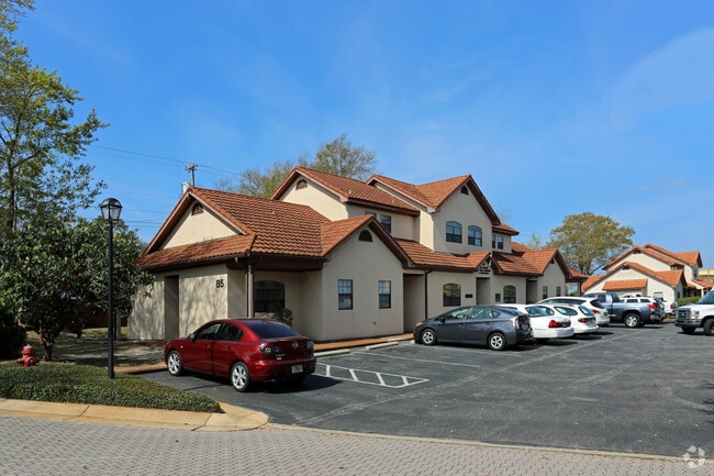
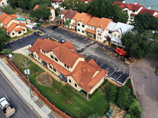
Property Record
85 Bay Bridge Dr, Gulf Breeze, FL 32561

NEARBY LISTINGS FOR SALE OR LEASE
Property Detail
85 Bay Bridge Dr
Pensacola-Ferry Pass-Brent, FL
Baybridge Sub
05-3S-29-0215-00100-0110
LOTS 11, 12 & 13 BLK 1 BAYBRIDGE AS DES IN OR 4634 PG 484
Medicalbuilding
Santa Rosa
X
Florida
12113C0606H
11
2024
0.08 AC
2025
Gulf Breeze
010900
Pensacola
3,988 SF
DEMOGRAPHICS near 85 Bay Bridge Dr
1 Mile
3 Mile
5 Mile
2024 Total Population
3,871
9,108
33,846
2029 Population
4,425
10,296
36,764
Pop Growth 2024-2029
+ 14.31%
+ 13.04%
+ 8.62%
Average Age
45
46
44
2024 Total Households
1,596
3,897
15,362
HH Growth 2024-2029
+ 14.60%
+ 13.16%
+ 8.35%
Median Household Inc
$111,577
$115,014
$74,382
Avg Household Size
2.40
2.30
2.10
2024 Avg HH Vehicles
2.00
2.00
2.00
Median Home Value
$509,387
$525,695
$397,957
Median Year Built
1973
1977
1976
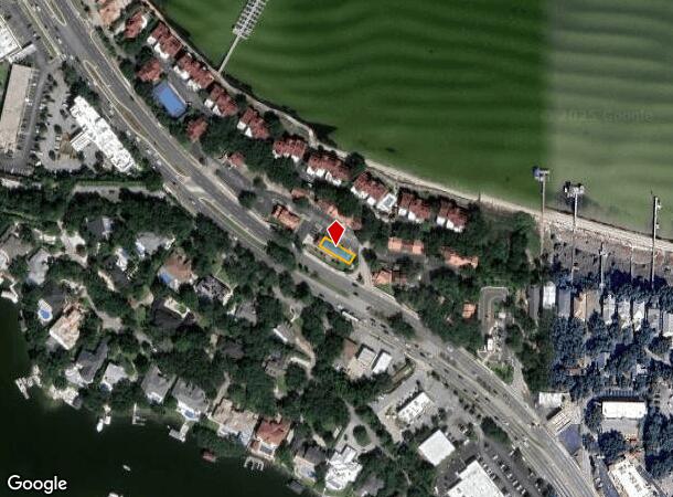
Nearby Places
Map Layers
Map Styles
 Street
 Aerial
- Restaurants
- Banks
- Shops
- Fitness
- Groceries
PUBLIC TRANSPORTATION
AIRPORT
Pensacola International
DRIVE
WALK
Distance
Pensacola International
20 min
10.1 mi
SALE & LEASE HISTORY
LISTING DATE
SALE/LEASE

Oct 31, 2024
For Lease
Oct 31, 2024
For Sale
Nearby Properties
Address
Land Use
TOTAL SIZE
Lot Size
Zoning
Address
Land Use
TOTAL SIZE
Lot Size
Zoning
3,476 SF
540 AC
Address
Land Use
TOTAL SIZE
Lot Size
Zoning
10,134 SF
308 AC
Address
Land Use
TOTAL SIZE
Lot Size
Zoning
83,895 SF
149.82 AC
P
Address
Land Use
TOTAL SIZE
Lot Size
Zoning
186,964 SF
21.30 AC
M
Address
Land Use
TOTAL SIZE
Lot Size
Zoning
5,410 SF
72 AC
P
Address
Land Use
TOTAL SIZE
Lot Size
Zoning
120,500 SF
11.11 AC
C1
Address
Land Use
TOTAL SIZE
Lot Size
Zoning
142,717 SF
5.25 AC
R1A
Address
Land Use
TOTAL SIZE
Lot Size
Zoning
135,461 SF
9.54 AC
C1
Address
Land Use
TOTAL SIZE
Lot Size
Zoning
77,250 SF
10 AC
G/C-PB
Address
Land Use
TOTAL SIZE
Lot Size
Zoning
116,896 SF
8.12 AC
C1
Address
Land Use
TOTAL SIZE
Lot Size
Zoning
84,933 SF
4.09 AC
C1
Address
Land Use
TOTAL SIZE
Lot Size
Zoning
73,354 SF
0.96 AC
C1
Address
Land Use
TOTAL SIZE
Lot Size
Zoning
65,959 SF
5.28 AC
C1
Address
Land Use
TOTAL SIZE
Lot Size
Zoning
56,031 SF
2.93 AC
C1
Address
Land Use
TOTAL SIZE
Lot Size
Zoning
73,396 SF
6.31 AC
C1
Address
Land Use
TOTAL SIZE
Lot Size
Zoning
57,926 SF
1.58 AC
C1
Address
Land Use
TOTAL SIZE
Lot Size
Zoning
38,717 SF
2.95 AC
C1
Address
Land Use
TOTAL SIZE
Lot Size
Zoning
57,128 SF
3.66 AC
CH-PB
Address
Land Use
TOTAL SIZE
Lot Size
Zoning
50,259 SF
3.52 AC
C1
Address
Land Use
TOTAL SIZE
Lot Size
Zoning
62,335 SF
8.76 AC
R1A
Address
Land Use
TOTAL SIZE
Lot Size
Zoning
70,426 SF
1.61 AC
C1
Address
Land Use
TOTAL SIZE
Lot Size
Zoning
43,495 SF
2.89 AC
C1
Address
Land Use
TOTAL SIZE
Lot Size
Zoning
28,913 SF
2.04 AC
C1
Address
Land Use
TOTAL SIZE
Lot Size
Zoning
9,421 SF
1.25 AC
P
Address
Land Use
TOTAL SIZE
Lot Size
Zoning
5.68 AC
GR-PB
Address
Land Use
TOTAL SIZE
Lot Size
Zoning
67,845 SF
3 AC
R1
Address
Land Use
TOTAL SIZE
Lot Size
Zoning
31,304 SF
1.32 AC
R1A
Address
Land Use
TOTAL SIZE
Lot Size
Zoning
17,640 SF
1.10 AC
C1
Address
Land Use
TOTAL SIZE
Lot Size
Zoning
32,374 SF
1.08 AC
C1
Address
Land Use
TOTAL SIZE
Lot Size
Zoning
24,820 SF
1.02 AC
C1
The World's #1 Commercial Real Estate Marketplace
Connect with us
© 2025 CoStar Group
The information above has been obtained from sources believed reliable. While we do not doubt its accuracy we have not verified it and make no guarantee, warranty or representation about it. It is your responsibility to independently confirm its accuracy and completeness. Any projections, opinions, assumptions, or estimates used are for example only and do not represent the current or future performance of the property. The value of this transaction to you depends on tax and other factors which should be evaluated by your tax, financial, and legal advisors. You and your advisors should conduct a careful, independent investigation of the property to determine to your satisfaction the suitability of the property for your needs.