Property Record
85 Beach Rd, Salisbury, MA 01952


Property Detail
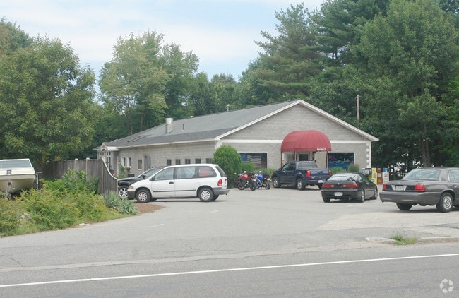
85 Beach Rd
Commercialofficeresidentialmixeduse
Essex
C
Massachusetts
B and X Area of moderate flood hazard, usually the area between the limits of the 100-year and 500-year floods.
0.69 AC
2025
Amesbury/Ipswich
2025
Boston
267104
Boston-Cambridge-Newton, MA-NH
4,264 SF
SALI-000025-000000-000060
NEARBY LISTINGS FOR SALE OR LEASE
DEMOGRAPHICS near 85 Beach Rd
1 mile
3 mile
5 mile
2025 Total Population
3,023
26,244
57,637
2030 Population
3,041
27,199
59,837
Pop Growth 2025-2030
+ 0.60%
+ 3.64%
+ 3.82%
Average Age
49
48
46
2025 Total Households
1,467
12,128
25,564
HH Growth 2025-2030
+ 0.41%
+ 3.73%
+ 3.86%
Median Household Inc
$89,449
$112,783
$107,039
Avg Household Size
2.10
2.10
2.20
2025 Avg HH Vehicles
2.00
2.00
2.00
Median Home Value
$447,619
$730,492
$690,276
Median Year Built
1982
1960
1969
Nearby Places
Map Layers
Map Styles
 Street
 Aerial
Transit
 Traffic
 Biking
Places
Listings with unknown addresses are not visible on the map
- Restaurants
- Banks
- Shops
- Fitness
- Groceries
PUBLIC TRANSPORTATION
COMMUTER RAIL
Newburyport (Newburyport/Rockport Line - Massachusetts Bay Transportation Authority Commuter Rail (Purple Line))
Drive
Walk
Distance
Newburyport (Newburyport/Rockport Line - Massachusetts Bay Transportation Authority Commuter Rail (Purple Line))
11 min
4.3 mi
AIRPORT
Portsmouth International at Pease
Drive
Walk
Distance
Portsmouth International at Pease
30 min
20.0 mi
Freight Ports
Port of Boston
Drive
Walk
Distance
Port of Boston
61 min
43.6 mi
SALE & LEASE HISTORY
LISTING DATE
SALE/LEASE

Jan 06, 2020
For Sale
Aug 16, 2021
For Sale
Nearby Properties
Address
Land Use
TOTAL SIZE
Lot Size
Zoning
Address
Land Use
TOTAL SIZE
Lot Size
Zoning
207,982 SF
14.58 AC
Address
Land Use
TOTAL SIZE
Lot Size
Zoning
267,857 SF
13.10 AC
BC
Address
Land Use
TOTAL SIZE
Lot Size
Zoning
107,053 SF
17.51 AC
Address
Land Use
TOTAL SIZE
Lot Size
Zoning
170,444 SF
13.30 AC
Address
Land Use
TOTAL SIZE
Lot Size
Zoning
441.30 AC
BC
Address
Land Use
TOTAL SIZE
Lot Size
Zoning
112,708 SF
40 AC
50
Address
Land Use
TOTAL SIZE
Lot Size
Zoning
191,775 SF
23.50 AC
C
Address
Land Use
TOTAL SIZE
Lot Size
Zoning
3,820 SF
9.15 AC
40
Address
Land Use
TOTAL SIZE
Lot Size
Zoning
7,768 SF
3.98 AC
Address
Land Use
TOTAL SIZE
Lot Size
Zoning
106,787 SF
22.25 AC
C
Address
Land Use
TOTAL SIZE
Lot Size
Zoning
20,518 SF
6.05 AC
BC
Address
Land Use
TOTAL SIZE
Lot Size
Zoning
95,903 SF
1.64 AC
Address
Land Use
TOTAL SIZE
Lot Size
Zoning
93,090 SF
87 SF
Address
Land Use
TOTAL SIZE
Lot Size
Zoning
148,744 SF
4.10 AC
Address
Land Use
TOTAL SIZE
Lot Size
Zoning
Address
Land Use
TOTAL SIZE
Lot Size
Zoning
65,124 SF
0.79 AC
Address
Land Use
TOTAL SIZE
Lot Size
Zoning
92,907 SF
5.76 AC
Address
Land Use
TOTAL SIZE
Lot Size
Zoning
52.50 AC
Address
Land Use
TOTAL SIZE
Lot Size
Zoning
39,728 SF
2.25 AC
Address
Land Use
TOTAL SIZE
Lot Size
Zoning
144 SF
9.18 AC
BC
Address
Land Use
TOTAL SIZE
Lot Size
Zoning
36,701 SF
1.10 AC
Address
Land Use
TOTAL SIZE
Lot Size
Zoning
30,270 SF
0.74 AC
Address
Land Use
TOTAL SIZE
Lot Size
Zoning
4.11 AC
Address
Land Use
TOTAL SIZE
Lot Size
Zoning
33,675 SF
27.18 AC
C3
Address
Land Use
TOTAL SIZE
Lot Size
Zoning
11,445 SF
0.75 AC
Address
Land Use
TOTAL SIZE
Lot Size
Zoning
42.20 AC
C1
Address
Land Use
TOTAL SIZE
Lot Size
Zoning
52,767 SF
5.61 AC
C
Address
Land Use
TOTAL SIZE
Lot Size
Zoning
96,232 SF
5.81 AC
I
Address
Land Use
TOTAL SIZE
Lot Size
Zoning
16,706 SF
6.60 AC
Address
Land Use
TOTAL SIZE
Lot Size
Zoning
12,324 SF
2.87 AC
The World's #1 Commercial Real Estate Marketplace
Connect with us
© 2026 CoStar Group
The information above has been obtained from sources believed reliable. While we do not doubt its accuracy we have not verified it and make no guarantee, warranty or representation about it. It is your responsibility to independently confirm its accuracy and completeness. Any projections, opinions, assumptions, or estimates used are for example only and do not represent the current or future performance of the property. The value of this transaction to you depends on tax and other factors which should be evaluated by your tax, financial, and legal advisors. You and your advisors should conduct a careful, independent investigation of the property to determine to your satisfaction the suitability of the property for your needs.