Property Record
85 Beaumont Dr, Northbridge, MA 01534
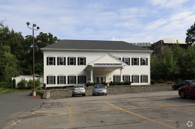


Property Detail
85 Beaumont Dr
NBRI-000025-000088
Worcester
Commercialnec
Massachusetts
B and X Area of moderate flood hazard, usually the area between the limits of the 100-year and 500-year floods.
12.65 AC
2025
Outlying Worcester
2025
Boston
750300
Worcester, MA
NEARBY LISTINGS FOR SALE OR LEASE
DEMOGRAPHICS near 85 Beaumont Dr
1 mile
3 mile
5 mile
2025 Total Population
4,490
23,248
50,650
2030 Population
4,585
23,862
52,037
Pop Growth 2025-2030
+ 2.12%
+ 2.64%
+ 2.74%
Average Age
43
41
42
2025 Total Households
1,724
8,817
19,343
HH Growth 2025-2030
+ 2.20%
+ 2.73%
+ 2.83%
Median Household Inc
$123,929
$131,462
$126,791
Avg Household Size
2.50
2.60
2.60
2025 Avg HH Vehicles
2.00
2.00
2.00
Median Home Value
$511,272
$539,786
$534,516
Median Year Built
1980
1980
1979
Nearby Places
Map Layers
Map Styles
 Street
 Aerial
Layers
 Traffic
 Biking
Places
Listings with unknown addresses are not visible on the map
- Restaurants
- Banks
- Shops
- Fitness
- Groceries
PUBLIC TRANSPORTATION
COMMUTER RAIL
Grafton (Framingham/Worcester Line - Massachusetts Bay Transportation Authority Commuter Rail (Purple Line))
Drive
Walk
Distance
Grafton (Framingham/Worcester Line - Massachusetts Bay Transportation Authority Commuter Rail (Purple Line))
18 min
8.6 mi
AIRPORT
Worcester Regional
Drive
Walk
Distance
Worcester Regional
31 min
18.5 mi
Freight Ports
Port of Boston
Drive
Walk
Distance
Port of Boston
64 min
43.6 mi
Nearby Properties
Address
Land Use
TOTAL SIZE
Lot Size
Zoning
Address
Land Use
TOTAL SIZE
Lot Size
Zoning
147,000 SF
28.41 AC
5
Address
Land Use
TOTAL SIZE
Lot Size
Zoning
159,250 SF
28.89 AC
2
Address
Land Use
TOTAL SIZE
Lot Size
Zoning
17.80 AC
R2
Address
Land Use
TOTAL SIZE
Lot Size
Zoning
99,891 SF
17.37 AC
1
Address
Land Use
TOTAL SIZE
Lot Size
Zoning
12.50 AC
RMF
Address
Land Use
TOTAL SIZE
Lot Size
Zoning
9.29 AC
RMF
Address
Land Use
TOTAL SIZE
Lot Size
Zoning
12.93 AC
Address
Land Use
TOTAL SIZE
Lot Size
Zoning
22,520 SF
7.03 AC
Address
Land Use
TOTAL SIZE
Lot Size
Zoning
32,573 SF
8.25 AC
R2
Address
Land Use
TOTAL SIZE
Lot Size
Zoning
2,576 SF
3.37 AC
5
Address
Land Use
TOTAL SIZE
Lot Size
Zoning
51,441 SF
3.50 AC
3
Address
Land Use
TOTAL SIZE
Lot Size
Zoning
87,250 SF
4.46 AC
6
Address
Land Use
TOTAL SIZE
Lot Size
Zoning
17.12 AC
Address
Land Use
TOTAL SIZE
Lot Size
Zoning
26.11 AC
Address
Land Use
TOTAL SIZE
Lot Size
Zoning
20,069 SF
224.29 AC
R4
Address
Land Use
TOTAL SIZE
Lot Size
Zoning
6.17 AC
Address
Land Use
TOTAL SIZE
Lot Size
Zoning
1.79 AC
Address
Land Use
TOTAL SIZE
Lot Size
Zoning
23,326 SF
33.14 AC
7
Address
Land Use
TOTAL SIZE
Lot Size
Zoning
146.25 AC
Address
Land Use
TOTAL SIZE
Lot Size
Zoning
52,700 SF
3.98 AC
Address
Land Use
TOTAL SIZE
Lot Size
Zoning
5.78 AC
OLI
Address
Land Use
TOTAL SIZE
Lot Size
Zoning
22,864 SF
3.96 AC
1
Address
Land Use
TOTAL SIZE
Lot Size
Zoning
54.40 AC
Address
Land Use
TOTAL SIZE
Lot Size
Zoning
30,821 SF
3.83 AC
Address
Land Use
TOTAL SIZE
Lot Size
Zoning
14,552 SF
1.01 AC
Address
Land Use
TOTAL SIZE
Lot Size
Zoning
16,998 SF
42.57 AC
5
Address
Land Use
TOTAL SIZE
Lot Size
Zoning
1.34 AC
Address
Land Use
TOTAL SIZE
Lot Size
Zoning
25,345 SF
2.14 AC
6
Address
Land Use
TOTAL SIZE
Lot Size
Zoning
7.50 AC
R2
The World's #1 Commercial Real Estate Marketplace
Connect with us
© 2026 CoStar Group
The information above has been obtained from sources believed reliable. While we do not doubt its accuracy we have not verified it and make no guarantee, warranty or representation about it. It is your responsibility to independently confirm its accuracy and completeness. Any projections, opinions, assumptions, or estimates used are for example only and do not represent the current or future performance of the property. The value of this transaction to you depends on tax and other factors which should be evaluated by your tax, financial, and legal advisors. You and your advisors should conduct a careful, independent investigation of the property to determine to your satisfaction the suitability of the property for your needs.