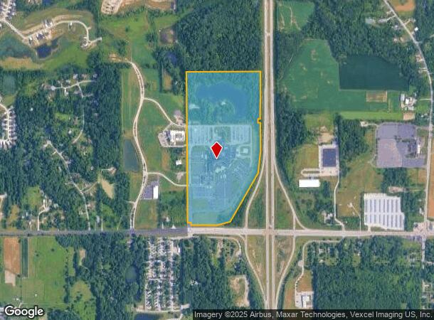
Property Record
85 E Us Highway 6, Valparaiso, IN 46383
NEARBY LISTINGS FOR SALE OR LEASE
Property Detail
85 E Us Highway 6
64-06-24-400-012.000-006
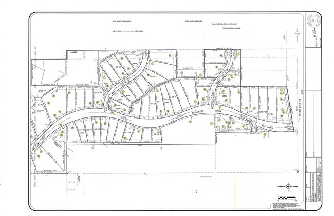
PARC IN E74A SE 24-36-6 65.322A
Hospitalprivate
Porter
X
Indiana
18127C0145D
0.01 AC
2023
Porter County
2024
Chicago
050104
Chicago-Naperville-Elgin, IL-IN-WI
389,754 SF
DEMOGRAPHICS near 85 E Us Highway 6
1 Mile
3 Mile
5 Mile
2024 Total Population
1,908
13,766
63,009
2029 Population
1,993
14,190
64,455
Pop Growth 2024-2029
+ 4.45%
+ 3.08%
+ 2.29%
Average Age
43
42
41
2024 Total Households
739
5,257
24,690
HH Growth 2024-2029
+ 4.47%
+ 3.10%
+ 2.28%
Median Household Inc
$110,119
$91,119
$80,012
Avg Household Size
2.50
2.60
2.50
2024 Avg HH Vehicles
2.00
2.00
2.00
Median Home Value
$338,317
$316,631
$275,162
Median Year Built
2001
1991
1984
Nearby Places
Map Layers
Map Styles
 Street
 Aerial
- Restaurants
- Banks
- Shops
- Fitness
- Groceries
PUBLIC TRANSPORTATION
COMMUTER RAIL
Dune Park (Chesterton) Station (South Shore Line - Northern Indiana Commuter Transportation District (South Shore Line))
DRIVE
WALK
Distance
Dune Park (Chesterton) Station (South Shore Line - Northern Indiana Commuter Transportation District (South Shore Line))
14 min
7.7 mi
Freight Ports
Port Milwaukee
DRIVE
WALK
Distance
Port Milwaukee
168 min
134.0 mi
Nearby Properties
Address
Land Use
TOTAL SIZE
Lot Size
Zoning
Address
Land Use
TOTAL SIZE
Lot Size
Zoning
531,461 SF
174 SF
Address
Land Use
TOTAL SIZE
Lot Size
Zoning
189,071 SF
87 SF
Address
Land Use
TOTAL SIZE
Lot Size
Zoning
109,131 SF
44 SF
Address
Land Use
TOTAL SIZE
Lot Size
Zoning
61,120 SF
44 SF
Address
Land Use
TOTAL SIZE
Lot Size
Zoning
78,087 SF
44 SF
Address
Land Use
TOTAL SIZE
Lot Size
Zoning
88,064 SF
3.87 AC
Address
Land Use
TOTAL SIZE
Lot Size
Zoning
70,692 SF
44 SF
Address
Land Use
TOTAL SIZE
Lot Size
Zoning
38,337 SF
44 SF
Address
Land Use
TOTAL SIZE
Lot Size
Zoning
62,127 SF
64.25 AC
Address
Land Use
TOTAL SIZE
Lot Size
Zoning
72,408 SF
2.75 AC
Address
Land Use
TOTAL SIZE
Lot Size
Zoning
50,191 SF
2.43 AC
Address
Land Use
TOTAL SIZE
Lot Size
Zoning
35,456 SF
7.88 AC
Address
Land Use
TOTAL SIZE
Lot Size
Zoning
62,261 SF
44 SF
Address
Land Use
TOTAL SIZE
Lot Size
Zoning
42.89 AC
Address
Land Use
TOTAL SIZE
Lot Size
Zoning
62,068 SF
10.56 AC
Address
Land Use
TOTAL SIZE
Lot Size
Zoning
35,384 SF
151 AC
Address
Land Use
TOTAL SIZE
Lot Size
Zoning
33,300 SF
1.97 AC
Address
Land Use
TOTAL SIZE
Lot Size
Zoning
8,820 SF
0.02 AC
Address
Land Use
TOTAL SIZE
Lot Size
Zoning
16,615 SF
1.55 AC
Address
Land Use
TOTAL SIZE
Lot Size
Zoning
174 SF
Address
Land Use
TOTAL SIZE
Lot Size
Zoning
100,000 SF
44 SF
Address
Land Use
TOTAL SIZE
Lot Size
Zoning
50,038 SF
44 SF
Address
Land Use
TOTAL SIZE
Lot Size
Zoning
15,788 SF
1.50 AC
Address
Land Use
TOTAL SIZE
Lot Size
Zoning
15,860 SF
3.91 AC
Address
Land Use
TOTAL SIZE
Lot Size
Zoning
7,597 SF
9.43 AC
Address
Land Use
TOTAL SIZE
Lot Size
Zoning
15,392 SF
2.46 AC
Address
Land Use
TOTAL SIZE
Lot Size
Zoning
10,697 SF
0.01 AC
Address
Land Use
TOTAL SIZE
Lot Size
Zoning
12,569 SF
10 AC
Address
Land Use
TOTAL SIZE
Lot Size
Zoning
9,512 SF
0.51 AC
The World's #1 Commercial Real Estate Marketplace
Connect with us
© 2026 CoStar Group
The information above has been obtained from sources believed reliable. While we do not doubt its accuracy we have not verified it and make no guarantee, warranty or representation about it. It is your responsibility to independently confirm its accuracy and completeness. Any projections, opinions, assumptions, or estimates used are for example only and do not represent the current or future performance of the property. The value of this transaction to you depends on tax and other factors which should be evaluated by your tax, financial, and legal advisors. You and your advisors should conduct a careful, independent investigation of the property to determine to your satisfaction the suitability of the property for your needs.