Property Record
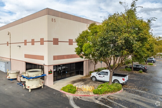
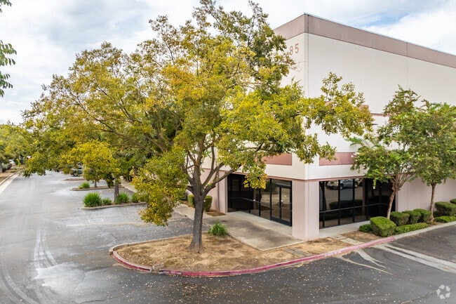
85 Enterprise Ct, Galt, CA 95632

Property Detail
85 Enterprise Ct
150-0011-071
PCLS 8, 9 & 11 KMS INDUSTRIAL PARK, EXC ANYTHING LYING WL'YOF LN DES AS BEG AT A PT LOC S89%59'30E 243.22 FT FR NW CORSD PCL 11, TH FR SD POB S00%00'10W 450.01 FT TO NL'Y R/WOF ENTERPRISE CT CONTG 4.28 AC
Shipyard
SACRAMENTO
LM
California
B and X Area of moderate flood hazard, usually the area between the limits of the 100-year and 500-year floods.
4.28 AC
2025
Elk Grove/Laguna
2025
Sacramento
009503
Sacramento-Roseville-Folsom, CA
68,400 SF
NEARBY LISTINGS FOR SALE OR LEASE
-
-
View all Galt listings for lease on LoopNet.com
DEMOGRAPHICS near 85 Enterprise Ct
1 mile
3 mile
5 mile
2025 Total Population
8,990
29,876
32,447
2030 Population
9,105
30,344
32,839
Pop Growth 2025-2030
+ 1.28%
+ 1.57%
+ 1.21%
Average Age
40
39
39
2025 Total Households
2,993
9,548
10,383
HH Growth 2025-2030
+ 1.27%
+ 1.58%
+ 1.21%
Median Household Inc
$86,803
$94,405
$96,400
Avg Household Size
3.00
3.10
3.10
2025 Avg HH Vehicles
2.00
2.00
2.00
Median Home Value
$484,453
$519,742
$538,721
Median Year Built
1991
1993
1992
Nearby Places
Map Layers
Map Styles
 Street
 Aerial
Layers
 Traffic
 Biking
Places
Listings with unknown addresses are not visible on the map
- Restaurants
- Banks
- Shops
- Fitness
- Groceries
PUBLIC TRANSPORTATION
AIRPORT
Stockton Metro
Drive
Walk
Distance
Stockton Metro
39 min
29.4 mi
Freight Ports
Port of Stockton
Drive
Walk
Distance
Port of Stockton
37 min
27.9 mi
SALE & LEASE HISTORY
LISTING DATE
SALE/LEASE

Oct 31, 2022
For Lease
Oct 27, 2022
For Lease
Dec 05, 2017
For Lease
Nearby Properties
Address
Land Use
TOTAL SIZE
Lot Size
Zoning
Address
Land Use
TOTAL SIZE
Lot Size
Zoning
284,700 SF
19.12 AC
LM
Address
Land Use
TOTAL SIZE
Lot Size
Zoning
223,974 SF
12.06 AC
LM
Address
Land Use
TOTAL SIZE
Lot Size
Zoning
127,249 SF
11.18 AC
HC
Address
Land Use
TOTAL SIZE
Lot Size
Zoning
65,200 SF
5.04 AC
HC
Address
Land Use
TOTAL SIZE
Lot Size
Zoning
77,052 SF
0.93 AC
DC
Address
Land Use
TOTAL SIZE
Lot Size
Zoning
0.99 AC
HC
Address
Land Use
TOTAL SIZE
Lot Size
Zoning
46,376 SF
4.18 AC
C
Address
Land Use
TOTAL SIZE
Lot Size
Zoning
95,616 SF
8.42 AC
R3
Address
Land Use
TOTAL SIZE
Lot Size
Zoning
4,986 SF
1.62 AC
HC
Address
Land Use
TOTAL SIZE
Lot Size
Zoning
52,000 SF
3.28 AC
C
Address
Land Use
TOTAL SIZE
Lot Size
Zoning
1.53 AC
LM
Address
Land Use
TOTAL SIZE
Lot Size
Zoning
316.88 AC
AG-80
Address
Land Use
TOTAL SIZE
Lot Size
Zoning
18,089 SF
10.36 AC
LM
Address
Land Use
TOTAL SIZE
Lot Size
Zoning
67,312 SF
10.20 AC
LM
Address
Land Use
TOTAL SIZE
Lot Size
Zoning
102,790 SF
6.29 AC
LM
Address
Land Use
TOTAL SIZE
Lot Size
Zoning
50,732 SF
6.19 AC
R2
Address
Land Use
TOTAL SIZE
Lot Size
Zoning
58 AC
R1C OS
Address
Land Use
TOTAL SIZE
Lot Size
Zoning
21,304 SF
2.91 AC
C
Address
Land Use
TOTAL SIZE
Lot Size
Zoning
47,710 SF
2.60 AC
R4
Address
Land Use
TOTAL SIZE
Lot Size
Zoning
17,340 SF
1.80 AC
C
Address
Land Use
TOTAL SIZE
Lot Size
Zoning
324.20 AC
AG-80
Address
Land Use
TOTAL SIZE
Lot Size
Zoning
R1C OS
Address
Land Use
TOTAL SIZE
Lot Size
Zoning
760 SF
8.35 AC
LM
Address
Land Use
TOTAL SIZE
Lot Size
Zoning
32,567 SF
6.27 AC
R3
Address
Land Use
TOTAL SIZE
Lot Size
Zoning
8,844 SF
6.16 AC
OP
Address
Land Use
TOTAL SIZE
Lot Size
Zoning
12,804 SF
9.89 AC
PQ
Address
Land Use
TOTAL SIZE
Lot Size
Zoning
64,868 SF
3.69 AC
LM
Address
Land Use
TOTAL SIZE
Lot Size
Zoning
4.51 AC
LM
Address
Land Use
TOTAL SIZE
Lot Size
Zoning
43,000 SF
1.90 AC
HC
Address
Land Use
TOTAL SIZE
Lot Size
Zoning
32,196 SF
2.89 AC
C
The World's #1 Commercial Real Estate Marketplace
Connect with us
© 2026 CoStar Group
The information above has been obtained from sources believed reliable. While we do not doubt its accuracy we have not verified it and make no guarantee, warranty or representation about it. It is your responsibility to independently confirm its accuracy and completeness. Any projections, opinions, assumptions, or estimates used are for example only and do not represent the current or future performance of the property. The value of this transaction to you depends on tax and other factors which should be evaluated by your tax, financial, and legal advisors. You and your advisors should conduct a careful, independent investigation of the property to determine to your satisfaction the suitability of the property for your needs.