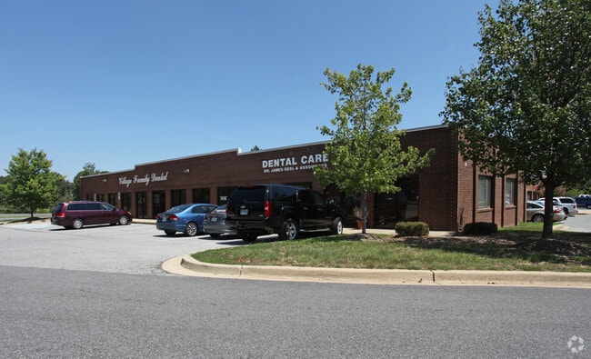
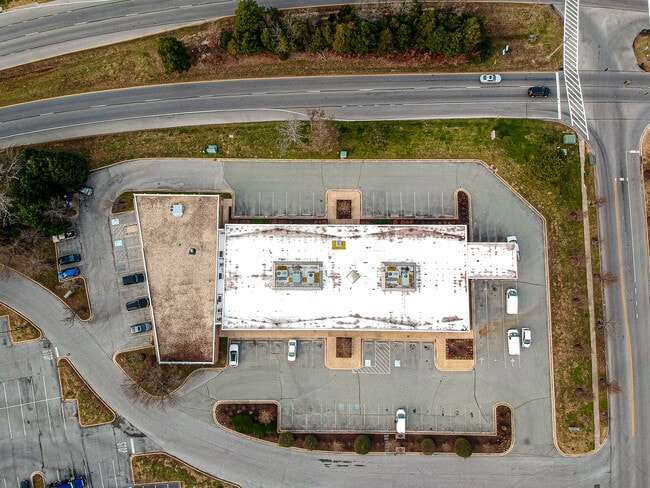
Property Record
85 High St, Waldorf, MD 20602

Property Detail
85 High St
06-100104
PAR H - 1.509 AC SMALLWOOD VILLAGE S-VII ST CHARLES SUB
Officebuilding
Charles
PUD
Maryland
B and X Area of moderate flood hazard, usually the area between the limits of the 100-year and 500-year floods.
h
0
1.50 AC
2025
Charles County
850906
Washington, DC
18,060 SF
Washington-Arlington-Alexandria, DC-VA-MD-WV
NEARBY LISTINGS FOR SALE OR LEASE
DEMOGRAPHICS near 85 High St
1 mile
3 mile
5 mile
2025 Total Population
14,584
55,269
94,142
2030 Population
14,977
57,134
97,532
Pop Growth 2025-2030
+ 2.69%
+ 3.37%
+ 3.60%
Average Age
38
38
38
2025 Total Households
5,682
20,313
33,652
HH Growth 2025-2030
+ 2.83%
+ 3.46%
+ 3.68%
Median Household Inc
$76,759
$100,099
$107,014
Avg Household Size
2.50
2.70
2.70
2025 Avg HH Vehicles
2.00
2.00
2.00
Median Home Value
$334,521
$374,290
$399,788
Median Year Built
1981
1990
1992
Nearby Places
Map Layers
Map Styles
 Street
 Aerial
Layers
 Traffic
 Biking
Places
Listings with unknown addresses are not visible on the map
- Restaurants
- Banks
- Shops
- Fitness
- Groceries
PUBLIC TRANSPORTATION
AIRPORT
Ronald Reagan Washington Ntl
Drive
Walk
Distance
Ronald Reagan Washington Ntl
46 min
28.6 mi
Freight Ports
Port of Baltimore
Drive
Walk
Distance
Port of Baltimore
81 min
55.5 mi
SALE & LEASE HISTORY
LISTING DATE
SALE/LEASE

Sep 25, 2016
For Lease
Nov 22, 2024
For Sale
Mar 16, 2023
For Lease
Jul 30, 2021
For Lease
Jan 06, 2021
For Sale
Dec 15, 2020
For Lease
Nearby Properties
Address
Land Use
TOTAL SIZE
Lot Size
Zoning
Address
Land Use
TOTAL SIZE
Lot Size
Zoning
714,134 SF
29.53 AC
PUD
Address
Land Use
TOTAL SIZE
Lot Size
Zoning
289,883 SF
98.95 AC
PUD
Address
Land Use
TOTAL SIZE
Lot Size
Zoning
477,958 SF
47.50 AC
CB
Address
Land Use
TOTAL SIZE
Lot Size
Zoning
287,760 SF
16.27 AC
PUD
Address
Land Use
TOTAL SIZE
Lot Size
Zoning
250,272 SF
12.37 AC
PUD
Address
Land Use
TOTAL SIZE
Lot Size
Zoning
312,478 SF
54.26 AC
PUD
Address
Land Use
TOTAL SIZE
Lot Size
Zoning
239,608 SF
11.28 AC
PUD
Address
Land Use
TOTAL SIZE
Lot Size
Zoning
392,124 SF
38.73 AC
PUD
Address
Land Use
TOTAL SIZE
Lot Size
Zoning
265,637 SF
54.72 AC
RH
Address
Land Use
TOTAL SIZE
Lot Size
Zoning
206,966 SF
32.61 AC
CB
Address
Land Use
TOTAL SIZE
Lot Size
Zoning
188,284 SF
9.02 AC
RM
Address
Land Use
TOTAL SIZE
Lot Size
Zoning
262,779 SF
26.84 AC
CB
Address
Land Use
TOTAL SIZE
Lot Size
Zoning
136,192 SF
17.85 AC
PUD
Address
Land Use
TOTAL SIZE
Lot Size
Zoning
239,208 SF
13.51 AC
PUD
Address
Land Use
TOTAL SIZE
Lot Size
Zoning
167,075 SF
11.01 AC
RH
Address
Land Use
TOTAL SIZE
Lot Size
Zoning
237,903 SF
16.03 AC
PRD
Address
Land Use
TOTAL SIZE
Lot Size
Zoning
207,928 SF
15.50 AC
PUD
Address
Land Use
TOTAL SIZE
Lot Size
Zoning
141,578 SF
7.40 AC
PUD
Address
Land Use
TOTAL SIZE
Lot Size
Zoning
42.74 AC
PUD
Address
Land Use
TOTAL SIZE
Lot Size
Zoning
161,208 SF
10.99 AC
RH
Address
Land Use
TOTAL SIZE
Lot Size
Zoning
160,985 SF
24.85 AC
CB
Address
Land Use
TOTAL SIZE
Lot Size
Zoning
143,728 SF
19.71 AC
CB
Address
Land Use
TOTAL SIZE
Lot Size
Zoning
86,880 SF
22.18 AC
PUD
Address
Land Use
TOTAL SIZE
Lot Size
Zoning
194,972 SF
59.84 AC
RH
Address
Land Use
TOTAL SIZE
Lot Size
Zoning
145,749 SF
20.15 AC
PUD
Address
Land Use
TOTAL SIZE
Lot Size
Zoning
118,880 SF
3.78 AC
PUD
Address
Land Use
TOTAL SIZE
Lot Size
Zoning
121,968 SF
2.23 AC
PUD
Address
Land Use
TOTAL SIZE
Lot Size
Zoning
109,304 SF
9.09 AC
PUD
Address
Land Use
TOTAL SIZE
Lot Size
Zoning
53,318 SF
20.01 AC
PUD
Address
Land Use
TOTAL SIZE
Lot Size
Zoning
147,800 SF
4.54 AC
RH
The World's #1 Commercial Real Estate Marketplace
Connect with us
© 2026 CoStar Group
The information above has been obtained from sources believed reliable. While we do not doubt its accuracy we have not verified it and make no guarantee, warranty or representation about it. It is your responsibility to independently confirm its accuracy and completeness. Any projections, opinions, assumptions, or estimates used are for example only and do not represent the current or future performance of the property. The value of this transaction to you depends on tax and other factors which should be evaluated by your tax, financial, and legal advisors. You and your advisors should conduct a careful, independent investigation of the property to determine to your satisfaction the suitability of the property for your needs.