Property Record
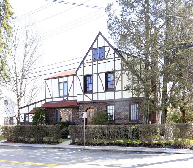
85 N Broadway, Nyack, NY 10960


NEARBY LISTINGS FOR SALE OR LEASE
Property Detail
85 N Broadway
392403-066-030-0002-085-000-0000
3/135/1383/20
Commercialnec
Rockland
X
New York
36087C0183G
85.0
2023
0.23 AC
2024
Orangetown
013102
Northern New Jersey
4,691 SF
New York-Jersey City-White Plains, NY-NJ
DEMOGRAPHICS near 85 N Broadway
1 Mile
3 Mile
5 Mile
2024 Total Population
10,241
35,396
113,479
2029 Population
10,089
35,248
112,479
Pop Growth 2024-2029
(1.48%)
(0.42%)
(0.88%)
Average Age
43
42
43
2024 Total Households
4,583
13,586
41,828
HH Growth 2024-2029
(1.55%)
(0.52%)
(1.02%)
Median Household Inc
$102,466
$107,303
$121,377
Avg Household Size
2.20
2.50
2.60
2024 Avg HH Vehicles
2.00
2.00
2.00
Median Home Value
$609,562
$591,658
$603,777
Median Year Built
1957
1962
1964
Nearby Places
Map Layers
Map Styles
 Street
 Aerial
- Restaurants
- Banks
- Shops
- Fitness
- Groceries
PUBLIC TRANSPORTATION
COMMUTER RAIL
Nanuet (Pascack Valley Line - NJ Transit Commuter Rail (NJ Transit))
DRIVE
WALK
Distance
Nanuet (Pascack Valley Line - NJ Transit Commuter Rail (NJ Transit))
11 min
5.9 mi
Tarrytown Station (Hudson Line - Metro-North Commuter Railroad Company (Metro-North))
DRIVE
WALK
Distance
Tarrytown Station (Hudson Line - Metro-North Commuter Railroad Company (Metro-North))
14 min
8.0 mi
Nearby Properties
Address
Land Use
TOTAL SIZE
Lot Size
Zoning
Address
Land Use
TOTAL SIZE
Lot Size
Zoning
415,374 SF
8.43 AC
H
Address
Land Use
TOTAL SIZE
Lot Size
Zoning
4,540,462 SF
30.89 AC
Address
Land Use
TOTAL SIZE
Lot Size
Zoning
2.93 AC
Address
Land Use
TOTAL SIZE
Lot Size
Zoning
25.52 AC
Address
Land Use
TOTAL SIZE
Lot Size
Zoning
1.98 AC
Address
Land Use
TOTAL SIZE
Lot Size
Zoning
108,264 SF
14.90 AC
R-18
Address
Land Use
TOTAL SIZE
Lot Size
Zoning
0.89 AC
Address
Land Use
TOTAL SIZE
Lot Size
Zoning
302.70 AC
R-40
Address
Land Use
TOTAL SIZE
Lot Size
Zoning
1.10 AC
R-3
Address
Land Use
TOTAL SIZE
Lot Size
Zoning
20.81 AC
Address
Land Use
TOTAL SIZE
Lot Size
Zoning
2,465 SF
2.03 AC
Address
Land Use
TOTAL SIZE
Lot Size
Zoning
8.54 AC
Address
Land Use
TOTAL SIZE
Lot Size
Zoning
984 SF
3.10 AC
LI
Address
Land Use
TOTAL SIZE
Lot Size
Zoning
1,887 SF
245.60 AC
02 - SINGL
Address
Land Use
TOTAL SIZE
Lot Size
Zoning
Address
Land Use
TOTAL SIZE
Lot Size
Zoning
441.47 AC
R-40
Address
Land Use
TOTAL SIZE
Lot Size
Zoning
142,608 SF
5.60 AC
HRA
Address
Land Use
TOTAL SIZE
Lot Size
Zoning
173,120 SF
4.80 AC
R6
Address
Land Use
TOTAL SIZE
Lot Size
Zoning
Address
Land Use
TOTAL SIZE
Lot Size
Zoning
184.50 AC
R-40
Address
Land Use
TOTAL SIZE
Lot Size
Zoning
10,280 SF
16.25 AC
R-40
Address
Land Use
TOTAL SIZE
Lot Size
Zoning
215,345 SF
18.60 AC
LO
Address
Land Use
TOTAL SIZE
Lot Size
Zoning
34.45 AC
Address
Land Use
TOTAL SIZE
Lot Size
Zoning
8.80 AC
R-1
Address
Land Use
TOTAL SIZE
Lot Size
Zoning
108,115 SF
2.21 AC
M
Address
Land Use
TOTAL SIZE
Lot Size
Zoning
142,143 SF
14 AC
R-18
Address
Land Use
TOTAL SIZE
Lot Size
Zoning
208,143 SF
13.15 AC
LO
Address
Land Use
TOTAL SIZE
Lot Size
Zoning
Address
Land Use
TOTAL SIZE
Lot Size
Zoning
141,480 SF
25.60 AC
LI
Address
Land Use
TOTAL SIZE
Lot Size
Zoning
188,101 SF
3.85 AC
M
The World's #1 Commercial Real Estate Marketplace
Connect with us
© 2026 CoStar Group
The information above has been obtained from sources believed reliable. While we do not doubt its accuracy we have not verified it and make no guarantee, warranty or representation about it. It is your responsibility to independently confirm its accuracy and completeness. Any projections, opinions, assumptions, or estimates used are for example only and do not represent the current or future performance of the property. The value of this transaction to you depends on tax and other factors which should be evaluated by your tax, financial, and legal advisors. You and your advisors should conduct a careful, independent investigation of the property to determine to your satisfaction the suitability of the property for your needs.