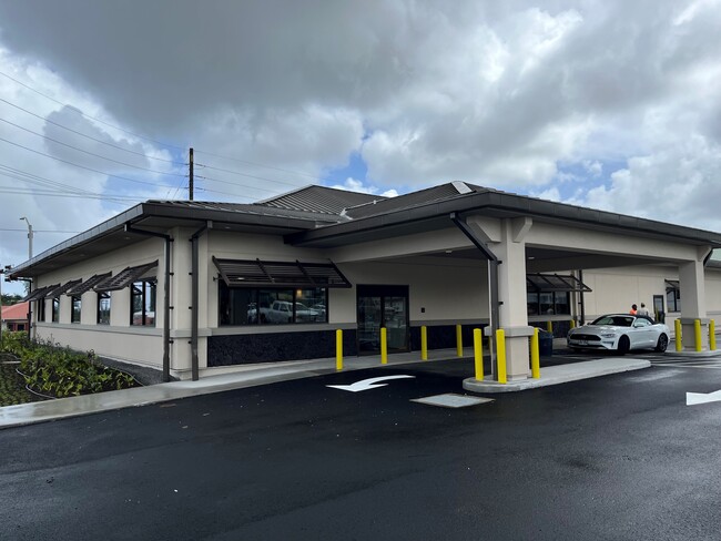
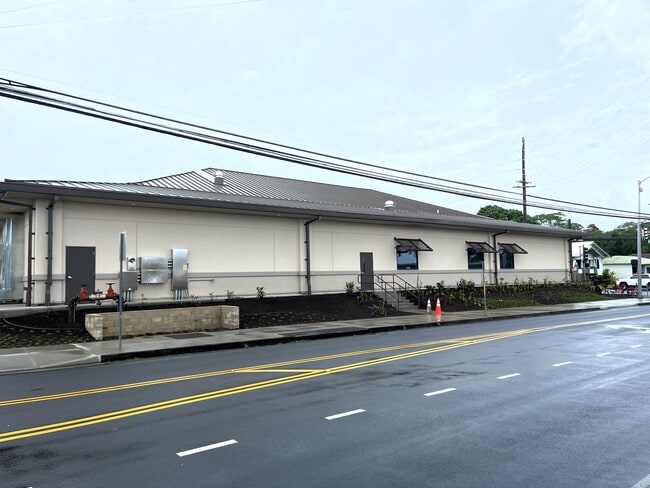
Property Record
85 W Lanikaula St, Hilo, HI 96720

NEARBY LISTINGS FOR SALE OR LEASE
Property Detail
85 W Lanikaula St
Hilo, HI
LOT C-1-A 46,212 SF DES GR 10,124 & S-16,034 SUBJ/ESMT
3-2-2-025-038-0000
Hawaii
Commercialnec
Hawaii
2024
c-1
2025
1.06 AC
020500
Hilo/East Big Island
674 SF
Hawaii
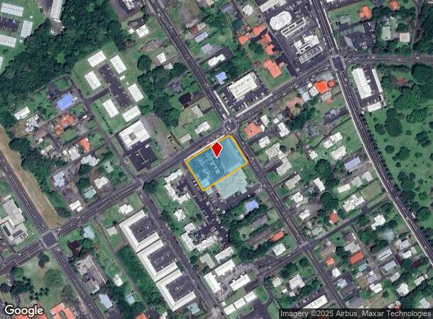
DEMOGRAPHICS near 85 W Lanikaula St
1 Mile
3 Mile
5 Mile
2024 Total Population
11,275
42,826
52,667
2029 Population
12,261
46,246
56,651
Pop Growth 2024-2029
+ 8.75%
+ 7.99%
+ 7.56%
Average Age
38
42
42
2024 Total Households
4,110
15,683
19,142
HH Growth 2024-2029
+ 8.76%
+ 7.94%
+ 7.51%
Median Household Inc
$48,186
$69,022
$71,531
Avg Household Size
2.50
2.60
2.60
2024 Avg HH Vehicles
2.00
2.00
2.00
Median Home Value
$370,366
$449,772
$471,052
Median Year Built
1977
1980
1980
Nearby Places
Map Layers
Map Styles
 Street
 Aerial
- Restaurants
- Banks
- Shops
- Fitness
- Groceries
PUBLIC TRANSPORTATION
AIRPORT
Hilo International
DRIVE
WALK
Distance
Hilo International
17 min
5.4 mi
SALE & LEASE HISTORY
LISTING DATE
SALE/LEASE

May 11, 2023
For Sale
Nearby Properties
Address
Land Use
TOTAL SIZE
Lot Size
Zoning
Address
Land Use
TOTAL SIZE
Lot Size
Zoning
165,552 SF
8 AC
CG-7.5
Address
Land Use
TOTAL SIZE
Lot Size
Zoning
231,016 SF
20.40 AC
RS-10
Address
Land Use
TOTAL SIZE
Lot Size
Zoning
474,990 SF
36.50 AC
OPEN
Address
Land Use
TOTAL SIZE
Lot Size
Zoning
328,862 SF
858.74 AC
OPEN
Address
Land Use
TOTAL SIZE
Lot Size
Zoning
218,538 SF
15.57 AC
MCX-20
Address
Land Use
TOTAL SIZE
Lot Size
Zoning
121,312 SF
5 AC
V-.75
Address
Land Use
TOTAL SIZE
Lot Size
Zoning
94,704 SF
2.95 AC
V-.75
Address
Land Use
TOTAL SIZE
Lot Size
Zoning
51,381 SF
4.04 AC
CG-7.5
Address
Land Use
TOTAL SIZE
Lot Size
Zoning
79,794 SF
6.54 AC
CG-7.5
Address
Land Use
TOTAL SIZE
Lot Size
Zoning
5.39 AC
RM-3
Address
Land Use
TOTAL SIZE
Lot Size
Zoning
103,234 SF
10.69 AC
ML-20
Address
Land Use
TOTAL SIZE
Lot Size
Zoning
26,540 SF
442.49 AC
A-5a
Address
Land Use
TOTAL SIZE
Lot Size
Zoning
101,100 SF
13.59 AC
OPEN
Address
Land Use
TOTAL SIZE
Lot Size
Zoning
38,412 SF
6.38 AC
RM-4
Address
Land Use
TOTAL SIZE
Lot Size
Zoning
39,714 SF
14.52 AC
MG-1a
Address
Land Use
TOTAL SIZE
Lot Size
Zoning
78,022 SF
8.04 AC
CN-10
Address
Land Use
TOTAL SIZE
Lot Size
Zoning
102,518 SF
7.72 AC
CN-10
Address
Land Use
TOTAL SIZE
Lot Size
Zoning
134,564 SF
5.19 AC
CG-20
Address
Land Use
TOTAL SIZE
Lot Size
Zoning
103,932 SF
4.02 AC
CG-7.5
Address
Land Use
TOTAL SIZE
Lot Size
Zoning
90,060 SF
10.56 AC
MG-1a
Address
Land Use
TOTAL SIZE
Lot Size
Zoning
53,338 SF
30 AC
A-1a
Address
Land Use
TOTAL SIZE
Lot Size
Zoning
8,000 SF
25.32 AC
MG-1a
Address
Land Use
TOTAL SIZE
Lot Size
Zoning
88,364 SF
7.94 AC
RM-1
Address
Land Use
TOTAL SIZE
Lot Size
Zoning
51,762 SF
9.17 AC
RS-10
Address
Land Use
TOTAL SIZE
Lot Size
Zoning
71,912 SF
3 AC
A-3a
Address
Land Use
TOTAL SIZE
Lot Size
Zoning
53,881 SF
1.82 AC
CDH
Address
Land Use
TOTAL SIZE
Lot Size
Zoning
35,854 SF
1.85 AC
V-.75
Address
Land Use
TOTAL SIZE
Lot Size
Zoning
12.77 AC
ML-20
Address
Land Use
TOTAL SIZE
Lot Size
Zoning
13,237 SF
2.55 AC
CG-7.5
Address
Land Use
TOTAL SIZE
Lot Size
Zoning
56,690 SF
2.91 AC
CN-10
The World's #1 Commercial Real Estate Marketplace
Connect with us
© 2026 CoStar Group
The information above has been obtained from sources believed reliable. While we do not doubt its accuracy we have not verified it and make no guarantee, warranty or representation about it. It is your responsibility to independently confirm its accuracy and completeness. Any projections, opinions, assumptions, or estimates used are for example only and do not represent the current or future performance of the property. The value of this transaction to you depends on tax and other factors which should be evaluated by your tax, financial, and legal advisors. You and your advisors should conduct a careful, independent investigation of the property to determine to your satisfaction the suitability of the property for your needs.