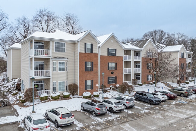
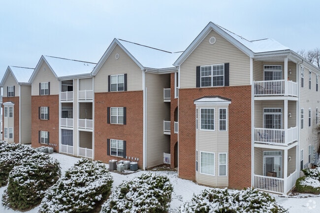
Property Record
850 Baldwin St, Pittsburgh, PA 15234
NEARBY LISTINGS FOR SALE OR LEASE
Property Detail
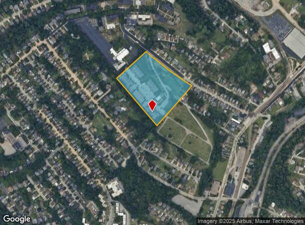
850 Baldwin St
Pittsburgh, PA
Lebanon City 4Th
0250-A-00072-0000-00
LEBANON CITY 4TH PLAN 41 9.1 A LD BALDWIN ST 1 STY BRK BEN SCHOOL BLDG (VENRIDGE SCHOOL)
Apartment
Allegheny
X
Pennsylvania
42003C0456H
72
2024
9.10 AC
2025
Castle Shannon
476100
Pittsburgh
DEMOGRAPHICS near 850 Baldwin St
1 Mile
3 Mile
5 Mile
2024 Total Population
14,995
119,971
264,355
2029 Population
14,598
116,663
257,877
Pop Growth 2024-2029
(2.65%)
(2.76%)
(2.45%)
Average Age
43
43
43
2024 Total Households
6,377
52,103
115,367
HH Growth 2024-2029
(2.70%)
(2.83%)
(2.53%)
Median Household Inc
$100,924
$87,134
$77,508
Avg Household Size
2.30
2.20
2.20
2024 Avg HH Vehicles
2.00
2.00
2.00
Median Home Value
$267,254
$215,757
$198,608
Median Year Built
1954
1954
1955
Nearby Places
Map Layers
Map Styles
 Street
 Aerial
- Restaurants
- Banks
- Shops
- Fitness
- Groceries
PUBLIC TRANSPORTATION
TRANSIT/SUBWAY
St Anne's (42S South Hills Village - Port Authority of Allegheny County Light Rail (The "T"), 47L Library - Port Authority of Allegheny County Light Rail (The "T"), 47S South Hills Village - Port Authority of Allegheny County Light Rail (The "T"))
DRIVE
WALK
Distance
St Anne's (42S South Hills Village - Port Authority of Allegheny County Light Rail (The "T"), 47L Library - Port Authority of Allegheny County Light Rail (The "T"), 47S South Hills Village - Port Authority of Allegheny County Light Rail (The "T"))
2 min
8 min
0.4 mi
Willow (42C Castle Shannon - Port Authority of Allegheny County Light Rail (The "T"), 42S South Hills Village - Port Authority of Allegheny County Light Rail (The "T"), 47L Library - Port Authority of Allegheny County Light Rail (The "T"), 47S South Hills Village - Port Authority of Allegheny County Light Rail (The "T"))
DRIVE
WALK
Distance
Willow (42C Castle Shannon - Port Authority of Allegheny County Light Rail (The "T"), 42S South Hills Village - Port Authority of Allegheny County Light Rail (The "T"), 47L Library - Port Authority of Allegheny County Light Rail (The "T"), 47S South Hills Village - Port Authority of Allegheny County Light Rail (The "T"))
2 min
12 min
0.5 mi
Smith Road (42S South Hills Village - Port Authority of Allegheny County Light Rail (The "T"), 47L Library - Port Authority of Allegheny County Light Rail (The "T"), 47S South Hills Village - Port Authority of Allegheny County Light Rail (The "T"))
DRIVE
WALK
Distance
Smith Road (42S South Hills Village - Port Authority of Allegheny County Light Rail (The "T"), 47L Library - Port Authority of Allegheny County Light Rail (The "T"), 47S South Hills Village - Port Authority of Allegheny County Light Rail (The "T"))
3 min
14 min
0.8 mi
Arlington (42C Castle Shannon - Port Authority of Allegheny County Light Rail (The "T"), 42S South Hills Village - Port Authority of Allegheny County Light Rail (The "T"))
DRIVE
WALK
Distance
Arlington (42C Castle Shannon - Port Authority of Allegheny County Light Rail (The "T"), 42S South Hills Village - Port Authority of Allegheny County Light Rail (The "T"))
3 min
16 min
0.9 mi
Castle Shannon (42C Castle Shannon - Port Authority of Allegheny County Light Rail (The "T"), 42S South Hills Village - Port Authority of Allegheny County Light Rail (The "T"))
DRIVE
WALK
Distance
Castle Shannon (42C Castle Shannon - Port Authority of Allegheny County Light Rail (The "T"), 42S South Hills Village - Port Authority of Allegheny County Light Rail (The "T"))
4 min
18 min
0.9 mi
COMMUTER RAIL
Pittsburgh Amtrak Station (Capitol Limited - Amtrak, Pennsylvanian - Amtrak)
DRIVE
WALK
Distance
Pittsburgh Amtrak Station (Capitol Limited - Amtrak, Pennsylvanian - Amtrak)
17 min
7.6 mi
AIRPORT
Pittsburgh International
DRIVE
WALK
Distance
Pittsburgh International
33 min
17.4 mi
Freight Ports
Port of Baltimore
DRIVE
WALK
Distance
Port of Baltimore
293 min
246.7 mi
Nearby Properties
Address
Land Use
TOTAL SIZE
Lot Size
Zoning
Address
Land Use
TOTAL SIZE
Lot Size
Zoning
73.76 AC
Address
Land Use
TOTAL SIZE
Lot Size
Zoning
Address
Land Use
TOTAL SIZE
Lot Size
Zoning
28.59 AC
Address
Land Use
TOTAL SIZE
Lot Size
Zoning
31.68 AC
Address
Land Use
TOTAL SIZE
Lot Size
Zoning
40.46 AC
Address
Land Use
TOTAL SIZE
Lot Size
Zoning
15.88 AC
Address
Land Use
TOTAL SIZE
Lot Size
Zoning
28.26 AC
Address
Land Use
TOTAL SIZE
Lot Size
Zoning
16.08 AC
Address
Land Use
TOTAL SIZE
Lot Size
Zoning
14.32 AC
Address
Land Use
TOTAL SIZE
Lot Size
Zoning
10.49 AC
Address
Land Use
TOTAL SIZE
Lot Size
Zoning
7.19 AC
Address
Land Use
TOTAL SIZE
Lot Size
Zoning
Address
Land Use
TOTAL SIZE
Lot Size
Zoning
5.24 AC
Address
Land Use
TOTAL SIZE
Lot Size
Zoning
31.39 AC
Address
Land Use
TOTAL SIZE
Lot Size
Zoning
Address
Land Use
TOTAL SIZE
Lot Size
Zoning
12.68 AC
Address
Land Use
TOTAL SIZE
Lot Size
Zoning
11.25 AC
Address
Land Use
TOTAL SIZE
Lot Size
Zoning
Address
Land Use
TOTAL SIZE
Lot Size
Zoning
Address
Land Use
TOTAL SIZE
Lot Size
Zoning
Address
Land Use
TOTAL SIZE
Lot Size
Zoning
5.34 AC
Address
Land Use
TOTAL SIZE
Lot Size
Zoning
21.45 AC
Address
Land Use
TOTAL SIZE
Lot Size
Zoning
5.29 AC
Address
Land Use
TOTAL SIZE
Lot Size
Zoning
2,015 SF
8.68 AC
Address
Land Use
TOTAL SIZE
Lot Size
Zoning
13.63 AC
Address
Land Use
TOTAL SIZE
Lot Size
Zoning
7.66 AC
Address
Land Use
TOTAL SIZE
Lot Size
Zoning
21.96 AC
Address
Land Use
TOTAL SIZE
Lot Size
Zoning
94.87 AC
Address
Land Use
TOTAL SIZE
Lot Size
Zoning
Address
Land Use
TOTAL SIZE
Lot Size
Zoning
26.91 AC
The World's #1 Commercial Real Estate Marketplace
Connect with us
© 2025 CoStar Group
The information above has been obtained from sources believed reliable. While we do not doubt its accuracy we have not verified it and make no guarantee, warranty or representation about it. It is your responsibility to independently confirm its accuracy and completeness. Any projections, opinions, assumptions, or estimates used are for example only and do not represent the current or future performance of the property. The value of this transaction to you depends on tax and other factors which should be evaluated by your tax, financial, and legal advisors. You and your advisors should conduct a careful, independent investigation of the property to determine to your satisfaction the suitability of the property for your needs.