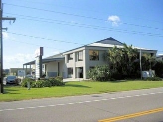
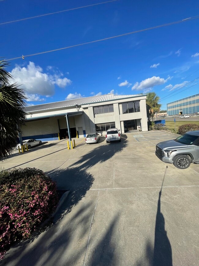
Property Record
850 Engineers Rd, Belle Chasse, LA 70037
Current Lease Availabilities
NEARBY LISTINGS FOR SALE OR LEASE
-
-
View all Belle Chasse listings for lease on LoopNet.com
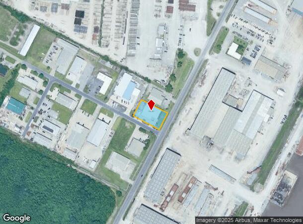
Property Detail
850 Engineers Rd
New Orleans/Metairie/Kenner
Highland Industrial
New Orleans-Metairie, LA
LOT 1A, HIGHLAND INDUSTRIAL PARK S/D, ALGIERS OUTFALL CANAL (SIDE) & BELLE CHASSE HWY (SIDE) - 125' FRONT ON ENGINEERS RD X 2
1621400
Plaquemines
Commercialnec
Louisiana
2024
1a,1a
2024
0.57 AC
050202
Plaquemines Parish
7,030 SF
DEMOGRAPHICS near 850 Engineers Rd
1 mile
3 mile
5 mile
2024 Total Population
7,161
66,302
147,057
2029 Population
6,849
63,360
140,601
Pop Growth 2024-2029
(4.36%)
(4.44%)
(4.39%)
Average Age
40
38
39
2024 Total Households
2,579
24,021
55,121
HH Growth 2024-2029
(4.50%)
(4.57%)
(4.55%)
Median Household Inc
$78,676
$64,888
$54,920
Avg Household Size
2.70
2.70
2.60
2024 Avg HH Vehicles
2.00
2.00
2.00
Median Home Value
$249,096
$213,827
$195,602
Median Year Built
1980
1979
1976
Nearby Places
Map Layers
Map Styles
 Street
 Aerial
Transit
 Traffic
 Biking
Places
Listings with unknown addresses are not visible on the map
- Restaurants
- Banks
- Shops
- Fitness
- Groceries
PUBLIC TRANSPORTATION
AIRPORT
Louis Armstrong New Orleans International
Drive
Walk
Distance
Louis Armstrong New Orleans International
35 min
23.2 mi
Nearby Properties
Address
Land Use
TOTAL SIZE
Lot Size
Zoning
Address
Land Use
TOTAL SIZE
Lot Size
Zoning
3,215.52 AC
Address
Land Use
TOTAL SIZE
Lot Size
Zoning
53.64 AC
Address
Land Use
TOTAL SIZE
Lot Size
Zoning
0.23 AC
Address
Land Use
TOTAL SIZE
Lot Size
Zoning
14.40 AC
Address
Land Use
TOTAL SIZE
Lot Size
Zoning
Address
Land Use
TOTAL SIZE
Lot Size
Zoning
Address
Land Use
TOTAL SIZE
Lot Size
Zoning
16.87 AC
R1A
Address
Land Use
TOTAL SIZE
Lot Size
Zoning
1.38 AC
Address
Land Use
TOTAL SIZE
Lot Size
Zoning
42.23 AC
Address
Land Use
TOTAL SIZE
Lot Size
Zoning
Address
Land Use
TOTAL SIZE
Lot Size
Zoning
0.12 AC
Address
Land Use
TOTAL SIZE
Lot Size
Zoning
Address
Land Use
TOTAL SIZE
Lot Size
Zoning
12.33 AC
Address
Land Use
TOTAL SIZE
Lot Size
Zoning
Address
Land Use
TOTAL SIZE
Lot Size
Zoning
0.10 AC
Address
Land Use
TOTAL SIZE
Lot Size
Zoning
Address
Land Use
TOTAL SIZE
Lot Size
Zoning
0.15 AC
Address
Land Use
TOTAL SIZE
Lot Size
Zoning
0.15 AC
Address
Land Use
TOTAL SIZE
Lot Size
Zoning
Address
Land Use
TOTAL SIZE
Lot Size
Zoning
45,000 SF
Address
Land Use
TOTAL SIZE
Lot Size
Zoning
2.92 AC
Address
Land Use
TOTAL SIZE
Lot Size
Zoning
14.55 AC
Address
Land Use
TOTAL SIZE
Lot Size
Zoning
2.18 AC
R1A
Address
Land Use
TOTAL SIZE
Lot Size
Zoning
0.08 AC
Address
Land Use
TOTAL SIZE
Lot Size
Zoning
11.62 AC
Address
Land Use
TOTAL SIZE
Lot Size
Zoning
9.39 AC
R1A
Address
Land Use
TOTAL SIZE
Lot Size
Zoning
7,200 SF
1.46 AC
C2
Address
Land Use
TOTAL SIZE
Lot Size
Zoning
11.99 AC
MUCD
Address
Land Use
TOTAL SIZE
Lot Size
Zoning
9.15 AC
R1A
Address
Land Use
TOTAL SIZE
Lot Size
Zoning
10.15 AC
The World's #1 Commercial Real Estate Marketplace
Connect with us
© 2026 CoStar Group
The information above has been obtained from sources believed reliable. While we do not doubt its accuracy we have not verified it and make no guarantee, warranty or representation about it. It is your responsibility to independently confirm its accuracy and completeness. Any projections, opinions, assumptions, or estimates used are for example only and do not represent the current or future performance of the property. The value of this transaction to you depends on tax and other factors which should be evaluated by your tax, financial, and legal advisors. You and your advisors should conduct a careful, independent investigation of the property to determine to your satisfaction the suitability of the property for your needs.