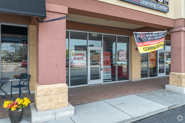
Property Record
850 Rt 59, Bartlett, IL 60103


Property Detail
850 Rt 59
01-04-401-028
BARTLETT COMMONS SUB /EX HWY DESC 16ED5/
Commercialnec
DUPAGE
C
Illinois
B and X Area of moderate flood hazard, usually the area between the limits of the 100-year and 500-year floods.
8.80 AC
2024
Far Northwest
2024
Chicago
841316
Chicago-Naperville-Elgin, IL-IN
86,781 SF
NEARBY LISTINGS FOR SALE OR LEASE
DEMOGRAPHICS near 850 Rt 59
1 mile
3 mile
5 mile
2025 Total Population
4,027
57,799
191,693
2030 Population
4,047
57,988
192,533
Pop Growth 2025-2030
+ 0.50%
+ 0.33%
+ 0.44%
Average Age
43
41
40
2025 Total Households
1,381
19,567
64,338
HH Growth 2025-2030
+ 0.51%
+ 0.16%
+ 0.30%
Median Household Inc
$145,469
$119,332
$105,287
Avg Household Size
2.90
2.90
2.90
2025 Avg HH Vehicles
2.00
2.00
2.00
Median Home Value
$412,698
$340,049
$301,620
Median Year Built
1982
1988
1984
Nearby Places
Map Layers
Map Styles
 Street
 Aerial
Transit
 Traffic
 Biking
Places
Listings with unknown addresses are not visible on the map
- Restaurants
- Banks
- Shops
- Fitness
- Groceries
PUBLIC TRANSPORTATION
COMMUTER RAIL
Bartlett Station (Milwaukee District West Line - Northeast Illinois Regional Commuter Railroad (Metra))
Drive
Walk
Distance
Bartlett Station (Milwaukee District West Line - Northeast Illinois Regional Commuter Railroad (Metra))
6 min
2.5 mi
Hanover Park Station (Milwaukee District West Line - Northeast Illinois Regional Commuter Railroad (Metra))
Drive
Walk
Distance
Hanover Park Station (Milwaukee District West Line - Northeast Illinois Regional Commuter Railroad (Metra))
10 min
5.5 mi
AIRPORT
Chicago O'Hare International
Drive
Walk
Distance
Chicago O'Hare International
37 min
27.0 mi
Chicago Midway International
Drive
Walk
Distance
Chicago Midway International
52 min
35.1 mi
Freight Ports
Port Milwaukee
Drive
Walk
Distance
Port Milwaukee
114 min
83.3 mi
SALE & LEASE HISTORY
LISTING DATE
SALE/LEASE

Sep 25, 2016
For Lease
Nearby Properties
Address
Land Use
TOTAL SIZE
Lot Size
Zoning
Address
Land Use
TOTAL SIZE
Lot Size
Zoning
421,722 SF
34.61 AC
Address
Land Use
TOTAL SIZE
Lot Size
Zoning
400,000 SF
31.67 AC
I
Address
Land Use
TOTAL SIZE
Lot Size
Zoning
328,208 SF
5.62 AC
Address
Land Use
TOTAL SIZE
Lot Size
Zoning
300,000 SF
16.56 AC
I
Address
Land Use
TOTAL SIZE
Lot Size
Zoning
271,200 SF
14.23 AC
Address
Land Use
TOTAL SIZE
Lot Size
Zoning
272,606 SF
15.92 AC
I
Address
Land Use
TOTAL SIZE
Lot Size
Zoning
261,725 SF
15.88 AC
I
Address
Land Use
TOTAL SIZE
Lot Size
Zoning
94,497 SF
9.43 AC
C
Address
Land Use
TOTAL SIZE
Lot Size
Zoning
401,250 SF
73.98 AC
Address
Land Use
TOTAL SIZE
Lot Size
Zoning
207,000 SF
11.72 AC
Address
Land Use
TOTAL SIZE
Lot Size
Zoning
348,500 SF
23.57 AC
Address
Land Use
TOTAL SIZE
Lot Size
Zoning
76,744 SF
2.41 AC
Address
Land Use
TOTAL SIZE
Lot Size
Zoning
207,000 SF
11.80 AC
Address
Land Use
TOTAL SIZE
Lot Size
Zoning
436,500 SF
Address
Land Use
TOTAL SIZE
Lot Size
Zoning
209,628 SF
11.44 AC
Address
Land Use
TOTAL SIZE
Lot Size
Zoning
423,726 SF
35.97 AC
Address
Land Use
TOTAL SIZE
Lot Size
Zoning
186,000 SF
10.50 AC
Address
Land Use
TOTAL SIZE
Lot Size
Zoning
Address
Land Use
TOTAL SIZE
Lot Size
Zoning
11,132 SF
2 AC
Address
Land Use
TOTAL SIZE
Lot Size
Zoning
167,449 SF
11.15 AC
Address
Land Use
TOTAL SIZE
Lot Size
Zoning
167,166 SF
12.85 AC
Address
Land Use
TOTAL SIZE
Lot Size
Zoning
462,984 SF
19 AC
Address
Land Use
TOTAL SIZE
Lot Size
Zoning
105,493 SF
16.26 AC
I
Address
Land Use
TOTAL SIZE
Lot Size
Zoning
123,484 SF
7.92 AC
Address
Land Use
TOTAL SIZE
Lot Size
Zoning
154,730 SF
8.76 AC
Address
Land Use
TOTAL SIZE
Lot Size
Zoning
Address
Land Use
TOTAL SIZE
Lot Size
Zoning
115,673 SF
5.95 AC
I
Address
Land Use
TOTAL SIZE
Lot Size
Zoning
147,305 SF
9.25 AC
Address
Land Use
TOTAL SIZE
Lot Size
Zoning
101,065 SF
9.01 AC
I
The World's #1 Commercial Real Estate Marketplace
Connect with us
© 2026 CoStar Group
The information above has been obtained from sources believed reliable. While we do not doubt its accuracy we have not verified it and make no guarantee, warranty or representation about it. It is your responsibility to independently confirm its accuracy and completeness. Any projections, opinions, assumptions, or estimates used are for example only and do not represent the current or future performance of the property. The value of this transaction to you depends on tax and other factors which should be evaluated by your tax, financial, and legal advisors. You and your advisors should conduct a careful, independent investigation of the property to determine to your satisfaction the suitability of the property for your needs.