Property Record
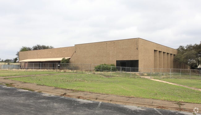
8500 Cameron Rd, Austin, TX 78754


Property Detail
8500 Cameron Rd
Austin-Round Rock-San Marcos, TX
LOT 1 *LESS 2702 SF HOUSTON SQUARE
361726
Travis
Industrialgeneral
Texas
B and X Area of moderate flood hazard, usually the area between the limits of the 100-year and 500-year floods.
1
0
19.61 AC
2025
Northeast
040300
Austin
94,898 SF
NEARBY LISTINGS FOR SALE OR LEASE
DEMOGRAPHICS near 8500 Cameron Rd
1 mile
3 mile
5 mile
2025 Total Population
15,985
135,979
337,550
2030 Population
16,579
142,589
355,019
Pop Growth 2025-2030
+ 3.72%
+ 4.86%
+ 5.18%
Average Age
34
37
37
2025 Total Households
6,027
54,096
145,216
HH Growth 2025-2030
+ 4.23%
+ 5.60%
+ 5.86%
Median Household Inc
$51,858
$70,746
$80,471
Avg Household Size
2.60
2.40
2.20
2025 Avg HH Vehicles
2.00
2.00
2.00
Median Home Value
$375,107
$479,942
$567,037
Median Year Built
1986
1983
1990
Nearby Places
Map Layers
Map Styles
 Street
 Aerial
Transit
 Traffic
 Biking
Places
Listings with unknown addresses are not visible on the map
- Restaurants
- Banks
- Shops
- Fitness
- Groceries
PUBLIC TRANSPORTATION
COMMUTER RAIL
Drive
Walk
Distance
17 min
8.5 mi
AIRPORT
Austin-Bergstrom International
Drive
Walk
Distance
Austin-Bergstrom International
28 min
16.0 mi
Nearby Properties
Address
Land Use
TOTAL SIZE
Lot Size
Zoning
Address
Land Use
TOTAL SIZE
Lot Size
Zoning
480,823 SF
18.46 AC
Address
Land Use
TOTAL SIZE
Lot Size
Zoning
322,150 SF
3.83 AC
Address
Land Use
TOTAL SIZE
Lot Size
Zoning
372,075 SF
4.97 AC
Address
Land Use
TOTAL SIZE
Lot Size
Zoning
346,319 SF
6.53 AC
Address
Land Use
TOTAL SIZE
Lot Size
Zoning
425,200 SF
2.49 AC
Address
Land Use
TOTAL SIZE
Lot Size
Zoning
276,772 SF
4.68 AC
Address
Land Use
TOTAL SIZE
Lot Size
Zoning
274,943 SF
42.35 AC
Address
Land Use
TOTAL SIZE
Lot Size
Zoning
18.45 AC
Address
Land Use
TOTAL SIZE
Lot Size
Zoning
376,385 SF
26.47 AC
Address
Land Use
TOTAL SIZE
Lot Size
Zoning
248,325 SF
2.46 AC
Address
Land Use
TOTAL SIZE
Lot Size
Zoning
115,640 SF
18 AC
Address
Land Use
TOTAL SIZE
Lot Size
Zoning
278,100 SF
3.55 AC
Address
Land Use
TOTAL SIZE
Lot Size
Zoning
264,401 SF
10.48 AC
Address
Land Use
TOTAL SIZE
Lot Size
Zoning
237,603 SF
8.38 AC
Address
Land Use
TOTAL SIZE
Lot Size
Zoning
252,450 SF
2.72 AC
Address
Land Use
TOTAL SIZE
Lot Size
Zoning
148,390 SF
15.86 AC
Address
Land Use
TOTAL SIZE
Lot Size
Zoning
233,267 SF
21.31 AC
Address
Land Use
TOTAL SIZE
Lot Size
Zoning
254,796 SF
11.29 AC
Address
Land Use
TOTAL SIZE
Lot Size
Zoning
235,476 SF
3.34 AC
Address
Land Use
TOTAL SIZE
Lot Size
Zoning
277,987 SF
11.01 AC
Address
Land Use
TOTAL SIZE
Lot Size
Zoning
267,928 SF
2.50 AC
Address
Land Use
TOTAL SIZE
Lot Size
Zoning
179,670 SF
2.89 AC
Address
Land Use
TOTAL SIZE
Lot Size
Zoning
7,268 SF
29.08 AC
Address
Land Use
TOTAL SIZE
Lot Size
Zoning
130,457 SF
1.07 AC
Address
Land Use
TOTAL SIZE
Lot Size
Zoning
246,675 SF
3.41 AC
Address
Land Use
TOTAL SIZE
Lot Size
Zoning
14.20 AC
Address
Land Use
TOTAL SIZE
Lot Size
Zoning
241,800 SF
13.27 AC
Address
Land Use
TOTAL SIZE
Lot Size
Zoning
189,263 SF
3.95 AC
Address
Land Use
TOTAL SIZE
Lot Size
Zoning
228,331 SF
13.63 AC
Address
Land Use
TOTAL SIZE
Lot Size
Zoning
316,064 SF
18.98 AC
The World's #1 Commercial Real Estate Marketplace
Connect with us
© 2026 CoStar Group
The information above has been obtained from sources believed reliable. While we do not doubt its accuracy we have not verified it and make no guarantee, warranty or representation about it. It is your responsibility to independently confirm its accuracy and completeness. Any projections, opinions, assumptions, or estimates used are for example only and do not represent the current or future performance of the property. The value of this transaction to you depends on tax and other factors which should be evaluated by your tax, financial, and legal advisors. You and your advisors should conduct a careful, independent investigation of the property to determine to your satisfaction the suitability of the property for your needs.