Property Record
8500 E Chapman Ave, Orange, CA 92869


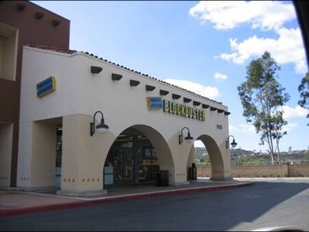
Property Detail
8500 E Chapman Ave
Anaheim-Santa Ana-Irvine, CA
P BK 280 PG 11 PAR 3 PM 280-11, POR. OF PAR. 3.
503-881-25
ORANGE
Commercialnec
California
B and X Area of moderate flood hazard, usually the area between the limits of the 100-year and 500-year floods.
0.99 AC
2024
East Orange
2025
Orange County (California)
075605
NEARBY LISTINGS FOR SALE OR LEASE
DEMOGRAPHICS near 8500 E Chapman Ave
1 mile
3 mile
5 mile
2025 Total Population
6,072
51,352
236,306
2030 Population
6,007
51,101
236,526
Pop Growth 2025-2030
(1.07%)
(0.49%)
+ 0.09%
Average Age
45
43
41
2025 Total Households
2,282
16,933
80,128
HH Growth 2025-2030
(1.14%)
(0.62%)
+ 0.08%
Median Household Inc
$176,636
$171,710
$136,611
Avg Household Size
2.60
2.90
2.80
2025 Avg HH Vehicles
2.00
3.00
2.00
Median Home Value
$1,075,808
$1,074,493
$1,054,387
Median Year Built
1983
1979
1980
Nearby Places
Map Layers
Map Styles
 Street
 Aerial
Transit
 Traffic
 Biking
Places
Listings with unknown addresses are not visible on the map
- Restaurants
- Banks
- Shops
- Fitness
- Groceries
PUBLIC TRANSPORTATION
COMMUTER RAIL
Orange (Inland Empire-Orange County Line - Southern California Regional Rail Authority (Metrolink), Orange County Line - Southern California Regional Rail Authority (Metrolink))
Drive
Walk
Distance
Orange (Inland Empire-Orange County Line - Southern California Regional Rail Authority (Metrolink), Orange County Line - Southern California Regional Rail Authority (Metrolink))
11 min
5.9 mi
Santa Ana (Inland Empire-Orange County Line - Southern California Regional Rail Authority (Metrolink), Orange County Line - Southern California Regional Rail Authority (Metrolink))
Drive
Walk
Distance
Santa Ana (Inland Empire-Orange County Line - Southern California Regional Rail Authority (Metrolink), Orange County Line - Southern California Regional Rail Authority (Metrolink))
15 min
7.9 mi
AIRPORT
John Wayne/Orange County
Drive
Walk
Distance
John Wayne/Orange County
18 min
12.4 mi
Long Beach (Daugherty Field)
Drive
Walk
Distance
Long Beach (Daugherty Field)
35 min
26.9 mi
Ontario International
Drive
Walk
Distance
Ontario International
41 min
28.7 mi
Freight Ports
Port of Long Beach
Drive
Walk
Distance
Port of Long Beach
39 min
26.4 mi
Nearby Properties
Address
Land Use
TOTAL SIZE
Lot Size
Zoning
Address
Land Use
TOTAL SIZE
Lot Size
Zoning
18.76 AC
Address
Land Use
TOTAL SIZE
Lot Size
Zoning
Address
Land Use
TOTAL SIZE
Lot Size
Zoning
38.38 AC
Address
Land Use
TOTAL SIZE
Lot Size
Zoning
2,459 SF
2.98 AC
Address
Land Use
TOTAL SIZE
Lot Size
Zoning
20.02 AC
Address
Land Use
TOTAL SIZE
Lot Size
Zoning
42.58 AC
Address
Land Use
TOTAL SIZE
Lot Size
Zoning
4.48 AC
Address
Land Use
TOTAL SIZE
Lot Size
Zoning
210.12 AC
Address
Land Use
TOTAL SIZE
Lot Size
Zoning
34,000 SF
3.05 AC
C
Address
Land Use
TOTAL SIZE
Lot Size
Zoning
Address
Land Use
TOTAL SIZE
Lot Size
Zoning
2.19 AC
Address
Land Use
TOTAL SIZE
Lot Size
Zoning
76,000 SF
4.80 AC
Address
Land Use
TOTAL SIZE
Lot Size
Zoning
Address
Land Use
TOTAL SIZE
Lot Size
Zoning
Address
Land Use
TOTAL SIZE
Lot Size
Zoning
3.59 AC
Address
Land Use
TOTAL SIZE
Lot Size
Zoning
27.84 AC
Address
Land Use
TOTAL SIZE
Lot Size
Zoning
Address
Land Use
TOTAL SIZE
Lot Size
Zoning
2.82 AC
Address
Land Use
TOTAL SIZE
Lot Size
Zoning
11.93 AC
Address
Land Use
TOTAL SIZE
Lot Size
Zoning
1.62 AC
Address
Land Use
TOTAL SIZE
Lot Size
Zoning
57,159 SF
1.54 AC
C1
Address
Land Use
TOTAL SIZE
Lot Size
Zoning
9,530 SF
5.89 AC
Address
Land Use
TOTAL SIZE
Lot Size
Zoning
185.56 AC
Address
Land Use
TOTAL SIZE
Lot Size
Zoning
29,104 SF
1.15 AC
Address
Land Use
TOTAL SIZE
Lot Size
Zoning
12,402 SF
7.82 AC
Address
Land Use
TOTAL SIZE
Lot Size
Zoning
22,588 SF
1.38 AC
R3
Address
Land Use
TOTAL SIZE
Lot Size
Zoning
10,132 SF
0.75 AC
Address
Land Use
TOTAL SIZE
Lot Size
Zoning
7.97 AC
Address
Land Use
TOTAL SIZE
Lot Size
Zoning
0.57 AC
Address
Land Use
TOTAL SIZE
Lot Size
Zoning
1,240 SF
4.20 AC
The World's #1 Commercial Real Estate Marketplace
Connect with us
© 2026 CoStar Group
The information above has been obtained from sources believed reliable. While we do not doubt its accuracy we have not verified it and make no guarantee, warranty or representation about it. It is your responsibility to independently confirm its accuracy and completeness. Any projections, opinions, assumptions, or estimates used are for example only and do not represent the current or future performance of the property. The value of this transaction to you depends on tax and other factors which should be evaluated by your tax, financial, and legal advisors. You and your advisors should conduct a careful, independent investigation of the property to determine to your satisfaction the suitability of the property for your needs.