Property Record
8500 Naples St Ne, Minneapolis, MN 55449


NEARBY LISTINGS FOR SALE OR LEASE
Property Detail
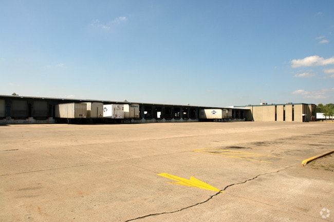
8500 Naples St Ne
34-31-23-44-0003
THAT PRT OF SE1/4 OF SEC 34 TWP 31 RGE 23 DESC AS FOL: BEG AT SE COR OF SD 1/4, TH N ALG E LINE THEREOF 1607.44 FT +OR- TO C/
Industrialgeneral
Anoka
X
Minnesota
27003C0343E
19.15 AC
2024
North Central
2025
Minneapolis/St Paul
050828
Minneapolis-St. Paul-Bloomington, MN-WI
70,653 SF
DEMOGRAPHICS near 8500 Naples St Ne
1 Mile
3 Mile
5 Mile
2024 Total Population
7,594
46,372
156,291
2029 Population
7,860
46,813
159,256
Pop Growth 2024-2029
+ 3.50%
+ 0.95%
+ 1.90%
Average Age
39
40
40
2024 Total Households
2,984
18,118
59,894
HH Growth 2024-2029
+ 3.62%
+ 0.84%
+ 1.79%
Median Household Inc
$73,148
$84,488
$87,544
Avg Household Size
2.50
2.50
2.50
2024 Avg HH Vehicles
2.00
2.00
2.00
Median Home Value
$227,413
$278,944
$294,427
Median Year Built
1994
1982
1981
Nearby Places
Map Layers
Map Styles
 Street
 Aerial
- Restaurants
- Banks
- Shops
- Fitness
- Groceries
PUBLIC TRANSPORTATION
AIRPORT
Minneapolis-St Paul International/Wold-Chamberlain
DRIVE
WALK
Distance
Minneapolis-St Paul International/Wold-Chamberlain
35 min
22.1 mi
Freight Ports
Port Milwaukee
DRIVE
WALK
Distance
Port Milwaukee
380 min
344.3 mi
Nearby Properties
Address
Land Use
TOTAL SIZE
Lot Size
Zoning
Address
Land Use
TOTAL SIZE
Lot Size
Zoning
2,443,869 SF
31.79 AC
Address
Land Use
TOTAL SIZE
Lot Size
Zoning
467.27 AC
Address
Land Use
TOTAL SIZE
Lot Size
Zoning
372.05 AC
Address
Land Use
TOTAL SIZE
Lot Size
Zoning
141,716 SF
567.20 AC
Address
Land Use
TOTAL SIZE
Lot Size
Zoning
226,201 SF
70.59 AC
Address
Land Use
TOTAL SIZE
Lot Size
Zoning
100,260 SF
74.82 AC
Address
Land Use
TOTAL SIZE
Lot Size
Zoning
33,060 SF
20.14 AC
Address
Land Use
TOTAL SIZE
Lot Size
Zoning
223.30 AC
Address
Land Use
TOTAL SIZE
Lot Size
Zoning
264,300 SF
4.16 AC
Address
Land Use
TOTAL SIZE
Lot Size
Zoning
239,389 SF
5.73 AC
Address
Land Use
TOTAL SIZE
Lot Size
Zoning
Address
Land Use
TOTAL SIZE
Lot Size
Zoning
260,375 SF
4.24 AC
Address
Land Use
TOTAL SIZE
Lot Size
Zoning
229,420 SF
4.14 AC
Address
Land Use
TOTAL SIZE
Lot Size
Zoning
214,300 SF
9.15 AC
Address
Land Use
TOTAL SIZE
Lot Size
Zoning
606,798 SF
49.16 AC
Address
Land Use
TOTAL SIZE
Lot Size
Zoning
239,318 SF
Address
Land Use
TOTAL SIZE
Lot Size
Zoning
Address
Land Use
TOTAL SIZE
Lot Size
Zoning
109.41 AC
Address
Land Use
TOTAL SIZE
Lot Size
Zoning
115.62 AC
Address
Land Use
TOTAL SIZE
Lot Size
Zoning
195,000 SF
Address
Land Use
TOTAL SIZE
Lot Size
Zoning
8,400 SF
10.10 AC
Address
Land Use
TOTAL SIZE
Lot Size
Zoning
Address
Land Use
TOTAL SIZE
Lot Size
Zoning
208 SF
228 AC
Address
Land Use
TOTAL SIZE
Lot Size
Zoning
14,908 SF
28.38 AC
Address
Land Use
TOTAL SIZE
Lot Size
Zoning
248,816 SF
14.02 AC
Address
Land Use
TOTAL SIZE
Lot Size
Zoning
186,928 SF
4.07 AC
Address
Land Use
TOTAL SIZE
Lot Size
Zoning
212,161 SF
35.98 AC
Address
Land Use
TOTAL SIZE
Lot Size
Zoning
398,544 SF
17.52 AC
Address
Land Use
TOTAL SIZE
Lot Size
Zoning
190,377 SF
9.61 AC
Address
Land Use
TOTAL SIZE
Lot Size
Zoning
109,136 SF
The World's #1 Commercial Real Estate Marketplace
Connect with us
© 2026 CoStar Group
The information above has been obtained from sources believed reliable. While we do not doubt its accuracy we have not verified it and make no guarantee, warranty or representation about it. It is your responsibility to independently confirm its accuracy and completeness. Any projections, opinions, assumptions, or estimates used are for example only and do not represent the current or future performance of the property. The value of this transaction to you depends on tax and other factors which should be evaluated by your tax, financial, and legal advisors. You and your advisors should conduct a careful, independent investigation of the property to determine to your satisfaction the suitability of the property for your needs.