Property Record
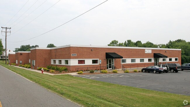
8500 Shilling St, Stokesdale, NC 27357


NEARBY LISTINGS FOR SALE OR LEASE
Property Detail
8500 Shilling St
Greensboro-High Point, NC
Stokesdale
0162148
STOKESDALE BUSINESS CENTER
Industrialgeneral
Guilford
X
North Carolina
3710791000J
7
2024
8.27 AC
2025
NW Guilford County
041001
Greensboro/Winston-Salem
27,785 SF
DEMOGRAPHICS near 8500 Shilling St
1 Mile
3 Mile
5 Mile
2024 Total Population
1,324
8,112
20,279
2029 Population
1,333
8,214
20,542
Pop Growth 2024-2029
+ 0.68%
+ 1.26%
+ 1.30%
Average Age
40
41
41
2024 Total Households
486
3,011
7,490
HH Growth 2024-2029
+ 0.41%
+ 1.20%
+ 1.34%
Median Household Inc
$99,274
$93,452
$92,481
Avg Household Size
2.70
2.70
2.70
2024 Avg HH Vehicles
2.00
2.00
2.00
Median Home Value
$271,705
$255,380
$298,754
Median Year Built
1996
1996
1995
Nearby Places
Map Layers
Map Styles
 Street
 Aerial
- Restaurants
- Banks
- Shops
- Fitness
- Groceries
PUBLIC TRANSPORTATION
AIRPORT
Piedmont Triad International
DRIVE
WALK
Distance
Piedmont Triad International
21 min
12.4 mi
SALE & LEASE HISTORY
LISTING DATE
SALE/LEASE

Sep 25, 2016
For Lease
Sep 23, 2016
For Sale
Aug 30, 2018
For Lease
Nearby Properties
Address
Land Use
TOTAL SIZE
Lot Size
Zoning
Address
Land Use
TOTAL SIZE
Lot Size
Zoning
516,172 SF
58.24 AC
LI
Address
Land Use
TOTAL SIZE
Lot Size
Zoning
516,221 SF
106.85 AC
AG
Address
Land Use
TOTAL SIZE
Lot Size
Zoning
121,825 SF
36.43 AC
GO-M
Address
Land Use
TOTAL SIZE
Lot Size
Zoning
25,755 SF
509.95 AC
AG
Address
Land Use
TOTAL SIZE
Lot Size
Zoning
50,853 SF
23.39 AC
CD-HB
Address
Land Use
TOTAL SIZE
Lot Size
Zoning
55,958 SF
5.82 AC
PI
Address
Land Use
TOTAL SIZE
Lot Size
Zoning
26,410 SF
5.06 AC
GB
Address
Land Use
TOTAL SIZE
Lot Size
Zoning
8,774 SF
2.07 AC
HB
Address
Land Use
TOTAL SIZE
Lot Size
Zoning
14,080 SF
40.69 AC
IN MORE TH
Address
Land Use
TOTAL SIZE
Lot Size
Zoning
8,732 SF
8.80 AC
RES AG COU
Address
Land Use
TOTAL SIZE
Lot Size
Zoning
10,000 SF
2.12 AC
RES PROTEC
Address
Land Use
TOTAL SIZE
Lot Size
Zoning
16,640 SF
4.20 AC
HB
Address
Land Use
TOTAL SIZE
Lot Size
Zoning
4,398 SF
76.58 AC
AG
Address
Land Use
TOTAL SIZE
Lot Size
Zoning
4,389 SF
119.23 AC
AG
Address
Land Use
TOTAL SIZE
Lot Size
Zoning
7,403 SF
3.36 AC
GO-M
Address
Land Use
TOTAL SIZE
Lot Size
Zoning
12,496 SF
7.65 AC
RS-30
Address
Land Use
TOTAL SIZE
Lot Size
Zoning
11,763 SF
5.65 AC
RS-30
Address
Land Use
TOTAL SIZE
Lot Size
Zoning
7,582 SF
3.82 AC
RS-30
Address
Land Use
TOTAL SIZE
Lot Size
Zoning
7,620 SF
60.13 AC
HI
Address
Land Use
TOTAL SIZE
Lot Size
Zoning
1 SF
155.18 AC
CZ-PD-R
Address
Land Use
TOTAL SIZE
Lot Size
Zoning
35,000 SF
5.48 AC
LI
Address
Land Use
TOTAL SIZE
Lot Size
Zoning
6,895 SF
1.76 AC
HB
Address
Land Use
TOTAL SIZE
Lot Size
Zoning
14,941 SF
4.61 AC
GB
Address
Land Use
TOTAL SIZE
Lot Size
Zoning
7,447 SF
3.64 AC
RS-30
Address
Land Use
TOTAL SIZE
Lot Size
Zoning
4,510 SF
23.16 AC
AG
Address
Land Use
TOTAL SIZE
Lot Size
Zoning
2,304 SF
1.67 AC
GB
Address
Land Use
TOTAL SIZE
Lot Size
Zoning
22,880 SF
7.46 AC
RS-30
Address
Land Use
TOTAL SIZE
Lot Size
Zoning
5,000 SF
7.30 AC
AG
Address
Land Use
TOTAL SIZE
Lot Size
Zoning
6,118 SF
100.25 AC
AG
Address
Land Use
TOTAL SIZE
Lot Size
Zoning
6,820 SF
1.37 AC
HB
The World's #1 Commercial Real Estate Marketplace
Connect with us
© 2025 CoStar Group
The information above has been obtained from sources believed reliable. While we do not doubt its accuracy we have not verified it and make no guarantee, warranty or representation about it. It is your responsibility to independently confirm its accuracy and completeness. Any projections, opinions, assumptions, or estimates used are for example only and do not represent the current or future performance of the property. The value of this transaction to you depends on tax and other factors which should be evaluated by your tax, financial, and legal advisors. You and your advisors should conduct a careful, independent investigation of the property to determine to your satisfaction the suitability of the property for your needs.