Property Record
8500/8600 Smiths Mill Rd, New Albany, OH 43054


NEARBY LISTINGS FOR SALE OR LEASE
Property Detail
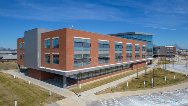
8500/8600 Smiths Mill Rd
093-107046-00.004
United States Military Distric
Officebuilding
35.000 AC SEC 15 R15 T2 Q3 TIF 2011-2040 (100%) TAX ABATE CRA 2017-2031 TAX ABATE CRA 2020-2034
X
Licking
39089C0259J
Ohio
2024
35 AC
2024
Licking County
007212
Columbus
163,020 SF
Columbus, OH
DEMOGRAPHICS near 8500/8600 Smiths Mill Rd
1 Mile
3 Mile
5 Mile
2024 Total Population
219
9,878
45,506
2029 Population
225
10,023
46,098
Pop Growth 2024-2029
+ 2.74%
+ 1.47%
+ 1.30%
Average Age
41
39
39
2024 Total Households
78
3,336
18,603
HH Growth 2024-2029
+ 2.56%
+ 1.56%
+ 1.08%
Median Household Inc
$153,261
$165,044
$116,185
Avg Household Size
2.80
2.90
2.40
2024 Avg HH Vehicles
3.00
2.00
2.00
Median Home Value
$367,856
$449,332
$372,647
Median Year Built
1985
2003
2004
Nearby Places
Map Layers
Map Styles
 Street
 Aerial
- Restaurants
- Banks
- Shops
- Fitness
- Groceries
PUBLIC TRANSPORTATION
AIRPORT
John Glenn Columbus International
DRIVE
WALK
Distance
John Glenn Columbus International
23 min
13.1 mi
Rickenbacker International
DRIVE
WALK
Distance
Rickenbacker International
39 min
26.0 mi
Nearby Properties
Address
Land Use
TOTAL SIZE
Lot Size
Zoning
Address
Land Use
TOTAL SIZE
Lot Size
Zoning
46,000 SF
214.46 AC
Address
Land Use
TOTAL SIZE
Lot Size
Zoning
624,564 SF
104.45 AC
Address
Land Use
TOTAL SIZE
Lot Size
Zoning
159,232 SF
66.44 AC
Address
Land Use
TOTAL SIZE
Lot Size
Zoning
141,988 SF
219.25 AC
Address
Land Use
TOTAL SIZE
Lot Size
Zoning
696,736 SF
76.73 AC
Address
Land Use
TOTAL SIZE
Lot Size
Zoning
14,120 SF
92.69 AC
Address
Land Use
TOTAL SIZE
Lot Size
Zoning
772,217 SF
98.64 AC
Address
Land Use
TOTAL SIZE
Lot Size
Zoning
672,706 SF
222.09 AC
Address
Land Use
TOTAL SIZE
Lot Size
Zoning
271,758 SF
63.69 AC
Address
Land Use
TOTAL SIZE
Lot Size
Zoning
1,435,497 SF
234.05 AC
Address
Land Use
TOTAL SIZE
Lot Size
Zoning
260,944 SF
17.30 AC
Address
Land Use
TOTAL SIZE
Lot Size
Zoning
122,941 SF
28.56 AC
Address
Land Use
TOTAL SIZE
Lot Size
Zoning
446,500 SF
37.26 AC
Address
Land Use
TOTAL SIZE
Lot Size
Zoning
279.62 AC
Address
Land Use
TOTAL SIZE
Lot Size
Zoning
454,348 SF
33.34 AC
Address
Land Use
TOTAL SIZE
Lot Size
Zoning
541,500 SF
41.30 AC
Address
Land Use
TOTAL SIZE
Lot Size
Zoning
173,661 SF
40.94 AC
Address
Land Use
TOTAL SIZE
Lot Size
Zoning
506,879 SF
142.43 AC
Address
Land Use
TOTAL SIZE
Lot Size
Zoning
524,527 SF
27.49 AC
Address
Land Use
TOTAL SIZE
Lot Size
Zoning
195,837 SF
31.48 AC
Address
Land Use
TOTAL SIZE
Lot Size
Zoning
237.57 AC
Address
Land Use
TOTAL SIZE
Lot Size
Zoning
754,614 SF
63.55 AC
Address
Land Use
TOTAL SIZE
Lot Size
Zoning
217.82 AC
Address
Land Use
TOTAL SIZE
Lot Size
Zoning
250,496 SF
15.13 AC
Address
Land Use
TOTAL SIZE
Lot Size
Zoning
315,599 SF
25.76 AC
Address
Land Use
TOTAL SIZE
Lot Size
Zoning
351,846 SF
33.05 AC
Address
Land Use
TOTAL SIZE
Lot Size
Zoning
1,469 SF
197.34 AC
Address
Land Use
TOTAL SIZE
Lot Size
Zoning
416,945 SF
15.01 AC
Address
Land Use
TOTAL SIZE
Lot Size
Zoning
372,683 SF
18.14 AC
The World's #1 Commercial Real Estate Marketplace
Connect with us
© 2026 CoStar Group
The information above has been obtained from sources believed reliable. While we do not doubt its accuracy we have not verified it and make no guarantee, warranty or representation about it. It is your responsibility to independently confirm its accuracy and completeness. Any projections, opinions, assumptions, or estimates used are for example only and do not represent the current or future performance of the property. The value of this transaction to you depends on tax and other factors which should be evaluated by your tax, financial, and legal advisors. You and your advisors should conduct a careful, independent investigation of the property to determine to your satisfaction the suitability of the property for your needs.