Property Record
8501 W 26Th St, Sioux Falls, SD 57106
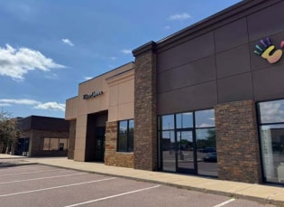

Property Detail
8501 W 26Th St
88038
TRACT 1B WESTRIDGE II ADDN TO THE CITY OF SIOUX FALLS
Stripcommercialcenter
Minnehaha
B and X Area of moderate flood hazard, usually the area between the limits of the 100-year and 500-year floods.
South Dakota
2024
4.16 AC
2024
Sioux Falls
001112
Other Market Areas
7,200 SF
Sioux Falls, SD-MN
NEARBY LISTINGS FOR SALE OR LEASE
DEMOGRAPHICS near 8501 W 26Th St
1 mile
3 mile
5 mile
2025 Total Population
12,885
52,174
102,996
2030 Population
13,751
55,276
109,796
Pop Growth 2025-2030
+ 6.72%
+ 5.95%
+ 6.60%
Average Age
35
37
37
2025 Total Households
4,873
20,506
42,742
HH Growth 2025-2030
+ 7.31%
+ 6.35%
+ 6.96%
Median Household Inc
$90,244
$80,794
$70,317
Avg Household Size
2.60
2.50
2.30
2025 Avg HH Vehicles
2.00
2.00
2.00
Median Home Value
$381,465
$287,947
$282,493
Median Year Built
2010
2001
1997
Nearby Places
Map Layers
Map Styles
 Street
 Aerial
Layers
 Traffic
 Biking
Places
Listings with unknown addresses are not visible on the map
- Restaurants
- Banks
- Shops
- Fitness
- Groceries
PUBLIC TRANSPORTATION
AIRPORT
Joe Foss Field
Drive
Walk
Distance
Joe Foss Field
28 min
9.8 mi
Freight Ports
Port Milwaukee
Drive
Walk
Distance
Port Milwaukee
556 min
510.9 mi
SALE & LEASE HISTORY
LISTING DATE
SALE/LEASE

Nov 12, 2023
For Lease
Aug 05, 2021
For Lease
Nearby Properties
Address
Land Use
TOTAL SIZE
Lot Size
Zoning
Address
Land Use
TOTAL SIZE
Lot Size
Zoning
32,169 SF
9.91 AC
Address
Land Use
TOTAL SIZE
Lot Size
Zoning
55,998 SF
5.42 AC
FP;FP
Address
Land Use
TOTAL SIZE
Lot Size
Zoning
15.89 AC
Address
Land Use
TOTAL SIZE
Lot Size
Zoning
100,053 SF
8.50 AC
FP;FP
Address
Land Use
TOTAL SIZE
Lot Size
Zoning
1.66 AC
FP;FP
Address
Land Use
TOTAL SIZE
Lot Size
Zoning
167,162 SF
17.11 AC
Address
Land Use
TOTAL SIZE
Lot Size
Zoning
26,601 SF
5.31 AC
Address
Land Use
TOTAL SIZE
Lot Size
Zoning
72,601 SF
15.33 AC
Address
Land Use
TOTAL SIZE
Lot Size
Zoning
21,060 SF
6.70 AC
FP;FP
Address
Land Use
TOTAL SIZE
Lot Size
Zoning
9.27 AC
MUNICIPALI
Address
Land Use
TOTAL SIZE
Lot Size
Zoning
8,768 SF
5.48 AC
Address
Land Use
TOTAL SIZE
Lot Size
Zoning
5,649 SF
9.13 AC
Address
Land Use
TOTAL SIZE
Lot Size
Zoning
60,929 SF
13.18 AC
Address
Land Use
TOTAL SIZE
Lot Size
Zoning
185,662 SF
18.09 AC
Address
Land Use
TOTAL SIZE
Lot Size
Zoning
72,820 SF
12.43 AC
Address
Land Use
TOTAL SIZE
Lot Size
Zoning
1,796 SF
7.57 AC
Address
Land Use
TOTAL SIZE
Lot Size
Zoning
42,810 SF
11.57 AC
Address
Land Use
TOTAL SIZE
Lot Size
Zoning
72,342 SF
6.09 AC
FP;FP
Address
Land Use
TOTAL SIZE
Lot Size
Zoning
75,319 SF
2.92 AC
Address
Land Use
TOTAL SIZE
Lot Size
Zoning
2,197 SF
46.99 AC
FP;FP
Address
Land Use
TOTAL SIZE
Lot Size
Zoning
170,372 SF
8.22 AC
Address
Land Use
TOTAL SIZE
Lot Size
Zoning
14.66 AC
C4;GENERAL
Address
Land Use
TOTAL SIZE
Lot Size
Zoning
11.07 AC
MUNICIPALI
Address
Land Use
TOTAL SIZE
Lot Size
Zoning
57,801 SF
3.75 AC
Address
Land Use
TOTAL SIZE
Lot Size
Zoning
41,134 SF
4.62 AC
FP;FP
Address
Land Use
TOTAL SIZE
Lot Size
Zoning
2,318 SF
6.80 AC
FP;FP
Address
Land Use
TOTAL SIZE
Lot Size
Zoning
2,550 SF
5.62 AC
Address
Land Use
TOTAL SIZE
Lot Size
Zoning
92,939 SF
5.06 AC
FP;FP
Address
Land Use
TOTAL SIZE
Lot Size
Zoning
5.12 AC
MUNICIPALI
Address
Land Use
TOTAL SIZE
Lot Size
Zoning
31,533 SF
3.46 AC
C;COMMERCI
The World's #1 Commercial Real Estate Marketplace
Connect with us
© 2026 CoStar Group
The information above has been obtained from sources believed reliable. While we do not doubt its accuracy we have not verified it and make no guarantee, warranty or representation about it. It is your responsibility to independently confirm its accuracy and completeness. Any projections, opinions, assumptions, or estimates used are for example only and do not represent the current or future performance of the property. The value of this transaction to you depends on tax and other factors which should be evaluated by your tax, financial, and legal advisors. You and your advisors should conduct a careful, independent investigation of the property to determine to your satisfaction the suitability of the property for your needs.