Property Record
8504 E Bay Blvd, Navarre, FL 32566

Property Detail
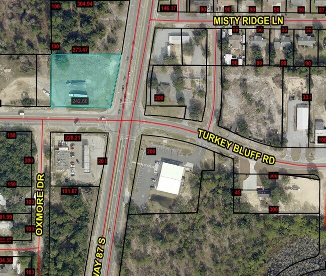
8504 E Bay Blvd
09-2S-26-0000-00401-0000
*DESCRIPTION UPDATED FOR 2022* PARCEL 2: COM NW COR 09-2S-26 TH S000912W 2057.50 FT TH CONT 200 FT TO POB TH S001035W 192.56 FT TO NLY R/W CNTY RD 399 TH S885422E ALNG R/W 220.97 FT TO I/S WLY R/W ST RD 87 TH ALNG WLY R/W NEXT 2 COURSES: N124405E 146
Commercialacreage
SANTA ROSA
HCD
Florida
B and X Area of moderate flood hazard, usually the area between the limits of the 100-year and 500-year floods.
1.10 AC
2024
Navarre
2025
Pensacola
010802
Pensacola-Ferry Pass-Brent, FL
NEARBY LISTINGS FOR SALE OR LEASE
DEMOGRAPHICS near 8504 E Bay Blvd
1 mile
3 mile
5 mile
2025 Total Population
3,681
25,484
51,150
2030 Population
4,015
27,605
55,836
Pop Growth 2025-2030
+ 9.07%
+ 8.32%
+ 9.16%
Average Age
38
38
40
2025 Total Households
1,347
9,289
19,202
HH Growth 2025-2030
+ 8.76%
+ 8.10%
+ 9.25%
Median Household Inc
$89,217
$93,016
$96,030
Avg Household Size
2.70
2.70
2.60
2025 Avg HH Vehicles
2.00
2.00
2.00
Median Home Value
$359,131
$373,889
$400,623
Median Year Built
2000
2000
2000
Nearby Places
Map Layers
Map Styles
 Street
 Aerial
Layers
 Traffic
 Biking
Places
Listings with unknown addresses are not visible on the map
- Restaurants
- Banks
- Shops
- Fitness
- Groceries
PUBLIC TRANSPORTATION
AIRPORT
Eglin AFB/Destin-Ft Walton Beach
Drive
Walk
Distance
Eglin AFB/Destin-Ft Walton Beach
55 min
28.9 mi
Pensacola International
Drive
Walk
Distance
Pensacola International
53 min
38.1 mi
Freight Ports
Port of Panama City
Drive
Walk
Distance
Port of Panama City
121 min
75.6 mi
Nearby Properties
Address
Land Use
TOTAL SIZE
Lot Size
Zoning
Address
Land Use
TOTAL SIZE
Lot Size
Zoning
375,552 SF
10.62 AC
PBD
Address
Land Use
TOTAL SIZE
Lot Size
Zoning
244,004 SF
10.54 AC
HCD
Address
Land Use
TOTAL SIZE
Lot Size
Zoning
110,921 SF
9.65 AC
HCD
Address
Land Use
TOTAL SIZE
Lot Size
Zoning
248,857 SF
22.80 AC
PBD
Address
Land Use
TOTAL SIZE
Lot Size
Zoning
7,800 SF
7.68 AC
R2
Address
Land Use
TOTAL SIZE
Lot Size
Zoning
77,417 SF
8.06 AC
HCD
Address
Land Use
TOTAL SIZE
Lot Size
Zoning
97,214 SF
2.79 AC
HCD
Address
Land Use
TOTAL SIZE
Lot Size
Zoning
65,936 SF
1.86 AC
PBD
Address
Land Use
TOTAL SIZE
Lot Size
Zoning
68,334 SF
4.45 AC
HCD
Address
Land Use
TOTAL SIZE
Lot Size
Zoning
85,562 SF
36.21 AC
PBD
Address
Land Use
TOTAL SIZE
Lot Size
Zoning
48,055 SF
9.12 AC
HCD
Address
Land Use
TOTAL SIZE
Lot Size
Zoning
48,198 SF
1.76 AC
PBD
Address
Land Use
TOTAL SIZE
Lot Size
Zoning
21,567 SF
5.56 AC
HCD
Address
Land Use
TOTAL SIZE
Lot Size
Zoning
4,975 SF
6.03 AC
HCD
Address
Land Use
TOTAL SIZE
Lot Size
Zoning
8,714 SF
7 AC
P2-HON
Address
Land Use
TOTAL SIZE
Lot Size
Zoning
2,046 SF
0.79 AC
HCD
Address
Land Use
TOTAL SIZE
Lot Size
Zoning
14,208 SF
4.53 AC
HCD
Address
Land Use
TOTAL SIZE
Lot Size
Zoning
36,749 SF
2.75 AC
HCD
Address
Land Use
TOTAL SIZE
Lot Size
Zoning
26,192 SF
3.82 AC
HCD
Address
Land Use
TOTAL SIZE
Lot Size
Zoning
40,544 SF
2.26 AC
HCD
Address
Land Use
TOTAL SIZE
Lot Size
Zoning
24,025 SF
2.66 AC
HCD
Address
Land Use
TOTAL SIZE
Lot Size
Zoning
38,588 SF
4.82 AC
HCD
Address
Land Use
TOTAL SIZE
Lot Size
Zoning
32,808 SF
9.37 AC
HCD
Address
Land Use
TOTAL SIZE
Lot Size
Zoning
400 SF
4.01 AC
HCD
Address
Land Use
TOTAL SIZE
Lot Size
Zoning
16,151 SF
2.53 AC
HCD
Address
Land Use
TOTAL SIZE
Lot Size
Zoning
13,716 SF
1.14 AC
HCD
Address
Land Use
TOTAL SIZE
Lot Size
Zoning
24,180 SF
4.07 AC
HCD
The World's #1 Commercial Real Estate Marketplace
Connect with us
© 2026 CoStar Group
The information above has been obtained from sources believed reliable. While we do not doubt its accuracy we have not verified it and make no guarantee, warranty or representation about it. It is your responsibility to independently confirm its accuracy and completeness. Any projections, opinions, assumptions, or estimates used are for example only and do not represent the current or future performance of the property. The value of this transaction to you depends on tax and other factors which should be evaluated by your tax, financial, and legal advisors. You and your advisors should conduct a careful, independent investigation of the property to determine to your satisfaction the suitability of the property for your needs.