Property Record
850409 Us Highway 17, Yulee, FL 32097


NEARBY LISTINGS FOR SALE OR LEASE
Property Detail
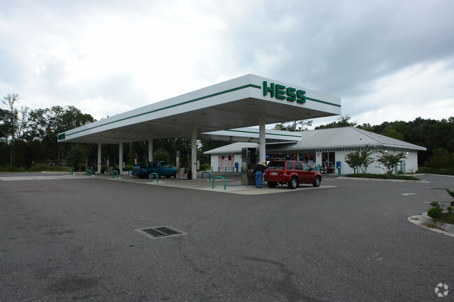
850409 Us Highway 17
Jacksonville, FL
John Lowe Mill Grant
42-2N-27-0000-0086-0030
IN OR 1721/1892 PARCELS 86-3 & 86-4 RECIPRICAL ESMT PT 1010/302
Storebuilding
Nassau
X
Florida
12031C0055J
86
2025
0.98 AC
2025
Nassau County
050304
Jacksonville (Florida)
4,400 SF
DEMOGRAPHICS near 850409 Us Highway 17
1 mile
3 mile
5 mile
2024 Total Population
2,591
13,981
36,413
2029 Population
3,122
16,947
43,590
Pop Growth 2024-2029
+ 20.49%
+ 21.21%
+ 19.71%
Average Age
39
41
41
2024 Total Households
925
5,234
13,510
HH Growth 2024-2029
+ 21.73%
+ 22.47%
+ 20.93%
Median Household Inc
$69,432
$74,293
$81,023
Avg Household Size
2.60
2.60
2.60
2024 Avg HH Vehicles
2.00
2.00
2.00
Median Home Value
$235,204
$266,261
$280,254
Median Year Built
2001
2005
2007
Nearby Places
Map Layers
Map Styles
 Street
 Aerial
Transit
 Traffic
 Biking
Places
Listings with unknown addresses are not visible on the map
- Restaurants
- Banks
- Shops
- Fitness
- Groceries
PUBLIC TRANSPORTATION
AIRPORT
Jacksonville International
Drive
Walk
Distance
Jacksonville International
20 min
11.5 mi
Freight Ports
Jacksonville Port
Drive
Walk
Distance
Jacksonville Port
30 min
21.8 mi
Nearby Properties
Address
Land Use
TOTAL SIZE
Lot Size
Zoning
Address
Land Use
TOTAL SIZE
Lot Size
Zoning
249,913 SF
160.04 AC
OR
Address
Land Use
TOTAL SIZE
Lot Size
Zoning
297,748 SF
92.23 AC
OR
Address
Land Use
TOTAL SIZE
Lot Size
Zoning
327,682 SF
24.09 AC
RG-2
Address
Land Use
TOTAL SIZE
Lot Size
Zoning
91,196 SF
86.52 AC
OR
Address
Land Use
TOTAL SIZE
Lot Size
Zoning
112,634 SF
16 AC
GPU
Address
Land Use
TOTAL SIZE
Lot Size
Zoning
83,799 SF
13.18 AC
PD - ENCPA
Address
Land Use
TOTAL SIZE
Lot Size
Zoning
42,189 SF
7.69 AC
PD - ENCPA
Address
Land Use
TOTAL SIZE
Lot Size
Zoning
92,327 SF
22.06 AC
OR
Address
Land Use
TOTAL SIZE
Lot Size
Zoning
23,934 SF
20.45 AC
CN
Address
Land Use
TOTAL SIZE
Lot Size
Zoning
13,472 SF
Address
Land Use
TOTAL SIZE
Lot Size
Zoning
81,960 SF
2.90 AC
PD - ENCPA
Address
Land Use
TOTAL SIZE
Lot Size
Zoning
59,703 SF
12.06 AC
GPU
Address
Land Use
TOTAL SIZE
Lot Size
Zoning
12,594 SF
Address
Land Use
TOTAL SIZE
Lot Size
Zoning
25,920 SF
14.72 AC
GPU
Address
Land Use
TOTAL SIZE
Lot Size
Zoning
89.52 AC
PD - ENCPA
Address
Land Use
TOTAL SIZE
Lot Size
Zoning
83.12 AC
PD - ENCPA
Address
Land Use
TOTAL SIZE
Lot Size
Zoning
18,750 SF
4.58 AC
CI
Address
Land Use
TOTAL SIZE
Lot Size
Zoning
18,276 SF
1.57 AC
PD - ENCPA
Address
Land Use
TOTAL SIZE
Lot Size
Zoning
6,285 SF
Address
Land Use
TOTAL SIZE
Lot Size
Zoning
25,635 SF
4.24 AC
CI
Address
Land Use
TOTAL SIZE
Lot Size
Zoning
19,000 SF
21.27 AC
PUD
Address
Land Use
TOTAL SIZE
Lot Size
Zoning
11,598 SF
1.03 AC
PD - ENCPA
Address
Land Use
TOTAL SIZE
Lot Size
Zoning
7.40 AC
CHT
Address
Land Use
TOTAL SIZE
Lot Size
Zoning
26,652 SF
3.67 AC
CG
Address
Land Use
TOTAL SIZE
Lot Size
Zoning
10.44 AC
Address
Land Use
TOTAL SIZE
Lot Size
Zoning
9,456 SF
20.63 AC
GPU
Address
Land Use
TOTAL SIZE
Lot Size
Zoning
24,401 SF
2.76 AC
CG
Address
Land Use
TOTAL SIZE
Lot Size
Zoning
13,997 SF
5.02 AC
OR
Address
Land Use
TOTAL SIZE
Lot Size
Zoning
1,576 SF
9.36 AC
CG
Address
Land Use
TOTAL SIZE
Lot Size
Zoning
26,450 SF
6.60 AC
RSF-2
The World's #1 Commercial Real Estate Marketplace
Connect with us
© 2026 CoStar Group
The information above has been obtained from sources believed reliable. While we do not doubt its accuracy we have not verified it and make no guarantee, warranty or representation about it. It is your responsibility to independently confirm its accuracy and completeness. Any projections, opinions, assumptions, or estimates used are for example only and do not represent the current or future performance of the property. The value of this transaction to you depends on tax and other factors which should be evaluated by your tax, financial, and legal advisors. You and your advisors should conduct a careful, independent investigation of the property to determine to your satisfaction the suitability of the property for your needs.