Property Record
8507 N 51St Ave, Glendale, AZ 85302
NEARBY LISTINGS FOR SALE OR LEASE
Property Detail
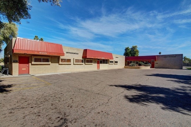
8507 N 51St Ave
Phoenix-Mesa-Scottsdale, AZ
Butler Professional Plaza
148-09-925
BUTLER PROFESSIONAL PLAZA MCR 318-25
Medicalbuilding
Maricopa
X
Arizona
04013C1720L
a
2025
0.04 AC
2025
Northwest Phoenix
092309
Phoenix
3,617 SF
DEMOGRAPHICS near 8507 N 51St Ave
1 Mile
3 Mile
5 Mile
2024 Total Population
20,835
188,413
497,442
2029 Population
22,348
202,606
535,930
Pop Growth 2024-2029
+ 7.26%
+ 7.53%
+ 7.74%
Average Age
39
36
36
2024 Total Households
7,535
64,001
165,242
HH Growth 2024-2029
+ 7.33%
+ 7.62%
+ 7.99%
Median Household Inc
$65,655
$54,878
$55,747
Avg Household Size
2.60
2.80
2.80
2024 Avg HH Vehicles
2.00
2.00
2.00
Median Home Value
$278,754
$262,002
$274,799
Median Year Built
1977
1976
1977
Nearby Places
Map Layers
Map Styles
 Street
 Aerial
- Restaurants
- Banks
- Shops
- Fitness
- Groceries
PUBLIC TRANSPORTATION
AIRPORT
Phoenix Sky Harbor International
DRIVE
WALK
Distance
Phoenix Sky Harbor International
26 min
17.9 mi
Freight Ports
Port of San Diego
DRIVE
WALK
Distance
Port of San Diego
1 min
294.7 mi
SALE & LEASE HISTORY
LISTING DATE
SALE/LEASE

Jun 11, 2018
For Sale
Nearby Properties
Address
Land Use
TOTAL SIZE
Lot Size
Zoning
Address
Land Use
TOTAL SIZE
Lot Size
Zoning
Address
Land Use
TOTAL SIZE
Lot Size
Zoning
19,474 SF
8.43 AC
C-3
Address
Land Use
TOTAL SIZE
Lot Size
Zoning
611,971 SF
36.16 AC
A1
Address
Land Use
TOTAL SIZE
Lot Size
Zoning
3,241 SF
2.13 AC
C-N
Address
Land Use
TOTAL SIZE
Lot Size
Zoning
629,928 SF
41.37 AC
Address
Land Use
TOTAL SIZE
Lot Size
Zoning
74,376 SF
2.12 AC
C-N
Address
Land Use
TOTAL SIZE
Lot Size
Zoning
276,102 SF
39.72 AC
AG
Address
Land Use
TOTAL SIZE
Lot Size
Zoning
4.43 AC
Address
Land Use
TOTAL SIZE
Lot Size
Zoning
310,295 SF
9.32 AC
Address
Land Use
TOTAL SIZE
Lot Size
Zoning
268,958 SF
38.42 AC
R-6
Address
Land Use
TOTAL SIZE
Lot Size
Zoning
212,227 SF
27.71 AC
R-6
Address
Land Use
TOTAL SIZE
Lot Size
Zoning
262,609 SF
18.96 AC
I-1
Address
Land Use
TOTAL SIZE
Lot Size
Zoning
200,998 SF
0.06 AC
C-C
Address
Land Use
TOTAL SIZE
Lot Size
Zoning
187,309 SF
19.99 AC
R-6
Address
Land Use
TOTAL SIZE
Lot Size
Zoning
88,059 SF
78.03 AC
AG
Address
Land Use
TOTAL SIZE
Lot Size
Zoning
217,214 SF
27.12 AC
R-6
Address
Land Use
TOTAL SIZE
Lot Size
Zoning
196,254 SF
17.36 AC
R2
Address
Land Use
TOTAL SIZE
Lot Size
Zoning
131,380 SF
25.55 AC
R-6
Address
Land Use
TOTAL SIZE
Lot Size
Zoning
90,148 SF
6.13 AC
R-6
Address
Land Use
TOTAL SIZE
Lot Size
Zoning
2.23 AC
Address
Land Use
TOTAL SIZE
Lot Size
Zoning
114,671 SF
13.28 AC
R-6
Address
Land Use
TOTAL SIZE
Lot Size
Zoning
287,199 SF
15.11 AC
M-H
Address
Land Use
TOTAL SIZE
Lot Size
Zoning
320,093 SF
14.56 AC
M-H
Address
Land Use
TOTAL SIZE
Lot Size
Zoning
113,313 SF
9.49 AC
R-6
Address
Land Use
TOTAL SIZE
Lot Size
Zoning
212,109 SF
20.14 AC
C-C
Address
Land Use
TOTAL SIZE
Lot Size
Zoning
114,424 SF
10.88 AC
R-6
Address
Land Use
TOTAL SIZE
Lot Size
Zoning
143,422 SF
14.16 AC
C-C
Address
Land Use
TOTAL SIZE
Lot Size
Zoning
173,934 SF
20.18 AC
Address
Land Use
TOTAL SIZE
Lot Size
Zoning
89,773 SF
17.78 AC
R-6
Address
Land Use
TOTAL SIZE
Lot Size
Zoning
340,580 SF
16.06 AC
M-H
The World's #1 Commercial Real Estate Marketplace
Connect with us
© 2025 CoStar Group
The information above has been obtained from sources believed reliable. While we do not doubt its accuracy we have not verified it and make no guarantee, warranty or representation about it. It is your responsibility to independently confirm its accuracy and completeness. Any projections, opinions, assumptions, or estimates used are for example only and do not represent the current or future performance of the property. The value of this transaction to you depends on tax and other factors which should be evaluated by your tax, financial, and legal advisors. You and your advisors should conduct a careful, independent investigation of the property to determine to your satisfaction the suitability of the property for your needs.