Property Record
851 Pierre Ridge Rd, Berthoud, CO 80513

Property Detail
851 Pierre Ridge Rd
Denver
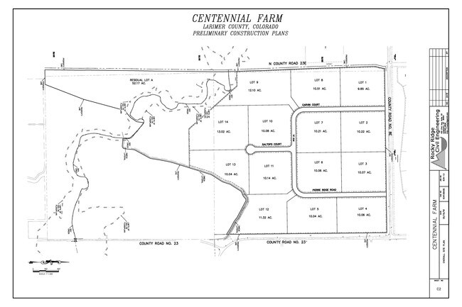
LOT 6, AMENDED POR OF CENTENNIAL FARM CONSERVATION DEVELOPMENT FILE 03-S2207 (20180070439)
Fort Collins-Loveland, CO
LARIMER
94184-08-006
Colorado
Recreationalacreage
6
B and X Area of moderate flood hazard, usually the area between the limits of the 100-year and 500-year floods.
10.05 AC
2024
Outlying Larimer County
2025
NEARBY LISTINGS FOR SALE OR LEASE
DEMOGRAPHICS near 851 Pierre Ridge Rd
1 mile
3 mile
5 mile
2025 Total Population
390
4,270
21,328
2030 Population
402
4,431
22,224
Pop Growth 2025-2030
+ 3.08%
+ 3.77%
+ 4.20%
Average Age
48
46
43
2025 Total Households
148
1,624
8,134
HH Growth 2025-2030
+ 2.70%
+ 3.88%
+ 4.29%
Median Household Inc
$153,488
$147,242
$116,264
Avg Household Size
2.60
2.60
2.60
2025 Avg HH Vehicles
3.00
3.00
3.00
Median Home Value
$836,956
$794,376
$650,877
Median Year Built
1991
1993
1996
Nearby Places
Map Layers
Map Styles
 Street
 Aerial
Layers
 Traffic
 Biking
Places
Listings with unknown addresses are not visible on the map
- Restaurants
- Banks
- Shops
- Fitness
- Groceries
SALE & LEASE HISTORY
LISTING DATE
SALE/LEASE

May 26, 2018
For Sale
Nearby Properties
Address
Land Use
TOTAL SIZE
Lot Size
Zoning
Address
Land Use
TOTAL SIZE
Lot Size
Zoning
35,978 SF
19.13 AC
C
Address
Land Use
TOTAL SIZE
Lot Size
Zoning
23,538 SF
42 AC
O
Address
Land Use
TOTAL SIZE
Lot Size
Zoning
10,740 SF
17.71 AC
FA1
Address
Land Use
TOTAL SIZE
Lot Size
Zoning
4,365 SF
0.67 AC
C
Address
Land Use
TOTAL SIZE
Lot Size
Zoning
2,610 SF
2.46 AC
C
Address
Land Use
TOTAL SIZE
Lot Size
Zoning
6,000 SF
10 AC
FA1
Address
Land Use
TOTAL SIZE
Lot Size
Zoning
2,118 SF
0.48 AC
FA1
Address
Land Use
TOTAL SIZE
Lot Size
Zoning
4,947 SF
1.30 AC
FA1
Address
Land Use
TOTAL SIZE
Lot Size
Zoning
11.25 AC
Address
Land Use
TOTAL SIZE
Lot Size
Zoning
10.23 AC
Address
Land Use
TOTAL SIZE
Lot Size
Zoning
9.85 AC
Address
Land Use
TOTAL SIZE
Lot Size
Zoning
14,856 SF
75.96 AC
FA1
Address
Land Use
TOTAL SIZE
Lot Size
Zoning
3.58 AC
FA1
Address
Land Use
TOTAL SIZE
Lot Size
Zoning
12,518 SF
35.23 AC
FA1
Address
Land Use
TOTAL SIZE
Lot Size
Zoning
12.10 AC
Address
Land Use
TOTAL SIZE
Lot Size
Zoning
157.66 AC
O
Address
Land Use
TOTAL SIZE
Lot Size
Zoning
35.02 AC
Address
Land Use
TOTAL SIZE
Lot Size
Zoning
7,282 SF
36 AC
FA1
Address
Land Use
TOTAL SIZE
Lot Size
Zoning
2.14 AC
FA1
Address
Land Use
TOTAL SIZE
Lot Size
Zoning
2.37 AC
FA1
Address
Land Use
TOTAL SIZE
Lot Size
Zoning
0.41 AC
Address
Land Use
TOTAL SIZE
Lot Size
Zoning
0.41 AC
Address
Land Use
TOTAL SIZE
Lot Size
Zoning
0.78 AC
Address
Land Use
TOTAL SIZE
Lot Size
Zoning
0.68 AC
Address
Land Use
TOTAL SIZE
Lot Size
Zoning
0.42 AC
Address
Land Use
TOTAL SIZE
Lot Size
Zoning
Address
Land Use
TOTAL SIZE
Lot Size
Zoning
0.41 AC
Address
Land Use
TOTAL SIZE
Lot Size
Zoning
0.83 AC
The World's #1 Commercial Real Estate Marketplace
Connect with us
© 2026 CoStar Group
The information above has been obtained from sources believed reliable. While we do not doubt its accuracy we have not verified it and make no guarantee, warranty or representation about it. It is your responsibility to independently confirm its accuracy and completeness. Any projections, opinions, assumptions, or estimates used are for example only and do not represent the current or future performance of the property. The value of this transaction to you depends on tax and other factors which should be evaluated by your tax, financial, and legal advisors. You and your advisors should conduct a careful, independent investigation of the property to determine to your satisfaction the suitability of the property for your needs.