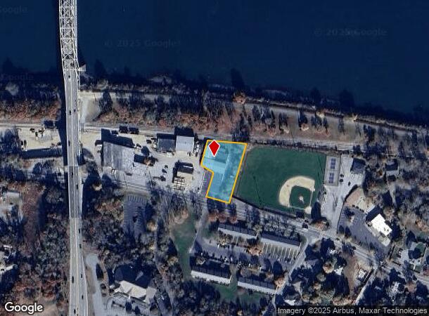
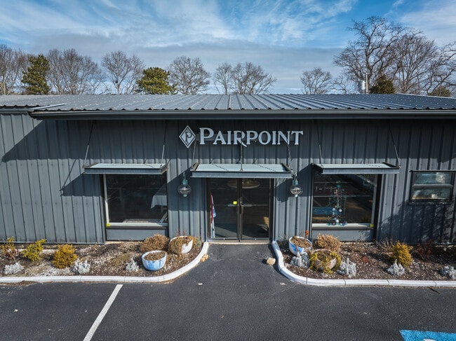
Property Record
851 Sandwich Rd, Buzzards Bay, MA 02532
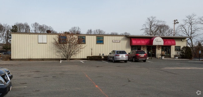

This Property Is For Sale
NEARBY LISTINGS FOR SALE OR LEASE
Property Detail
851 Sandwich Rd
Manufacturinglight
Barnstable
X
Massachusetts
25001C0318K
0.68 AC
2025
Cape Cod
2025
Other Market Areas
013700
Barnstable Town, MA
9,170 SF
BOUR-000114-000000-000009
DEMOGRAPHICS near 851 Sandwich Rd
1 Mile
3 Mile
5 Mile
2024 Total Population
1,959
10,324
29,242
2029 Population
1,880
10,242
29,420
Pop Growth 2024-2029
(4.03%)
(0.79%)
+ 0.61%
Average Age
44
47
45
2024 Total Households
783
4,277
11,430
HH Growth 2024-2029
(4.60%)
(1.12%)
+ 0.29%
Median Household Inc
$97,326
$97,791
$93,858
Avg Household Size
2.40
2.30
2.40
2024 Avg HH Vehicles
2.00
2.00
2.00
Median Home Value
$445,970
$452,644
$446,681
Median Year Built
1981
1979
1980
Nearby Places
Map Layers
Map Styles
 Street
 Aerial
- Restaurants
- Banks
- Shops
- Fitness
- Groceries
PUBLIC TRANSPORTATION
COMMUTER RAIL
Bourne (CapeFLYER - Cape Cod Regional Transit Authority)
DRIVE
WALK
Distance
Bourne (CapeFLYER - Cape Cod Regional Transit Authority)
6 min
3.6 mi
Buzzards Bay (CapeFLYER - Cape Cod Regional Transit Authority)
DRIVE
WALK
Distance
Buzzards Bay (CapeFLYER - Cape Cod Regional Transit Authority)
12 min
6.6 mi
AIRPORT
Martha's Vineyard
DRIVE
WALK
Distance
Martha's Vineyard
94 min
34.4 mi
Freight Ports
Port of New Bedford Harbor
DRIVE
WALK
Distance
Port of New Bedford Harbor
41 min
30.9 mi
Nearby Properties
Address
Land Use
TOTAL SIZE
Lot Size
Zoning
Address
Land Use
TOTAL SIZE
Lot Size
Zoning
75.70 AC
R40
Address
Land Use
TOTAL SIZE
Lot Size
Zoning
654.71 AC
R40
Address
Land Use
TOTAL SIZE
Lot Size
Zoning
Address
Land Use
TOTAL SIZE
Lot Size
Zoning
2,295.68 AC
R-1
Address
Land Use
TOTAL SIZE
Lot Size
Zoning
68,120 SF
119.50 AC
B-2
Address
Land Use
TOTAL SIZE
Lot Size
Zoning
16.20 AC
BL-1
Address
Land Use
TOTAL SIZE
Lot Size
Zoning
325 AC
R-1
Address
Land Use
TOTAL SIZE
Lot Size
Zoning
35,732 SF
289.94 AC
R40
Address
Land Use
TOTAL SIZE
Lot Size
Zoning
46.68 AC
R-1
Address
Land Use
TOTAL SIZE
Lot Size
Zoning
208 SF
125.13 AC
SDD
Address
Land Use
TOTAL SIZE
Lot Size
Zoning
5,928 SF
12.90 AC
Address
Land Use
TOTAL SIZE
Lot Size
Zoning
148.70 AC
R40
Address
Land Use
TOTAL SIZE
Lot Size
Zoning
Address
Land Use
TOTAL SIZE
Lot Size
Zoning
485.97 AC
RR
Address
Land Use
TOTAL SIZE
Lot Size
Zoning
29.83 AC
IND
Address
Land Use
TOTAL SIZE
Lot Size
Zoning
41.40 AC
IND
Address
Land Use
TOTAL SIZE
Lot Size
Zoning
4.94 AC
VILLAG
Address
Land Use
TOTAL SIZE
Lot Size
Zoning
11.97 AC
MARINE
Address
Land Use
TOTAL SIZE
Lot Size
Zoning
31.50 AC
MARINE
Address
Land Use
TOTAL SIZE
Lot Size
Zoning
36,388 SF
6.70 AC
BL-1
Address
Land Use
TOTAL SIZE
Lot Size
Zoning
40,476 SF
7 AC
BL-1
Address
Land Use
TOTAL SIZE
Lot Size
Zoning
17,110 SF
1.68 AC
R-1
Address
Land Use
TOTAL SIZE
Lot Size
Zoning
39,202 SF
6.31 AC
BL-1
Address
Land Use
TOTAL SIZE
Lot Size
Zoning
610 SF
24.11 AC
R-1
Address
Land Use
TOTAL SIZE
Lot Size
Zoning
21.30 AC
IND
Address
Land Use
TOTAL SIZE
Lot Size
Zoning
4,146 SF
11.40 AC
BL-1
Address
Land Use
TOTAL SIZE
Lot Size
Zoning
8,989 SF
1.19 AC
MARINE
Address
Land Use
TOTAL SIZE
Lot Size
Zoning
Address
Land Use
TOTAL SIZE
Lot Size
Zoning
16,449 SF
4.21 AC
Address
Land Use
TOTAL SIZE
Lot Size
Zoning
10,691 SF
0.75 AC
VILLAG
The World's #1 Commercial Real Estate Marketplace
Connect with us
© 2025 CoStar Group
The information above has been obtained from sources believed reliable. While we do not doubt its accuracy we have not verified it and make no guarantee, warranty or representation about it. It is your responsibility to independently confirm its accuracy and completeness. Any projections, opinions, assumptions, or estimates used are for example only and do not represent the current or future performance of the property. The value of this transaction to you depends on tax and other factors which should be evaluated by your tax, financial, and legal advisors. You and your advisors should conduct a careful, independent investigation of the property to determine to your satisfaction the suitability of the property for your needs.