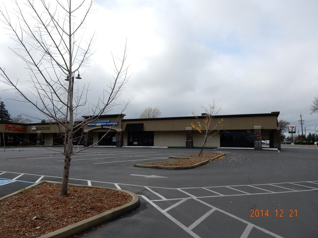
Property Record
8510 Madison Ave, Fair Oaks, CA 95628


NEARBY LISTINGS FOR SALE OR LEASE
Property Detail
8510 Madison Ave
253-0220-060
PORTION LOTS1&2
Storebuilding
Sacramento
X
California
06067C0111J
3.60 AC
2024
Carmichael
2025
Sacramento
008006
Sacramento-Roseville-Folsom, CA
37,800 SF
DEMOGRAPHICS near 8510 Madison Ave
1 mile
3 mile
5 mile
2024 Total Population
11,450
104,791
269,465
2029 Population
11,511
105,365
272,163
Pop Growth 2024-2029
+ 0.53%
+ 0.55%
+ 1.00%
Average Age
45
43
42
2024 Total Households
4,445
42,101
105,276
HH Growth 2024-2029
+ 0.52%
+ 0.54%
+ 0.97%
Median Household Inc
$110,969
$91,948
$88,094
Avg Household Size
2.50
2.40
2.50
2024 Avg HH Vehicles
2.00
2.00
2.00
Median Home Value
$665,269
$543,364
$506,709
Median Year Built
1977
1977
1977
Nearby Places
Map Layers
Map Styles
 Street
 Aerial
Transit
 Traffic
 Biking
Places
Listings with unknown addresses are not visible on the map
- Restaurants
- Banks
- Shops
- Fitness
- Groceries
PUBLIC TRANSPORTATION
COMMUTER RAIL
Drive
Walk
Distance
20 min
9.4 mi
AIRPORT
Sacramento International
Drive
Walk
Distance
Sacramento International
36 min
23.7 mi
SALE & LEASE HISTORY
LISTING DATE
SALE/LEASE

Sep 25, 2016
For Lease
Sep 12, 2019
For Lease
Mar 31, 2023
For Lease
Nearby Properties
Address
Land Use
TOTAL SIZE
Lot Size
Zoning
Address
Land Use
TOTAL SIZE
Lot Size
Zoning
17,642 SF
26.44 AC
RD30
Address
Land Use
TOTAL SIZE
Lot Size
Zoning
SPA (ASPA)
Address
Land Use
TOTAL SIZE
Lot Size
Zoning
304,607 SF
14.70 AC
LC
Address
Land Use
TOTAL SIZE
Lot Size
Zoning
251,225 SF
23.54 AC
SC
Address
Land Use
TOTAL SIZE
Lot Size
Zoning
199,580 SF
10.29 AC
RD20
Address
Land Use
TOTAL SIZE
Lot Size
Zoning
202,776 SF
12.17 AC
RD-25 (PC)
Address
Land Use
TOTAL SIZE
Lot Size
Zoning
241,672 SF
18.54 AC
SC
Address
Land Use
TOTAL SIZE
Lot Size
Zoning
12,548 SF
14.36 AC
RD-30
Address
Land Use
TOTAL SIZE
Lot Size
Zoning
156,365 SF
12.81 AC
SC
Address
Land Use
TOTAL SIZE
Lot Size
Zoning
84,387 SF
3.52 AC
LC
Address
Land Use
TOTAL SIZE
Lot Size
Zoning
166,268 SF
9.50 AC
RD30
Address
Land Use
TOTAL SIZE
Lot Size
Zoning
99,568 SF
10.92 AC
RD-5
Address
Land Use
TOTAL SIZE
Lot Size
Zoning
91,983 SF
3.27 AC
SPA
Address
Land Use
TOTAL SIZE
Lot Size
Zoning
137,732 SF
12.87 AC
SC
Address
Land Use
TOTAL SIZE
Lot Size
Zoning
112,065 SF
8.52 AC
RD20
Address
Land Use
TOTAL SIZE
Lot Size
Zoning
78,379 SF
4.91 AC
RD20
Address
Land Use
TOTAL SIZE
Lot Size
Zoning
82,499 SF
4.74 AC
RD-30
Address
Land Use
TOTAL SIZE
Lot Size
Zoning
52,595 SF
4.48 AC
LC
Address
Land Use
TOTAL SIZE
Lot Size
Zoning
104,750 SF
5.66 AC
RD-20
Address
Land Use
TOTAL SIZE
Lot Size
Zoning
87,942 SF
9.03 AC
SPA
Address
Land Use
TOTAL SIZE
Lot Size
Zoning
2,940 SF
4.97 AC
RD10
Address
Land Use
TOTAL SIZE
Lot Size
Zoning
105,703 SF
4.75 AC
RD-30 BP
Address
Land Use
TOTAL SIZE
Lot Size
Zoning
134,216 SF
7.79 AC
SPA
Address
Land Use
TOTAL SIZE
Lot Size
Zoning
139,734 SF
8.03 AC
SPA
Address
Land Use
TOTAL SIZE
Lot Size
Zoning
124,339 SF
10.28 AC
RD-20
Address
Land Use
TOTAL SIZE
Lot Size
Zoning
57,465 SF
3 AC
RD-5
Address
Land Use
TOTAL SIZE
Lot Size
Zoning
67,724 SF
9.73 AC
SPA
Address
Land Use
TOTAL SIZE
Lot Size
Zoning
131,535 SF
13.19 AC
SC
Address
Land Use
TOTAL SIZE
Lot Size
Zoning
112,068 SF
10.22 AC
SC
Address
Land Use
TOTAL SIZE
Lot Size
Zoning
130,708 SF
8.85 AC
RD-30
The World's #1 Commercial Real Estate Marketplace
Connect with us
© 2026 CoStar Group
The information above has been obtained from sources believed reliable. While we do not doubt its accuracy we have not verified it and make no guarantee, warranty or representation about it. It is your responsibility to independently confirm its accuracy and completeness. Any projections, opinions, assumptions, or estimates used are for example only and do not represent the current or future performance of the property. The value of this transaction to you depends on tax and other factors which should be evaluated by your tax, financial, and legal advisors. You and your advisors should conduct a careful, independent investigation of the property to determine to your satisfaction the suitability of the property for your needs.