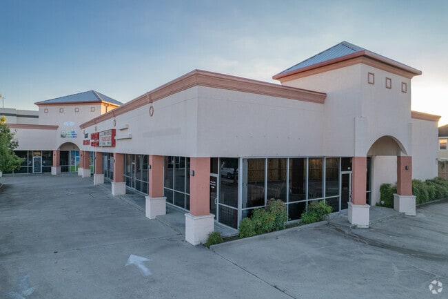
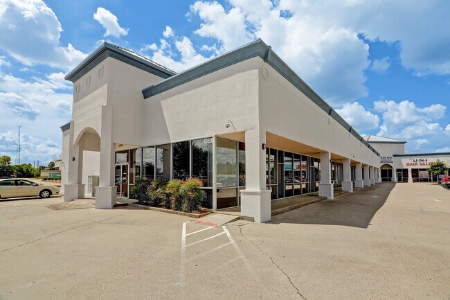
Property Record
8511 N Houston Rosslyn Rd, Houston, TX 77088

NEARBY LISTINGS FOR SALE OR LEASE
Property Detail
8511 N Houston Rosslyn Rd
1289590010001
Rosslyn One
Stripcommercialcenter
RES A BLK 1 ROSSLYN ONE
X
Harris
48201C0655M
Texas
2024
2.06 AC
2025
Near Northwest Oaks
532400
Houston
25,410 SF
Houston-The Woodlands-Sugar Land, TX
DEMOGRAPHICS near 8511 N Houston Rosslyn Rd
1 Mile
3 Mile
5 Mile
2024 Total Population
10,814
119,884
319,954
2029 Population
10,936
121,893
326,524
Pop Growth 2024-2029
+ 1.13%
+ 1.68%
+ 2.05%
Average Age
36
35
36
2024 Total Households
3,629
41,043
109,866
HH Growth 2024-2029
+ 1.05%
+ 1.60%
+ 2.10%
Median Household Inc
$53,016
$45,364
$52,006
Avg Household Size
2.90
2.80
2.80
2024 Avg HH Vehicles
2.00
2.00
2.00
Median Home Value
$167,985
$182,721
$218,614
Median Year Built
1977
1979
1979
Nearby Places
Map Layers
Map Styles
 Street
 Aerial
- Restaurants
- Banks
- Shops
- Fitness
- Groceries
PUBLIC TRANSPORTATION
AIRPORT
George Bush Intcntl/Houston
DRIVE
WALK
Distance
George Bush Intcntl/Houston
25 min
18.2 mi
William P Hobby
DRIVE
WALK
Distance
William P Hobby
42 min
26.7 mi
Freight Ports
Port of Houston
DRIVE
WALK
Distance
Port of Houston
33 min
22.3 mi
SALE & LEASE HISTORY
LISTING DATE
SALE/LEASE

Sep 25, 2016
For Lease
Sep 19, 2022
For Sale
Sep 03, 2022
For Sale
May 15, 2020
For Lease
Jul 02, 2025
For Lease
Nearby Properties
Address
Land Use
TOTAL SIZE
Lot Size
Zoning
Address
Land Use
TOTAL SIZE
Lot Size
Zoning
350,655 SF
16.76 AC
Address
Land Use
TOTAL SIZE
Lot Size
Zoning
643,804 SF
31.40 AC
Address
Land Use
TOTAL SIZE
Lot Size
Zoning
397,248 SF
26.37 AC
Address
Land Use
TOTAL SIZE
Lot Size
Zoning
456,294 SF
19.02 AC
Address
Land Use
TOTAL SIZE
Lot Size
Zoning
308,168 SF
21.34 AC
Address
Land Use
TOTAL SIZE
Lot Size
Zoning
426,748 SF
26.09 AC
Address
Land Use
TOTAL SIZE
Lot Size
Zoning
401,600 SF
20.48 AC
Address
Land Use
TOTAL SIZE
Lot Size
Zoning
409,271 SF
20.70 AC
Address
Land Use
TOTAL SIZE
Lot Size
Zoning
447,480 SF
18.48 AC
Address
Land Use
TOTAL SIZE
Lot Size
Zoning
357,300 SF
23.38 AC
Address
Land Use
TOTAL SIZE
Lot Size
Zoning
185,252 SF
17.14 AC
Address
Land Use
TOTAL SIZE
Lot Size
Zoning
330,161 SF
20.90 AC
Address
Land Use
TOTAL SIZE
Lot Size
Zoning
268,678 SF
14 AC
Address
Land Use
TOTAL SIZE
Lot Size
Zoning
257,400 SF
13.34 AC
Address
Land Use
TOTAL SIZE
Lot Size
Zoning
299,640 SF
13.95 AC
Address
Land Use
TOTAL SIZE
Lot Size
Zoning
377,771 SF
19.76 AC
Address
Land Use
TOTAL SIZE
Lot Size
Zoning
206,777 SF
8.77 AC
Address
Land Use
TOTAL SIZE
Lot Size
Zoning
252,080 SF
13.92 AC
Address
Land Use
TOTAL SIZE
Lot Size
Zoning
201,947 SF
8.80 AC
Address
Land Use
TOTAL SIZE
Lot Size
Zoning
244,727 SF
10.49 AC
Address
Land Use
TOTAL SIZE
Lot Size
Zoning
358,164 SF
14.79 AC
Address
Land Use
TOTAL SIZE
Lot Size
Zoning
217,700 SF
16.16 AC
Address
Land Use
TOTAL SIZE
Lot Size
Zoning
437,052 SF
15.90 AC
Address
Land Use
TOTAL SIZE
Lot Size
Zoning
339,500 SF
17.05 AC
Address
Land Use
TOTAL SIZE
Lot Size
Zoning
322,748 SF
12.23 AC
Address
Land Use
TOTAL SIZE
Lot Size
Zoning
234,215 SF
5.67 AC
Address
Land Use
TOTAL SIZE
Lot Size
Zoning
397,012 SF
35.38 AC
Address
Land Use
TOTAL SIZE
Lot Size
Zoning
282,024 SF
13.13 AC
Address
Land Use
TOTAL SIZE
Lot Size
Zoning
232,702 SF
14.75 AC
Address
Land Use
TOTAL SIZE
Lot Size
Zoning
211,344 SF
13.32 AC
The World's #1 Commercial Real Estate Marketplace
Connect with us
© 2026 CoStar Group
The information above has been obtained from sources believed reliable. While we do not doubt its accuracy we have not verified it and make no guarantee, warranty or representation about it. It is your responsibility to independently confirm its accuracy and completeness. Any projections, opinions, assumptions, or estimates used are for example only and do not represent the current or future performance of the property. The value of this transaction to you depends on tax and other factors which should be evaluated by your tax, financial, and legal advisors. You and your advisors should conduct a careful, independent investigation of the property to determine to your satisfaction the suitability of the property for your needs.