Property Record
8515 Fannin St, Houston, TX 77054
Current Lease Availabilities
NEARBY LISTINGS FOR SALE OR LEASE
Property Detail
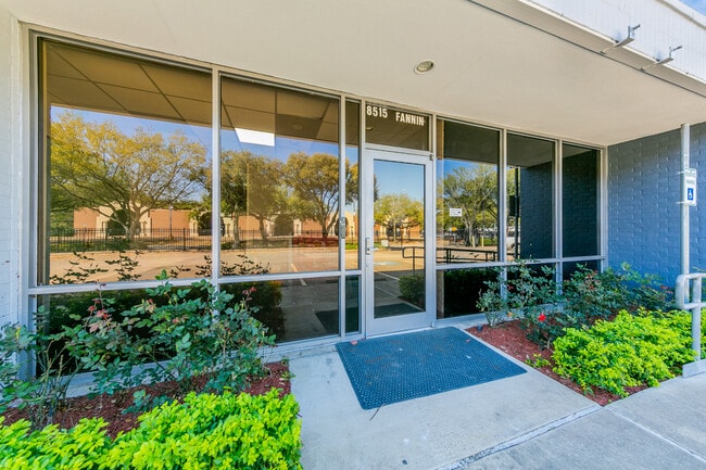
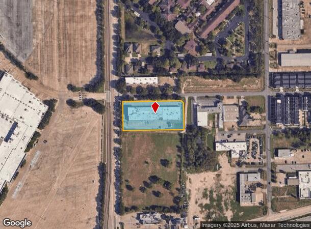
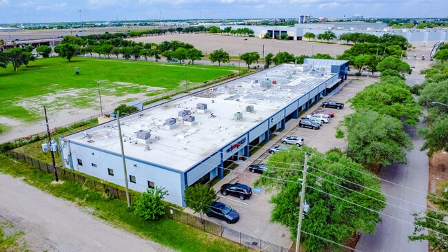
8515 Fannin St
1328450010001
Treeline Village
Medicalbuilding
RES A BLK 1 TREELINE VILLAGE
X
Harris
48201C0870M
Texas
2024
1.81 AC
2025
South Main/Medical Center
314005
Houston
27,883 SF
Houston-The Woodlands-Sugar Land, TX
DEMOGRAPHICS near 8515 Fannin St
1 Mile
3 Mile
5 Mile
2024 Total Population
13,713
130,180
412,001
2029 Population
14,185
134,813
425,669
Pop Growth 2024-2029
+ 3.44%
+ 3.56%
+ 3.32%
Average Age
33
37
38
2024 Total Households
7,719
58,755
176,668
HH Growth 2024-2029
+ 3.30%
+ 3.65%
+ 3.49%
Median Household Inc
$49,941
$60,614
$68,723
Avg Household Size
1.70
2.10
2.20
2024 Avg HH Vehicles
1.00
1.00
2.00
Median Home Value
$157,507
$402,654
$362,717
Median Year Built
1985
1991
1988
Nearby Places
- Restaurants
- Banks
- Shops
- Fitness
- Groceries
PUBLIC TRANSPORTATION
TRANSIT/SUBWAY
Reliant Park (METRORAIL RED LINE - Metropolitan Transit Authority of Harris County, Redline - Metropolitan Transit Authority of Harris County)
DRIVE
WALK
Distance
Reliant Park (METRORAIL RED LINE - Metropolitan Transit Authority of Harris County, Redline - Metropolitan Transit Authority of Harris County)
0 min
6 min
0.3 mi
Fannin South (METRORAIL RED LINE - Metropolitan Transit Authority of Harris County, Redline - Metropolitan Transit Authority of Harris County)
DRIVE
WALK
Distance
Fannin South (METRORAIL RED LINE - Metropolitan Transit Authority of Harris County, Redline - Metropolitan Transit Authority of Harris County)
1 min
13 min
0.7 mi
COMMUTER RAIL
Houston (Sunset Limited - Amtrak)
DRIVE
WALK
Distance
Houston (Sunset Limited - Amtrak)
14 min
8.6 mi
AIRPORT
William P Hobby
DRIVE
WALK
Distance
William P Hobby
23 min
11.9 mi
George Bush Intcntl/Houston
DRIVE
WALK
Distance
George Bush Intcntl/Houston
35 min
25.5 mi
Freight Ports
Port of Houston
DRIVE
WALK
Distance
Port of Houston
19 min
12.2 mi
Nearby Properties
Address
Land Use
TOTAL SIZE
Lot Size
Zoning
Address
Land Use
TOTAL SIZE
Lot Size
Zoning
519,409 SF
1.52 AC
Address
Land Use
TOTAL SIZE
Lot Size
Zoning
1,252,274 SF
2.02 AC
Address
Land Use
TOTAL SIZE
Lot Size
Zoning
704,249 SF
2.34 AC
Address
Land Use
TOTAL SIZE
Lot Size
Zoning
1,359,194 SF
Address
Land Use
TOTAL SIZE
Lot Size
Zoning
402,467 SF
28.30 AC
Address
Land Use
TOTAL SIZE
Lot Size
Zoning
1,009,859 SF
28.73 AC
Address
Land Use
TOTAL SIZE
Lot Size
Zoning
701,043 SF
4.69 AC
Address
Land Use
TOTAL SIZE
Lot Size
Zoning
507,499 SF
7.66 AC
Address
Land Use
TOTAL SIZE
Lot Size
Zoning
310,967 SF
1.38 AC
Address
Land Use
TOTAL SIZE
Lot Size
Zoning
444,589 SF
11 AC
Address
Land Use
TOTAL SIZE
Lot Size
Zoning
577,327 SF
28.80 AC
Address
Land Use
TOTAL SIZE
Lot Size
Zoning
828,746 SF
7.76 AC
Address
Land Use
TOTAL SIZE
Lot Size
Zoning
396,888 SF
2.02 AC
Address
Land Use
TOTAL SIZE
Lot Size
Zoning
486,076 SF
3.79 AC
Address
Land Use
TOTAL SIZE
Lot Size
Zoning
517,548 SF
1.60 AC
Address
Land Use
TOTAL SIZE
Lot Size
Zoning
527,457 SF
6.21 AC
Address
Land Use
TOTAL SIZE
Lot Size
Zoning
499,411 SF
5.73 AC
Address
Land Use
TOTAL SIZE
Lot Size
Zoning
1,000,928 SF
18.79 AC
Address
Land Use
TOTAL SIZE
Lot Size
Zoning
271,936 SF
0.83 AC
Address
Land Use
TOTAL SIZE
Lot Size
Zoning
236,010 SF
6.08 AC
Address
Land Use
TOTAL SIZE
Lot Size
Zoning
706,892 SF
5.86 AC
Address
Land Use
TOTAL SIZE
Lot Size
Zoning
550,115 SF
6.38 AC
Address
Land Use
TOTAL SIZE
Lot Size
Zoning
562,131 SF
4.11 AC
Address
Land Use
TOTAL SIZE
Lot Size
Zoning
356,610 SF
2.26 AC
Address
Land Use
TOTAL SIZE
Lot Size
Zoning
557,397 SF
5.58 AC
Address
Land Use
TOTAL SIZE
Lot Size
Zoning
353,738 SF
2.04 AC
Address
Land Use
TOTAL SIZE
Lot Size
Zoning
651,551 SF
52.18 AC
Address
Land Use
TOTAL SIZE
Lot Size
Zoning
372,028 SF
26.56 AC
Address
Land Use
TOTAL SIZE
Lot Size
Zoning
284,836 SF
4.22 AC
Address
Land Use
TOTAL SIZE
Lot Size
Zoning
335,626 SF
4.22 AC
The World's #1 Commercial Real Estate Marketplace
Connect with us
© 2025 CoStar Group
The information above has been obtained from sources believed reliable. While we do not doubt its accuracy we have not verified it and make no guarantee, warranty or representation about it. It is your responsibility to independently confirm its accuracy and completeness. Any projections, opinions, assumptions, or estimates used are for example only and do not represent the current or future performance of the property. The value of this transaction to you depends on tax and other factors which should be evaluated by your tax, financial, and legal advisors. You and your advisors should conduct a careful, independent investigation of the property to determine to your satisfaction the suitability of the property for your needs.