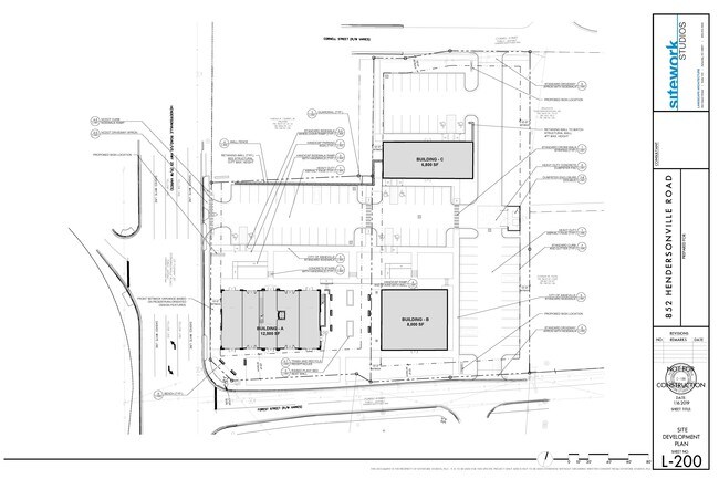
Property Record
852 Hendersonville Rd, Asheville, NC 28803


NEARBY LISTINGS FOR SALE OR LEASE
Property Detail
852 Hendersonville Rd
Asheville
LOT: 2 PLAT: 0222-0032
Asheville, NC
Buncombe
9647-91-6100-00000
North Carolina
Commercialacreage
2
0
0.94 AC
2025
S Asheville/Royal Pines
002102
DEMOGRAPHICS near 852 Hendersonville Rd
1 Mile
3 Mile
5 Mile
2024 Total Population
5,276
28,299
90,586
2029 Population
5,462
29,351
93,955
Pop Growth 2024-2029
+ 3.53%
+ 3.72%
+ 3.72%
Average Age
42
43
42
2024 Total Households
2,258
13,103
41,860
HH Growth 2024-2029
+ 3.01%
+ 3.17%
+ 3.23%
Median Household Inc
$67,377
$63,526
$65,119
Avg Household Size
2.20
2.10
2.10
2024 Avg HH Vehicles
2.00
2.00
2.00
Median Home Value
$304,833
$348,068
$377,557
Median Year Built
1986
1987
1984
Nearby Places
Map Layers
Map Styles
 Street
 Aerial
- Restaurants
- Banks
- Shops
- Fitness
- Groceries
PUBLIC TRANSPORTATION
AIRPORT
Asheville Regional
DRIVE
WALK
Distance
Asheville Regional
16 min
8.5 mi
SALE & LEASE HISTORY
LISTING DATE
SALE/LEASE

Dec 17, 2020
For Sale
Aug 29, 2019
For Sale
Nearby Properties
Address
Land Use
TOTAL SIZE
Lot Size
Zoning
Address
Land Use
TOTAL SIZE
Lot Size
Zoning
1,663,129 SF
27.85 AC
INST
Address
Land Use
TOTAL SIZE
Lot Size
Zoning
426,749 SF
2,485.30 AC
CS
Address
Land Use
TOTAL SIZE
Lot Size
Zoning
416,455 SF
135.80 AC
RM16
Address
Land Use
TOTAL SIZE
Lot Size
Zoning
430,117 SF
119.99 AC
COM EXP
Address
Land Use
TOTAL SIZE
Lot Size
Zoning
496,200 SF
109.28 AC
INST
Address
Land Use
TOTAL SIZE
Lot Size
Zoning
94,776 SF
39.70 AC
INST
Address
Land Use
TOTAL SIZE
Lot Size
Zoning
125,122 SF
13.63 AC
UP
Address
Land Use
TOTAL SIZE
Lot Size
Zoning
166,747 SF
2,480.61 AC
CR
Address
Land Use
TOTAL SIZE
Lot Size
Zoning
81,765 SF
23.53 AC
HB
Address
Land Use
TOTAL SIZE
Lot Size
Zoning
170,226 SF
29.47 AC
INST
Address
Land Use
TOTAL SIZE
Lot Size
Zoning
89,714 SF
15.86 AC
HB
Address
Land Use
TOTAL SIZE
Lot Size
Zoning
426,688 SF
40.88 AC
UP
Address
Land Use
TOTAL SIZE
Lot Size
Zoning
112,066 SF
20.92 AC
RM16
Address
Land Use
TOTAL SIZE
Lot Size
Zoning
50,248 SF
12.87 AC
INST
Address
Land Use
TOTAL SIZE
Lot Size
Zoning
79,701 SF
15.26 AC
RM16
Address
Land Use
TOTAL SIZE
Lot Size
Zoning
180,324 SF
54.83 AC
RM16
Address
Land Use
TOTAL SIZE
Lot Size
Zoning
75,342 SF
8.07 AC
HB
Address
Land Use
TOTAL SIZE
Lot Size
Zoning
3,161 SF
1,161.20 AC
CR
Address
Land Use
TOTAL SIZE
Lot Size
Zoning
196,645 SF
30.61 AC
RM16
Address
Land Use
TOTAL SIZE
Lot Size
Zoning
40,900 SF
13.77 AC
R-5
Address
Land Use
TOTAL SIZE
Lot Size
Zoning
99,161 SF
25.88 AC
R-1
Address
Land Use
TOTAL SIZE
Lot Size
Zoning
150,650 SF
18.31 AC
IND
Address
Land Use
TOTAL SIZE
Lot Size
Zoning
28,047 SF
4.71 AC
INST
Address
Land Use
TOTAL SIZE
Lot Size
Zoning
21,344 SF
3.05 AC
INST
Address
Land Use
TOTAL SIZE
Lot Size
Zoning
468,373 SF
11.99 AC
INST
Address
Land Use
TOTAL SIZE
Lot Size
Zoning
130,636 SF
13.19 AC
UP
Address
Land Use
TOTAL SIZE
Lot Size
Zoning
41,094 SF
1.08 AC
R-5
Address
Land Use
TOTAL SIZE
Lot Size
Zoning
91,448 SF
8.78 AC
INST
Address
Land Use
TOTAL SIZE
Lot Size
Zoning
64,868 SF
11.20 AC
HB
Address
Land Use
TOTAL SIZE
Lot Size
Zoning
153,820 SF
13.79 AC
UP
The World's #1 Commercial Real Estate Marketplace
Connect with us
© 2026 CoStar Group
The information above has been obtained from sources believed reliable. While we do not doubt its accuracy we have not verified it and make no guarantee, warranty or representation about it. It is your responsibility to independently confirm its accuracy and completeness. Any projections, opinions, assumptions, or estimates used are for example only and do not represent the current or future performance of the property. The value of this transaction to you depends on tax and other factors which should be evaluated by your tax, financial, and legal advisors. You and your advisors should conduct a careful, independent investigation of the property to determine to your satisfaction the suitability of the property for your needs.