Property Record
8522 Liberty Rd, Randallstown, MD 21133

NEARBY LISTINGS FOR SALE OR LEASE
Property Detail
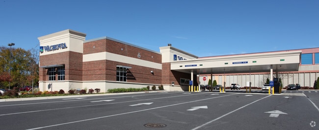
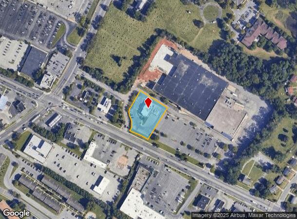
8522 Liberty Rd
Baltimore-Columbia-Towson, MD
Liberty Park Center
02-2300003539
.974 AC LIBERTY PARK CENTER
Financialbuilding
Baltimore
X
Maryland
24013C0450D
2
2024
0.97 AC
2025
Reisterstown Rd Corridor
402306
Baltimore
4,604 SF
DEMOGRAPHICS near 8522 Liberty Rd
1 Mile
3 Mile
5 Mile
2024 Total Population
17,369
95,557
218,927
2029 Population
17,023
94,260
214,897
Pop Growth 2024-2029
(1.99%)
(1.36%)
(1.84%)
Average Age
41
41
41
2024 Total Households
6,569
37,576
85,569
HH Growth 2024-2029
(2.07%)
(1.42%)
(1.96%)
Median Household Inc
$69,138
$79,776
$77,471
Avg Household Size
2.50
2.50
2.50
2024 Avg HH Vehicles
2.00
2.00
2.00
Median Home Value
$261,715
$269,191
$279,086
Median Year Built
1968
1978
1975
Nearby Places
Map Layers
Map Styles
 Street
 Aerial
- Restaurants
- Banks
- Shops
- Fitness
- Groceries
PUBLIC TRANSPORTATION
COMMUTER RAIL
Penn Station (Penn Line - Maryland Area Regional Commuter Trains (The MARC))
DRIVE
WALK
Distance
Penn Station (Penn Line - Maryland Area Regional Commuter Trains (The MARC))
26 min
9.9 mi
AIRPORT
Baltimore/Washington International Thurgood Marshall
DRIVE
WALK
Distance
Baltimore/Washington International Thurgood Marshall
27 min
15.6 mi
Freight Ports
Port of Baltimore
DRIVE
WALK
Distance
Port of Baltimore
27 min
15.9 mi
Nearby Properties
Address
Land Use
TOTAL SIZE
Lot Size
Zoning
Address
Land Use
TOTAL SIZE
Lot Size
Zoning
630,367 SF
470.44 AC
DR1
Address
Land Use
TOTAL SIZE
Lot Size
Zoning
452,042 SF
17.18 AC
RAE2
Address
Land Use
TOTAL SIZE
Lot Size
Zoning
709,328 SF
25.59 AC
OT
Address
Land Use
TOTAL SIZE
Lot Size
Zoning
233,082 SF
10.98 AC
Address
Land Use
TOTAL SIZE
Lot Size
Zoning
27.75 AC
DR16
Address
Land Use
TOTAL SIZE
Lot Size
Zoning
16.75 AC
MLR02
Address
Land Use
TOTAL SIZE
Lot Size
Zoning
336,539 SF
12.38 AC
DR16
Address
Land Use
TOTAL SIZE
Lot Size
Zoning
Address
Land Use
TOTAL SIZE
Lot Size
Zoning
325,203 SF
6.24 AC
DR5.5
Address
Land Use
TOTAL SIZE
Lot Size
Zoning
16.70 AC
Address
Land Use
TOTAL SIZE
Lot Size
Zoning
16.48 AC
DR16
Address
Land Use
TOTAL SIZE
Lot Size
Zoning
26.88 AC
DR16
Address
Land Use
TOTAL SIZE
Lot Size
Zoning
29.14 AC
DR16
Address
Land Use
TOTAL SIZE
Lot Size
Zoning
224,204 SF
7.64 AC
RAE2
Address
Land Use
TOTAL SIZE
Lot Size
Zoning
19.10 AC
DR16
Address
Land Use
TOTAL SIZE
Lot Size
Zoning
99,153 SF
9.41 AC
OR2
Address
Land Use
TOTAL SIZE
Lot Size
Zoning
13.82 AC
DR16
Address
Land Use
TOTAL SIZE
Lot Size
Zoning
Address
Land Use
TOTAL SIZE
Lot Size
Zoning
14.36 AC
DR16
Address
Land Use
TOTAL SIZE
Lot Size
Zoning
7.05 AC
BM
Address
Land Use
TOTAL SIZE
Lot Size
Zoning
11.96 AC
DR16
Address
Land Use
TOTAL SIZE
Lot Size
Zoning
252,674 SF
11.49 AC
DR16
Address
Land Use
TOTAL SIZE
Lot Size
Zoning
190,068 SF
8.40 AC
RAE2
Address
Land Use
TOTAL SIZE
Lot Size
Zoning
186,708 SF
10.92 AC
DR3.5
Address
Land Use
TOTAL SIZE
Lot Size
Zoning
451,526 SF
11.11 AC
RT
Address
Land Use
TOTAL SIZE
Lot Size
Zoning
6.14 AC
02
Address
Land Use
TOTAL SIZE
Lot Size
Zoning
194,844 SF
14.33 AC
ML
Address
Land Use
TOTAL SIZE
Lot Size
Zoning
12.07 AC
DR16
Address
Land Use
TOTAL SIZE
Lot Size
Zoning
140,286 SF
11.71 AC
BR
Address
Land Use
TOTAL SIZE
Lot Size
Zoning
140,580 SF
0.56 AC
BM
The World's #1 Commercial Real Estate Marketplace
Connect with us
© 2025 CoStar Group
The information above has been obtained from sources believed reliable. While we do not doubt its accuracy we have not verified it and make no guarantee, warranty or representation about it. It is your responsibility to independently confirm its accuracy and completeness. Any projections, opinions, assumptions, or estimates used are for example only and do not represent the current or future performance of the property. The value of this transaction to you depends on tax and other factors which should be evaluated by your tax, financial, and legal advisors. You and your advisors should conduct a careful, independent investigation of the property to determine to your satisfaction the suitability of the property for your needs.