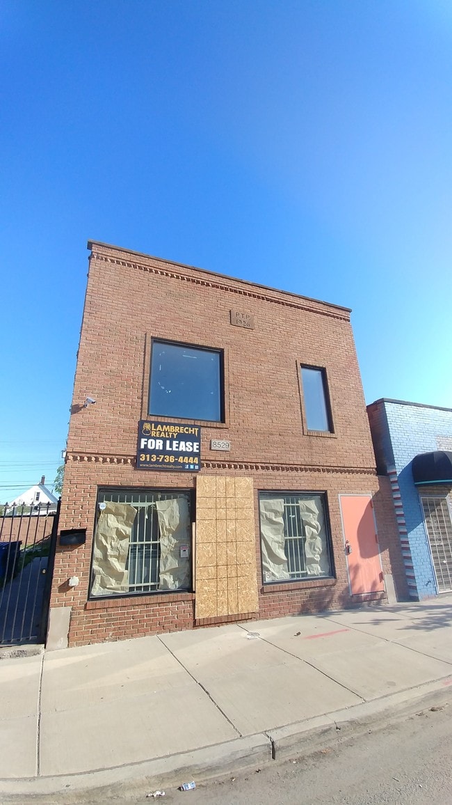
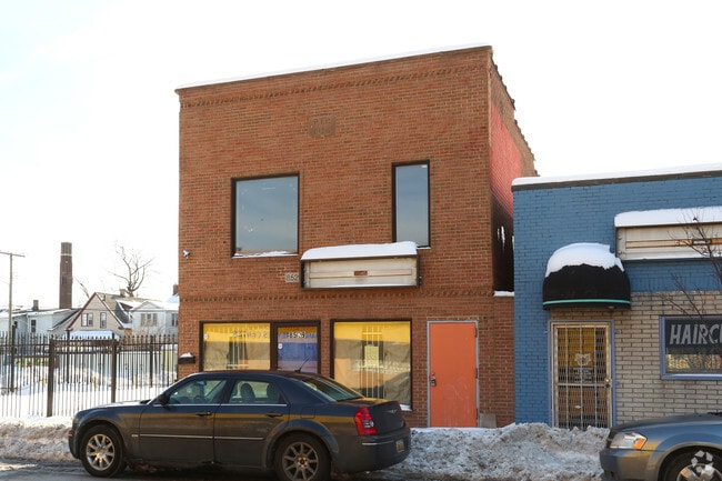
Property Record
8529 W Vernor Hwy, Detroit, MI 48209
NEARBY LISTINGS FOR SALE OR LEASE
Property Detail
8529 W Vernor Hwy
Detroit-Warren-Dearborn, MI
Crosmans
20-0042334
S VERNOR HIGHWAY 27 28 CROSMANS SUB L16 P93 PLATS, WCR 20/183 60 X 100 SPLIT/COMBINED ON 02/19/2021 FROM 20004234., 20004233.;
Commercialnec
Wayne
X
Michigan
26163C0270F
0.14 AC
2024
Detroit W of Woodward
2025
Detroit
524200
DEMOGRAPHICS near 8529 W Vernor Hwy
1 Mile
3 Mile
5 Mile
2024 Total Population
18,218
95,786
277,720
2029 Population
17,578
93,618
273,388
Pop Growth 2024-2029
(3.51%)
(2.26%)
(1.56%)
Average Age
32
34
36
2024 Total Households
5,450
30,418
104,227
HH Growth 2024-2029
(3.45%)
(2.04%)
(1.18%)
Median Household Inc
$35,440
$35,858
$37,829
Avg Household Size
3.20
3.00
2.50
2024 Avg HH Vehicles
1.00
1.00
1.00
Median Home Value
$76,866
$89,233
$96,342
Median Year Built
1947
1947
1948
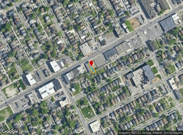
Nearby Places
Map Layers
Map Styles
 Street
 Aerial
- Restaurants
- Banks
- Shops
- Fitness
- Groceries
PUBLIC TRANSPORTATION
COMMUTER RAIL
DRIVE
WALK
Distance
15 min
6.8 mi
DRIVE
WALK
Distance
17 min
7.0 mi
AIRPORT
Windsor International
DRIVE
WALK
Distance
Windsor International
32 min
14.9 mi
Detroit Metro Wayne County
DRIVE
WALK
Distance
Detroit Metro Wayne County
31 min
17.9 mi
Freight Ports
DRIVE
WALK
Distance
71 min
56.7 mi
SALE & LEASE HISTORY
LISTING DATE
SALE/LEASE

Jun 01, 2018
For Lease
Nearby Properties
Address
Land Use
TOTAL SIZE
Lot Size
Zoning
Address
Land Use
TOTAL SIZE
Lot Size
Zoning
6,620 SF
9.43 AC
B6
Address
Land Use
TOTAL SIZE
Lot Size
Zoning
590,116 SF
388.80 AC
ID
Address
Land Use
TOTAL SIZE
Lot Size
Zoning
153,040 SF
2.13 AC
BC
Address
Land Use
TOTAL SIZE
Lot Size
Zoning
2,822,007 SF
75.54 AC
ID
Address
Land Use
TOTAL SIZE
Lot Size
Zoning
309,661 SF
8.81 AC
M4
Address
Land Use
TOTAL SIZE
Lot Size
Zoning
1,076,924 SF
125.54 AC
ID
Address
Land Use
TOTAL SIZE
Lot Size
Zoning
102,646 SF
77.55 AC
ID
Address
Land Use
TOTAL SIZE
Lot Size
Zoning
198,237 SF
11.07 AC
RE
Address
Land Use
TOTAL SIZE
Lot Size
Zoning
80,861 SF
1.17 AC
BC
Address
Land Use
TOTAL SIZE
Lot Size
Zoning
111,008 SF
26.62 AC
IB
Address
Land Use
TOTAL SIZE
Lot Size
Zoning
365,040 SF
382 AC
M4
Address
Land Use
TOTAL SIZE
Lot Size
Zoning
520,522 SF
51.78 AC
M4
Address
Land Use
TOTAL SIZE
Lot Size
Zoning
590,652 SF
21.79 AC
TM
Address
Land Use
TOTAL SIZE
Lot Size
Zoning
342,272 SF
16.48 AC
M4
Address
Land Use
TOTAL SIZE
Lot Size
Zoning
303,705 SF
17.28 AC
ID
Address
Land Use
TOTAL SIZE
Lot Size
Zoning
381,532 SF
M4
Address
Land Use
TOTAL SIZE
Lot Size
Zoning
196,801 SF
38.32 AC
M5
Address
Land Use
TOTAL SIZE
Lot Size
Zoning
153,668 SF
9.16 AC
RD
Address
Land Use
TOTAL SIZE
Lot Size
Zoning
83,552 SF
20.32 AC
IC
Address
Land Use
TOTAL SIZE
Lot Size
Zoning
735,435 SF
37.86 AC
ID
Address
Land Use
TOTAL SIZE
Lot Size
Zoning
147,942 SF
14 AC
IA
Address
Land Use
TOTAL SIZE
Lot Size
Zoning
193,155 SF
8.68 AC
R1 1 FA
Address
Land Use
TOTAL SIZE
Lot Size
Zoning
47,524 SF
Address
Land Use
TOTAL SIZE
Lot Size
Zoning
1,452 SF
19.24 AC
IC
Address
Land Use
TOTAL SIZE
Lot Size
Zoning
483,165 SF
22.98 AC
IB
Address
Land Use
TOTAL SIZE
Lot Size
Zoning
145,572 SF
58.41 AC
M4
Address
Land Use
TOTAL SIZE
Lot Size
Zoning
314,003 SF
26.32 AC
B6
Address
Land Use
TOTAL SIZE
Lot Size
Zoning
336,958 SF
15.54 AC
IB
Address
Land Use
TOTAL SIZE
Lot Size
Zoning
79.03 AC
M2 HEAV
Address
Land Use
TOTAL SIZE
Lot Size
Zoning
193,114 SF
20.29 AC
M4
The World's #1 Commercial Real Estate Marketplace
Connect with us
© 2025 CoStar Group
The information above has been obtained from sources believed reliable. While we do not doubt its accuracy we have not verified it and make no guarantee, warranty or representation about it. It is your responsibility to independently confirm its accuracy and completeness. Any projections, opinions, assumptions, or estimates used are for example only and do not represent the current or future performance of the property. The value of this transaction to you depends on tax and other factors which should be evaluated by your tax, financial, and legal advisors. You and your advisors should conduct a careful, independent investigation of the property to determine to your satisfaction the suitability of the property for your needs.