Property Record
853 N Nellis Blvd, Las Vegas, NV 89110
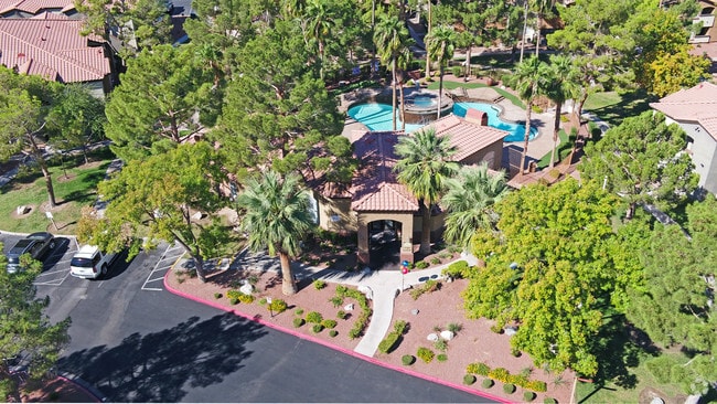


Property Detail
853 N Nellis Blvd
140-29-702-002
PARCEL MAP FILE 71 PAGE 67 LOT 1
Apartment
CLARK
RPD16
Nevada
C and X Area of minimal flood hazard, usually depicted on FIRMs as above the 500-year flood level.
1
2026
12.36 AC
2026
East Las Vegas
000515
Las Vegas
2,304 SF
Las Vegas-Henderson-North Las Vegas, NV
NEARBY LISTINGS FOR SALE OR LEASE
DEMOGRAPHICS near 853 N Nellis Blvd
1 mile
3 mile
5 mile
2025 Total Population
27,285
221,882
432,600
2030 Population
28,436
231,352
451,359
Pop Growth 2025-2030
+ 4.22%
+ 4.27%
+ 4.34%
Average Age
35
36
37
2025 Total Households
8,075
70,614
143,237
HH Growth 2025-2030
+ 4.30%
+ 4.34%
+ 4.45%
Median Household Inc
$53,077
$53,800
$52,995
Avg Household Size
3.30
3.00
2.90
2025 Avg HH Vehicles
2.00
2.00
2.00
Median Home Value
$319,878
$311,289
$316,063
Median Year Built
1987
1988
1985
Nearby Places
Map Layers
Map Styles
 Street
 Aerial
Layers
 Traffic
 Biking
Places
Listings with unknown addresses are not visible on the map
- Restaurants
- Banks
- Shops
- Fitness
- Groceries
PUBLIC TRANSPORTATION
AIRPORT
Harry Reid International
Drive
Walk
Distance
Harry Reid International
20 min
12.6 mi
Boulder City Municipal
Drive
Walk
Distance
Boulder City Municipal
35 min
23.8 mi
Freight Ports
Port of Long Beach
Drive
Walk
Distance
Port of Long Beach
326 min
290.9 mi
Nearby Properties
Address
Land Use
TOTAL SIZE
Lot Size
Zoning
Address
Land Use
TOTAL SIZE
Lot Size
Zoning
90.41 AC
Address
Land Use
TOTAL SIZE
Lot Size
Zoning
7.24 AC
PF
Address
Land Use
TOTAL SIZE
Lot Size
Zoning
35.95 AC
PF
Address
Land Use
TOTAL SIZE
Lot Size
Zoning
67,649 SF
13.42 AC
CV
Address
Land Use
TOTAL SIZE
Lot Size
Zoning
342,160 SF
37.72 AC
RT
Address
Land Use
TOTAL SIZE
Lot Size
Zoning
29.35 AC
CV
Address
Land Use
TOTAL SIZE
Lot Size
Zoning
15.95 AC
PF
Address
Land Use
TOTAL SIZE
Lot Size
Zoning
43.25 AC
PF
Address
Land Use
TOTAL SIZE
Lot Size
Zoning
20.91 AC
PF
Address
Land Use
TOTAL SIZE
Lot Size
Zoning
1,008 SF
31.47 AC
PF
Address
Land Use
TOTAL SIZE
Lot Size
Zoning
58,188 SF
20.04 AC
L:C-V
Address
Land Use
TOTAL SIZE
Lot Size
Zoning
339,280 SF
18.19 AC
Address
Land Use
TOTAL SIZE
Lot Size
Zoning
374,712 SF
18.88 AC
MD
Address
Land Use
TOTAL SIZE
Lot Size
Zoning
4.34 AC
RE
Address
Land Use
TOTAL SIZE
Lot Size
Zoning
19.30 AC
RE
Address
Land Use
TOTAL SIZE
Lot Size
Zoning
420,000 SF
21.23 AC
M1
Address
Land Use
TOTAL SIZE
Lot Size
Zoning
421,000 SF
19.59 AC
M1
Address
Land Use
TOTAL SIZE
Lot Size
Zoning
9,044 SF
8.62 AC
Address
Land Use
TOTAL SIZE
Lot Size
Zoning
223,422 SF
18.21 AC
R3
Address
Land Use
TOTAL SIZE
Lot Size
Zoning
2,926 SF
19.73 AC
R3
Address
Land Use
TOTAL SIZE
Lot Size
Zoning
307,997 SF
14.01 AC
Address
Land Use
TOTAL SIZE
Lot Size
Zoning
3,183 SF
18.35 AC
R3
Address
Land Use
TOTAL SIZE
Lot Size
Zoning
9.11 AC
PF
Address
Land Use
TOTAL SIZE
Lot Size
Zoning
3,424 SF
14.53 AC
R3
Address
Land Use
TOTAL SIZE
Lot Size
Zoning
11.69 AC
CV
Address
Land Use
TOTAL SIZE
Lot Size
Zoning
228,760 SF
12.72 AC
Address
Land Use
TOTAL SIZE
Lot Size
Zoning
326,165 SF
17.37 AC
Address
Land Use
TOTAL SIZE
Lot Size
Zoning
346,598 SF
17.95 AC
M1
Address
Land Use
TOTAL SIZE
Lot Size
Zoning
165,380 SF
8.57 AC
Address
Land Use
TOTAL SIZE
Lot Size
Zoning
8.39 AC
CV
The World's #1 Commercial Real Estate Marketplace
Connect with us
© 2026 CoStar Group
The information above has been obtained from sources believed reliable. While we do not doubt its accuracy we have not verified it and make no guarantee, warranty or representation about it. It is your responsibility to independently confirm its accuracy and completeness. Any projections, opinions, assumptions, or estimates used are for example only and do not represent the current or future performance of the property. The value of this transaction to you depends on tax and other factors which should be evaluated by your tax, financial, and legal advisors. You and your advisors should conduct a careful, independent investigation of the property to determine to your satisfaction the suitability of the property for your needs.